|
Welcome to the May 2023 edition of FGS News and Research. The Florida Geological Survey has been busy, and we are excited to share some of our ongoing projects and things that make Florida’s geology unique and interesting. During our recent annual awards ceremony, I had the opportunity to recognize some of the outstanding geoscience experts that make the FGS such a successful organization. These exceptional employees are highlighted in this issue.
Among them are members of the FGS National Geological and Geophysical Data Preservation Program (NGGDPP) team. The FGS has been awarded annual funding since 2007 through a competitive grant program from the U.S. Geological Survey (USGS) to focus on preserving geologic data. The team was recently awarded funding for federal fiscal year 2023-24 from the NGGDPP, extending the team’s success for another year.
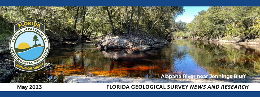
In this issue, you will find articles highlighting the Cedar Keys Formation, Madison Blue Spring State Park geology, and outreach and education activities we have recently been engaged in. Last month, I was honored to name the Jennings Bluff Tract in Hamilton County as Florida’s seventh State Geological Site. The Suwannee River Water Management District owns and manages this vital conservation land. Read more about Jennings Bluff’s geological significance below.
In our Guide to Identifying Springs and Seeps article, you will learn what springs and seeps are, how to spot one, tell the difference between the two and report one of these features. Finally, our GEOFACT article, the first of a three-part series about tracers, explains why hydrologic tracers are an essential tool for managing water resources in Florida.
Sincerely,

Guy H. Means
Director and State Geologist
Florida Geological Survey
Florida Department of Environmental Protection
 |

|

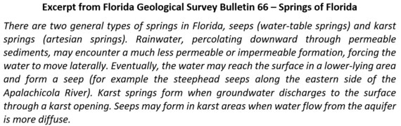
Tracing refers to a collection of methods that allows scientists to trace where water goes. This is the first of a special three-part series examining different tracing methods and how their resulting data can benefit water resource management. In part one of this series, you will learn about dye tracing, but first, let’s cover some background information.
The word water is so synonymous with Florida and its natural resources that resdients and visitors often associate it with Florida’s waterbodies and coastline. After all, the state is nearly surrounded by water, with over 1,000 miles of continuous coastline. Florida is home to pristine springs and rivers, countless sinkholes, lakes, ponds, reservoirs, large swaths of swamps and wetlands and one of the largest and most productive aquifers in the United States, the Floridan aquifer system. According to the National Oceanic and Atmospheric Administration (NOAA), wetlands cover over 31 percent of Florida. These features relate to the state’s geology and coastline and provide people with opportunities for recreation and, most importantly, drinking water.
But what about the vast amounts of water that people do not see on the land surface? Florida has an impressive array of interconnected underground water-filled cave systems. Caves are subterranean passages large enough for a human to walk or swim through. Geologists refer to underwater cave passages through which groundwater moves as conduits. In fact, the Leon Sinks-Wakulla Springs cave system in Leon and Wakulla counties at more than 40 miles long is the longest-mapped underwater cave system in the United States.
Here in Florida, water also acts as the driving force behind land erosion and karst development. The state’s shallow subsurface consists primarily of sands, clays and carbonate rock (limestone and dolostone). Carbonate rocks are especially susceptible to mechanical (erosion by moving water) and chemical (dissolution by weak naturally occurring acids) weathering. These weathering processes slowly carve and dissolve the carbonate rock, allowing for the formation of fractures, sinkholes and conduits. These features continue to be carved and enlarged over time as the water table fluctuates and water migrates from the surface into subterranean passageways. These conduits transport large quantities of groundwater. Hydrologic tracing enables water resource managers to understand, protect and responsibly sustain springs, rivers, lakes, groundwater, and drinking water resources.
Because surface and groundwater interactions are often obscured, it can take an exceptional amount of time and effort to discover how these pathways connect. Geologists and other scientists use physical, chemical or biological tracers as tools to discover the course that a tracing substance takes to get from one point of origin to another location (Neuendorf et al., 2005). More specifically, a tracing tool can help to inform us about changes in a natural system as the tracing substance migrates from an “introduction” or “injection” site to a “detection” site.
There are many applications and types of tracers. Hydrologic tracers are essential tools utilized by geologists in many surface water and groundwater interaction studies. These studies, or “traces,” can be qualitative (with descriptive, non-numerical results), quantitative (with measurable, numerical results), or both, depending upon site-specific and study-specific parameters, goals and available resources. This article (Part I) is the first of a three-part series to discuss various hydrologic tracers (Parts I and II) and the need for a state-wide tracer database (Part III).
|

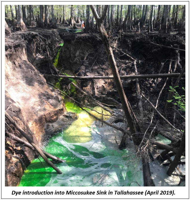
Sample Collection and Dye Detection
Sampling regimens are predetermined and tailored to each independent study. Samples are generally collected at selected sites using two methods: activated carbon packets and timed interval water samples.
Activated carbon packets are the most reliable method used for detecting dye. Packets are strategically placed throughout the hydrologic system, in most cases at or near spring vents, and collected at regular intervals. If dye is present in the water flow passing through the packet, it is absorbed and thus detected. Simultaneously, timed interval water samples are collected via automatic water samplers. If dye is detected in the activated carbon packets, then the timed interval water samples are analyzed to further characterize the peak arrival concentration (e.g., the bulk of the dye has arrived at the sampling site) and the duration it took to achieve peak concentration at the sample site. The frequency at which water is sampled, coupled with the volume of dye detected in each sample and strategic discharge measurements, may allow for the volumes of dye recovered and water transported by the system to be calculated, therefore quantifying the trace.
|
Dye Measurement
Each type of dye has a specific wavelength of fluorescence magnitude which is measured in nanometers using a specialized instrument called a spectrofluorophotometer. Once samples are collected at various detection points via activated carbon packets and/or timed interval water sampling, the spectrofluorophotometer is used. Dye is typically measured in parts per billion (ppb), but this instrument is so sensitive that it is capable of detecting dyes in as little as parts per trillion (ppt). Adsorption potential must be considered and corresponds to several factors, including pH, temperature, water quality, degree of agitation, sediment suspension, sediment type, dye concentration and dye type (Smart and Laidlaw, 1977; Aley, 2019).
The ability of spectrofluorophotometers to detect dye concentrations in parts per trillion, means avoiding site, sample and equipment contamination which is critical to maintaining the integrity of a study. The FGS minimizes contamination potential by separating introduction and sampling operations, adding multiple decontamination steps prior to sampling. Even after applying rigorous lab and field practices, the FGS addresses the potential for any excess dye present, whether in visible or non-visible quantities, by manually degrading or “deactivating” the dye via exposure to sunlight and/or chlorine.
These studies are fundamental to helping scientists understand Florida’s unique and complex hydrologic environment. Dye tracing studies can yield measurable and observable data with respect to transmissivity and hydraulic conductivity, confirm the presence or absence of conduit flow and provide valuable insight for hydrologic flow and transport modeling at various scales. The studies help characterize hydrologic and hydrogeologic systems revealing more about environmental impacts, vulnerability and potential risks or hazards. Through continued research, scientists, stakeholders, government resource managers, regulators and policymakers can work together to improve and protect our state’s most valuable resource.
Stay tuned for Tracers Part II (Chemical and Biologic Tracing) and Tracers Part III (Benefits of Tracer Database Development).
Contact: Mary E. Lupo, Ph.D., P.G. & Clint Kromhout, P.G.
References:
Aley, T., 2019. The Ozark Underground Laboratory’s Groundwater Tracing Handbook. Ozark Underground Laboratory, 41 p.
Neuendorf, K.K.E., Mehl, J.P., and Jackson, J.A., Glossary of Geology. American Geological Institute, Fifth Ed, 779 p.
Smart, P.L. and I.M.S. Laidlaw, 1977. An evaluation of some fluorescent dyes for water tracing. Water Resources Research, Vol. 13:1, pp. 15-33.
Back to top
On March 17, 2023, the FGS was joined by the Suwannee River Water Management District (SRWMD) to celebrate the designation of Jennings Bluff Tract in Hamilton County as the newest State Geological Site. State Geological Sites are special locations the Florida Geological Survey has determined to be significant to the scientific study and the public's understanding of Florida's geological history.
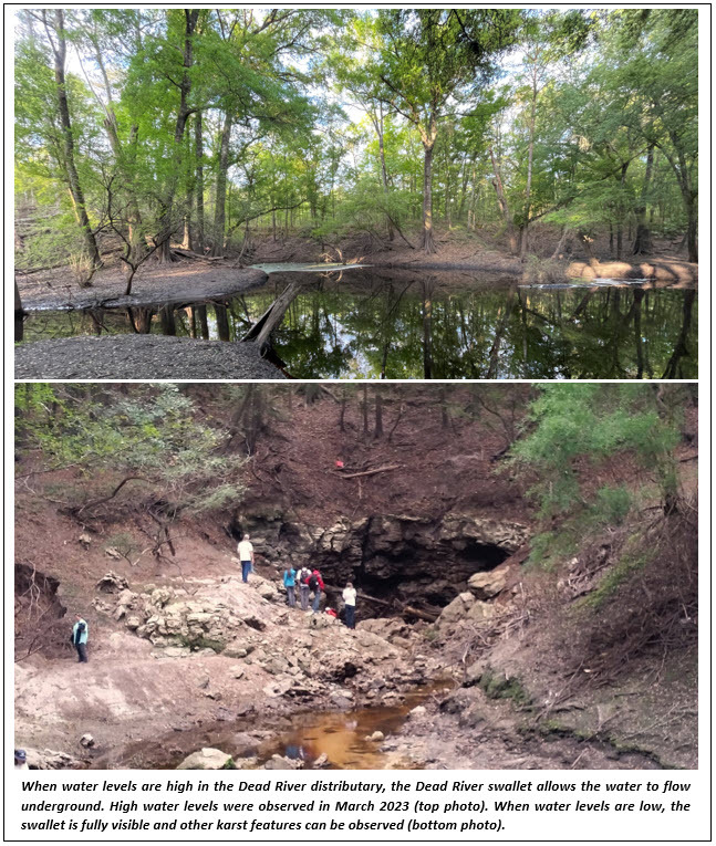
The site is geologically significant because it preserves numerous karst features, including the Dead River swallet, where water from the Alapaha River, when water levels are sufficiently high, flows down the Dead River distributary and disappears underground into Upper Floridan aquifer through the Dead River swallet. The water then flows underground through the aquifer’s porous limestone and eventually reemerges about 10 miles south where it enters the Suwannee River. The karst features on the Jennings Bluff Tract demonstrate the complex and interconnected nature of this region’s water resources.
After the dedication ceremony, attendees, including members of the Hamilton County Board of County Commissioners, the SRWMD Board of Directors, and the public, joined FGS Director Harley Means on a short walk down to the Dead River swallet, where further discussions were had about the importance of this tract.
DEP provided a press release and posted about the event on its social media platforms. Regional media news outlets, including WUFT in Gainesville and the Lake City Reporter, ran pieces on the event. For more information about this site, visit the FGS State Geological Site webpage.
Contact: Sarah Erb
Back to top
Florida's geologic strata are divided into formations. Formations are the basic rock units used in lithostratigraphy, the branch of geology that deals with sedimentary rock layers that have accumulated over geologic time. In each issue of FGS News and Research, we feature a different formation that can be found in the state. In this issue, we examine the Cedar Keys Formation.
The Cedar Keys Formation was deposited during the early Paleocene epoch between 65.5 and 55.8 million years ago. The Paleocene Cedar Keys Formation unconformably sits atop the Late Cretaceous Lawson Formation and is unconformably overlain by the early Eocene Oldsmar Formation. The Cedar Keys Formation consists predominantly of gray- to cream-colored, crystalline dolostone with varying amounts of gypsum and anhydrite (evaporites). Interestingly, there are no Cedar Keys Formation outcrops at the ground surface anywhere in Florida because they been buried and covered up by younger carbonates deposited on top of them. This is an example of how Florida’s geology is like a layer cake, where older rocks are buried by younger rocks.
Lithologic Characteristics
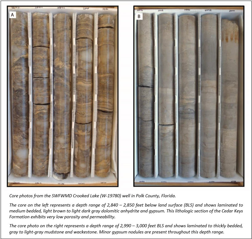
Dolostone and evaporite minerals are the predominant lithologies of the Cedar Keys Formation. Unique characteristics are helpful when trying to differentiate the Cedar Keys Formation from other formations, such as the Oldsmar or Lawson formations. In southwestern and southern Florida, approximately the upper one-third of the formation is a gray- to cream-colored, crystalline dolostone with inclusions of gypsum and anhydrite as accessory minerals. Although limestone (packstones and grainstones) is present, crystalline dolostone is more common throughout the formation. Pore-filling gypsum is commonly observed in the Cedar Keys Formation, giving the rock a speckled appearance.
The lower two-thirds of the formation consists of a tan- to gray-colored, finely crystalline to microcrystalline dolostone interbedded with white to clear anhydrite. The anhydrite is thin and vein-like, often forming a chicken wire appearance. These evaporitic minerals indicate the carbonate unit was deposited in a coastal tidal flat environment. Tidal flats are flat, muddy or marshy areas of land that are covered and uncovered by the rise and fall of tides. This environment has persisted in Florida for millions of years and still occurs today.
Stratigraphic Relationships
The contact between the Cedar Keys Formation and the overlying Oldsmar Formation is rather sharp and does not exhibit gradational characteristics. In some boreholes (i.e., ROMP 88 – W-19710), there is a clearly identifiable rubble zone, representative of paleo-hardground conditions, where the upper Cedar Keys Formation was likely somewhat exposed at the surface during deposition in the Paleocene. The dense, well-indurated, crystalline dolostone of the basal Oldsmar Formation contrasts with the “chalky” appearance of the upper Cedar Keys Formation.
The top of the Cedar Keys Formation can consist of a very pale orange limestone (packstone/grainstone) or light gray to cream colored, crystalline dolostone. The basal Cedar Keys Formation is in contact with a tan or cream-colored, microcrystalline, sucrosic (sugar-like appearance) dolostone marks contact between the Cedar Keys Formation and the underlying Upper Cretaceous Lawson Formation, which is at the top of the Upper Cretaceous Lawson Formation.
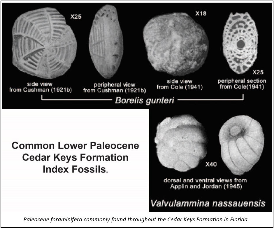
Index Fossils
Although numerous index fossils are found within the Cedar Keys Formation, some are considered more prevalent than others (i.e., Borelis gunteri). Borelis spp. fauna and Valvulamina nassauensis are commonly found throughout the Cedar Keys Formation. However, where sections of Cedar Keys Formation are predominantly evaporite-rich, it often lacks index fossils.
Contact: Benjamin L. Davis, Ph.D., GIT
References:
Cole, W. S., 1944, Stratigraphic and paleontologic studies of wells in Florida; Number 3: Florida Geological Survey Bulletin, no. 26, 168 p.
Miller, J. A., 1986, Hydrogeologic framework of the Floridan aquifer system in Florida and parts of Georgia, Alabama, and South Carolina: U.S. Geological Survey Professional Paper 1403-B, 91 p.
Vernon, R. O., 1951, Geology of Citrus and Levy Counties, Florida: Florida Geological Survey Bulletin, no. 33, 256 p.
Winston, G.O., 1977. Cotype wells for the five classic formations in peninsular Florida: Gulf Coast Association of Geological Societies Transactions, v. 27, 6 p.
Winston, G. O., 1994, The Paleogene of Florida: Miami, Florida, Miami Geological Society, 57 p.
Back to top
Madison Blue Spring State Park provides a wide variety of recreational activities including swimming, picnicking, hiking, paddling and scuba diving. The park includes Madison Blue Spring, that discharges to the Withlacoochee River, and numerous other karst features. The crystal blue waters of Madison Blue Spring are world famous for underwater cave diving and exploration, while the Withlacoochee River provides ample opportunities for kayaking and canoeing.
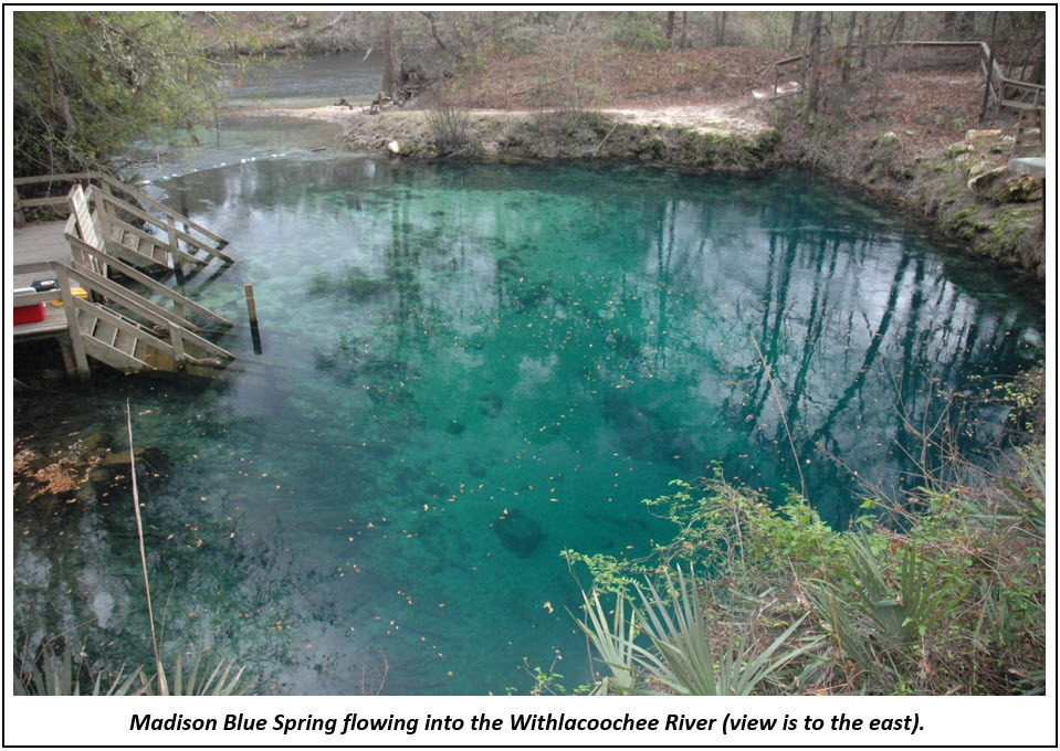
The park, located in easternmost Madison County on the west bank of the Withlacoochee River, lies approximately 12 miles north of the confluence of the Withlacoochee and Suwannee rivers. Madison Blue Spring, one of 33 first magnitude springs in Florida, flows from an 80-foot diameter spring pool, down a 100-foot spring run and into the Withlacoochee River. A large opening about 30 feet below the surface of the spring leads to an extensive underwater cave system. Over 26,000 feet of passages have been mapped by certified cave divers, making it one of the longest underwater caves systems in the state. The cave system extends well outside of the park boundary and passes under the Withlacoochee River just south of the State Road 6 bridge.
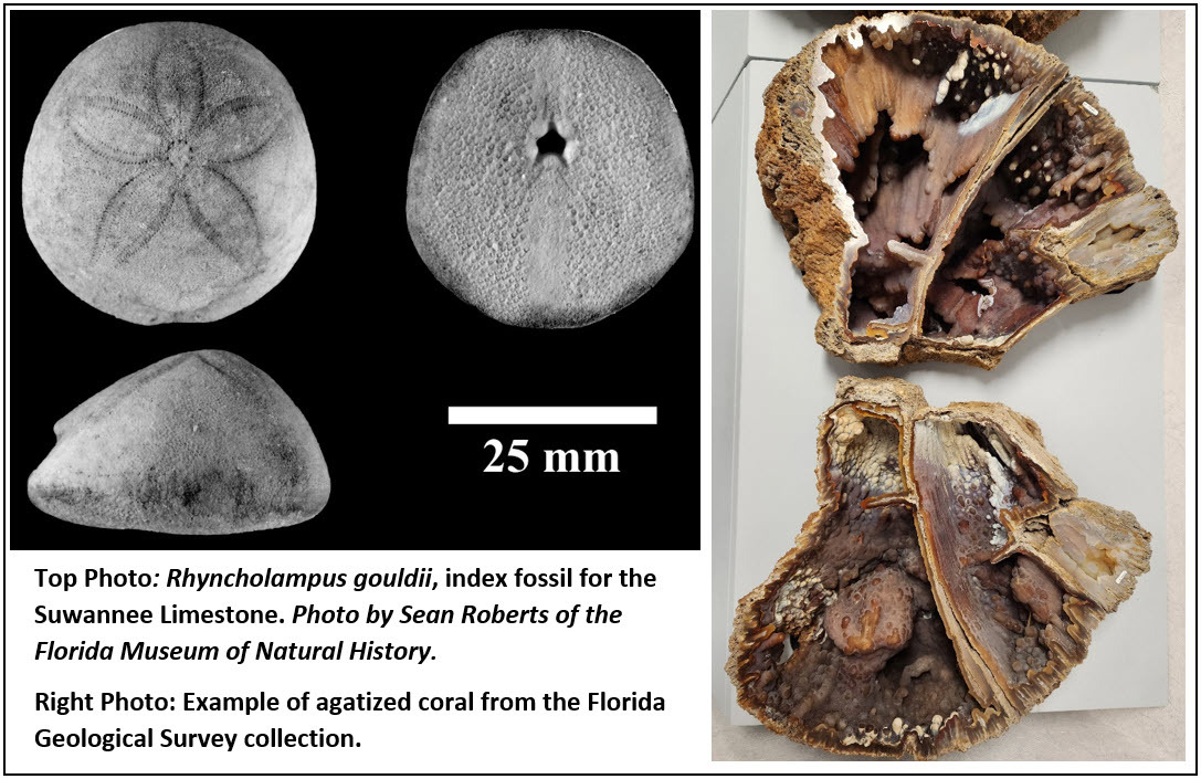
The spring’s clear blue waters originate from the lower Oligocene Suwannee Limestone, part of the Floridan aquifer system. The Suwannee Limestone, which is a white to cream-colored fossiliferous limestone, crops out in the Withlacoochee River and in the spring. The Suwannee Limestone is the upper geologic formation within the Floridan aquifer system throughout the park. The fossil sea biscuit Ryncholampas gouldii is an index fossil for the Suwannee Limestone and is commonly found in outcrops of the formation like seen in Madison Blue Spring and along the Withlacoochee River. An index fossil is a special fossil that is found only in a singular formation and helps geologists easily identify the formation and its geologic age. Agatized coral is another unique fossil that can be found at the confluence of the Withlacoochee River and Madison Spring’s waters in the gravelly bed of the river.
In the area surrounding Madison Blue Spring and to the west, the Suwannee Limestone is overlain by the lower Miocene Torreya Formation of the Hawthorn Group. The Torreya Formation is typically a siliciclastic unit with increasing amounts of carbonate in the lower part. Most of the exposures of Torreya Formation in the park are the siliciclastic portions, which vary from white to light gray to bluish gray, slightly clayey sands. The Torreya Formation is overlain by the Pliocene Miccosukee Formation, which forms the tops of many hills in the area. The Miccosukee Formation is a grayish-orange to grayish-red mottled clay, sand and gravel unit. In most of the upland areas of the park, the Miccosukee Formation is overlain by a thin (generally less than 20 feet thick) layer of undifferentiated Quaternary sands and clays.
Contact: Rick Green, P.G.
References:
Green, R.C., Paul, D.T., Petrushak, S.C., Kromhout, C., and Scott, T.M., 2007a, Geologic Map of the Eastern Portion of the USGS Perry 30 x 60 Minute Quadrangle, Northern Florida: Florida Geological Survey Open-File Map Series 98, 3 plates
Green, R.C., Paul, D.T., and Scott, T.M., 2007, Text to Accompany the Geologic Map of the Eastern Portion of the USGS Perry 30 x 60 Minute Quadrangle, Northern Florida: Florida Geological Survey Open-File Report 91, 32p.
Gulden, B., and Coke, J., 2022, World’s Longest Underwater Caves. Website accessed on Feb. 15, 2023. http://www.caverbob.com/state.htm.
Scott, T.M., Means, G.H., Meegan, R.P., Means, R.C., Upchurch, S.B., Copeland, R.E., Jones, J, Roberts, T., and Willet, A., 2004, Springs of Florida: Florida Geological Survey Bulletin 66, 377p.
Back to top
The mission of the FGS is to collect, maintain, interpret and distribute geologic information to benefit Florida. One way that FGS accomplishes this mission is through various education and outreach events, and FGS professionals have engaged in multiple outreach efforts recently.
January got off to an exciting start when FGS received a new museum exhibit on loan for one year from the Florida Museum of Natural History. The exhibit, located at the FGS Museum at 3000 Commonwealth Blvd., Tallahassee, is a replica of a terror bird (Titanus walleri). This giant, flightless, carnivorous bird lived in Florida several million years ago. It stood over 6 feet tall and was a formidable predator. The terror bird was featured in a video post on DEP’s Facebook page and received a mention on March 3 in DEP’s OneConnection Newsletter. In addition to this loan, the FGS Museum is being renovated to accommodate more exhibits.
FGS geoscientists enjoy conducting public outreach, but it is a rare privilege to extend geology education to fellow employees of the department. In January, FGS Director Harley Means, David Paul and Ed Chelette hosted 17 employees from DEP’s Office of General Counsel for a tour of headquarters at 3000 Commonwealth Blvd. and the FGS Core Repository behind the DEP Annex Building at 3900 Commonwealth Blvd. After the tour, OGC staff thanked the FGS and said that the experience allowed them to understand what FGS does to further our knowledge of geologic resources and processes. Later in March, leadership from Regulatory Programs, including Deputy Secretary Jessica Kramer, toured the Florida Geologic Sample Collections Facility. Recently, Harley Means visited the DEP Southwest District office in Temple Terrace to speak about ongoing collaborative efforts and services that the FGS provides.
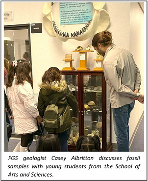
On Feb. 13, teachers, chaperones and students from the School of Arts and Sciences in Tallahassee visited FGS headquarters. There were 114 visitors, divided into a morning session and an afternoon session. For each session, 50 fourth- and fifth-grade students (plus chaperones) rotated between the following stations: Museum, Three Rock Types and Florida Geologic Specimens, Paint-a-Rock and Intern Activity, and Florida Fossils.
Young geoscientists often go on to pursue their scientific interests in higher education. Harley Means presented “The Woodville Karst Plain” to the Florida State University Capstone Class. Because geology spans multiple disciplines, Harley provided an “Introduction to Florida Hydrogeology” lecture to FSU Law School students studying environmental law.
In March, outreach and education coordinator Dr. Mabry Gaboardi Calhoun and FGS Intern Jo Martinez hosted seven Raa Middle School students and their teacher at the FGS. The group toured FGS headquarters, talked with several geoscientists about what they do, and visited the sample collections facility, where Ed Chelette answered questions about the repository. That same day, Mabry and Environmental Specialist Dylan Cook worked with eight elementary school students and two teachers at a homeschool co-op. Students tested geologic samples, tried out a water-level sounder and explored Florida fossils.
|
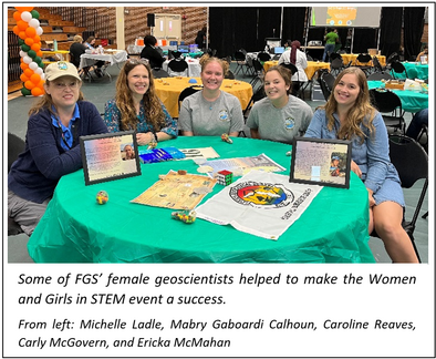
FGS was proud to be included in the Women and Girls in STEM event hosted by Florida A&M University. FGS’ Mabry Gaboardi Calhoun assisted with organizing the event. The hosting of this annual event rotates between FAMU, Tallahassee Community College and FSU. More than 215 young women between fifth and 12th grade visited the FGS booth, where five female geoscientists served as mentors. Mabry Gaboardi Calhoun, Michelle Ladle, Ericka McMahan, Carly McGovern and Caroline Reaves talked about their experiences in STEM. Each of the young women who visited the booth explored rock and fossil samples of Florida and received an FGS folder and bookmark for their take-home STEM kits.
The FGS shows no sign of slowing down during 2023 with its outreach efforts. During April, 27 hydrogeology and field methods students from FSU visited FGS. Geologists Clint Kromhout and Mabry Gaboardi Calhoun provided tours of FGS headquarters. During the visit, Ben Davis talked about field practices for geoscientists, including how to gain site access, take good notes and address and be familiar with drilling procedures. Alan Baker showed the students how to take water level readings from a well and discussed borehole geophysical tools. Dave Paul assisted Ed Chelette with providing a tour of the sample collections facility and, along with Ben Davis, demonstrated how to drill a shallow hole with an AMS PowerProbe push rig.
These outreach events are just the beginning of what promises to be a productive year for public geoscience education. The FGS outreach program continues to grow and provide positive and valuable benefits to Floridians.
Contact: Sarah Erb
|
Back to top
A successful organization relies on the collective abilities and talent of its employees. The FGS award ceremony allows staff to be recognized by their peers for their hard work and dedicated effort. As the Director of the Florida Geological Survey, it was my great honor to acknowledge the following people who have significantly contributed to our success during 2022.
Dr. Christopher Williams received the prestigious Sustained Exemplary Performance Award. Many contributed to the publication of our Florida Geomorphology Atlas (Special Publication 59), but with the long-sustained efforts of Christopher, this monumental project came to fruition. Christopher managed to complete this difficult task while maintaining his other FGS commitments. For well over a decade, his efforts and hard work have ensured the success of our geologic mapping projects. In addition to SP59, he has authored or co-authored 27 FGS geologic map publications.
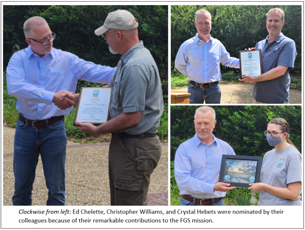
Ed Chelette was selected as the Employee of the Year for 2022 due to his exemplary management of the Florida Geologic Collections Facility. Ed is a valuable asset to FGS. He is reliable, trustworthy and known by his colleagues as exceptionally hardworking and kind. He balances multiple job responsibilities, goes the extra mile and pays attention to detail. Ed’s duties include providing accurate and consistent GEODES data entries; tracking requests and returns of geologic samples; handling warehouse shipments; providing superior customer service to visiting scientists; and providing the physical labor necessary to get the job done. His leadership and other great qualities make him very deserving of this honor.
Crystal Hebets received the Individual Extra Effort award because she is critical to the success of the STATEMAP Program. During 2022, the program managed overlapping study areas of multiple projects. All FGS employees recognize how skilled Crystal is at her job. Crystal handles the GIS needs for four mapping projects; meets regularly with other project staff to assist in GIS tasks and training; organizes and archives older STATEMAP projects; works with our data scientists to meet new data requirements for digital mapping publications; and updates the STATEMAP web page and Story Map. Her dedication, skills and professionalism make her an absolute pleasure to have on our team.
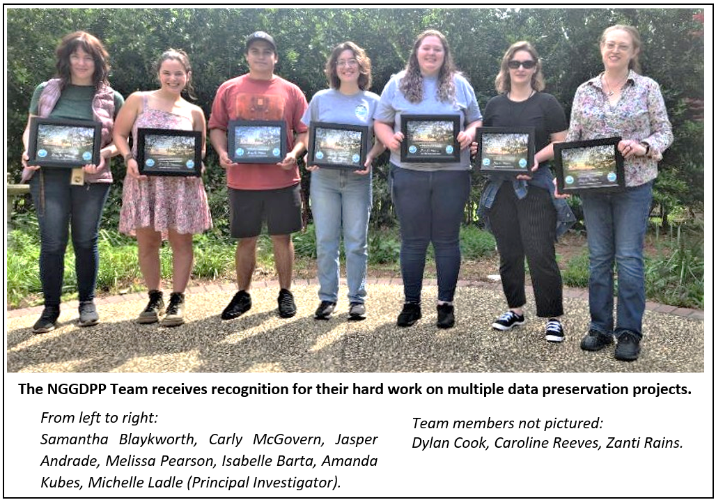
Last but certainly not least, the FGS National Geological and Geophysical Data Preservation Program (NGGDPP) team received the Team Extra Effort Award. In 2022, the team took on two key projects, one of which focused on preserving lithologic data and secondary analysis of historic coastal projects. It included scanning approximately 4,200 pages of historic paperwork, entering lithology data for 152 boreholes and verifying the location of another 270 boreholes. The second project included the rescuing and accessing of more than 7,500 borehole samples from South Florida underground injection control (UIC) wells. These projects are labor intensive and add significantly to the geologic data we use internally and serve out to our customers. Through the hard work of Michelle Ladle, the project lead, the FGS has been awarded grant funding through the U.S. Geological Survey’s NGGDPP Program since 2007.
Contact: Harley Means
Visiting, enjoying recreational activities and relaxing in one of Florida’s many beautiful springs are favorite activities of Florida residents and tourists. Springs elicit a sense of wonder and greater appreciation for our natural world. Florida has over 1,000 documented springs and innumerable seeps. In this guide, we briefly explain what springs and seeps are, how to identify them and how to report your discovery. Although this guide covers common characteristics of these features, it is not comprehensive. Additional resources are provided for more in-depth descriptions of spring and seep characteristics and examples.
Definitions & Identification Characteristics
Springs
Most of Florida’s springs are karst springs. The groundwater emitted from a karst spring is sourced from a limestone aquifer with sufficient hydraulic pressure to cause water to flow out, also known as artesian pressure. The artesian pressure and character of the aquifer’s porous limestone cause groundwater to flow from a point location, or spring vent. Some springs have a spring run, a stream whose water is emitted from a spring. In Florida, most karst springs source their groundwater from the Floridan aquifer system, which is a vast system of interconnected limestone formations underlying all of Florida and parts of Alabama, Georgia and South Carolina.
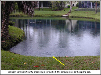
A spring boil may be visible on the water’s surface depending on the groundwater flow volume. The term spring boil refers to the vigor of the flow, giving the appearance of water boiling in a pot. Due to the volume of the flow, the water’s surface is slightly elevated above the groundwater discharge location relative to the body of water the spring is discharging into. Conversely, a boil may not be visible when the flow volume is low.
Sediment or rock can be observed in many springs. A thin layer of sediment may sometimes cover a spring vent, or an opening in the rock from which groundwater emits. This sediment is often quartz sand that can be observed boiling directly above the vent. Rock, usually limestone, may also be exposed in springs.
Groundwater in the Floridan aquifer system consistently stays between 68 F to 75 F. Therefore, groundwater emitted from a spring may feel cool or warm relative to the seasonal air temperature. On a cold day, the temperature contrast between the warm groundwater and cold air temperature can cause the air to condense above the spring pool or spring run, creating a steam-like appearance.
If spring or sand boils or a noticeable water temperature difference are not observed, other visible context clues may help determine if a feature is a spring. Groundwater emitted from a limestone aquifer is often clear and exhibits a slightly blue tint when pooled. Thus, observing a concentration of pooled, slightly blue-tinted water or a stream of clear water may indicate a spring’s presence. Although this is a helpful clue, springs do not always emit clear groundwater.
Pooled spring water appearing cloudy or opaque (but still with a blueish tint) may be caused by turbidity (microscopic or large particles suspended, also called total dissolved solids [TDS] in the water), particularly in areas close to the coast. Another example of color variation can be seen when tannic surface water runoff, or a tannic stream, sinks underground through a sinkhole connected to the aquifer. The tannic surface water and clear groundwater mix for a short period and distance before flowing out of a spring. This water may have a brownish tint. Thus, springs that normally emit clear to blue groundwater can sometimes temporarily emit brownish colored groundwater.
Groundwater chemistry can affect how a spring smells or looks. Sulfurous smells can indicate the presence of a spring emitting groundwater with a high sulfur concentration. Iron-reducing bacteria can produce an orangish color in a spring or spring run where the iron concentration in groundwater is elevated.
Springs can be found as standalone features emitting groundwater from a single spring pool with an accompanying spring run. Springs that are not standalone features may be found alongside or in bodies of water, such as rivers, lakes, marshes or lagoons. In these cases, the springs will not have a spring run, and you may have to look for other context clues to identify them.
Seeps
A seep occurs at the land surface where groundwater from the water table slowly emerges from porous sediment. The water flowing from a seep (seepage) is diffuse, meaning it does not come from a single location. Seepage flow is commonly intermittent because the flow is dependent on rainwater infiltration to the water table. Seeps are typically found where there are high-to-low topographic elevation changes like on a hillside or lakeshore. The elevation variation can be minimal.
The location where water emerges from a seep may have more lush vegetation than the surrounding area, and the ground may be soft or slightly muddy from the saturated, diffuse flow. Seepage on the land surface may or may not be channelized or distinctly visible.
|

What to Do if You Discover a Spring or Seep
If you believe you have discovered a spring or seep, we encourage you to contact the Florida Geological Survey, which maintains a statewide database of springs and seeps. Help us investigate the spring by including information such as the location, photos, and any notable identifiable features such as those outlined above.
Contact: Clint Kromhout, P.G., Alan E. Baker, P.G.
References and Additional Resources
Scott, T.M., Means, G.H., Meegan, R.P., Means, R.C., Upchurch, S.B., Copeland, R.E., Jones, J., Roberts, T., and Willet, A., 2004, Springs of Florida: Florida Geological Survey Bulletin 66, 377 p., 6 pl.,
https://doi.org/10.35256/B66.
Florida Springs:
https://floridadep.gov/fgs/fgs/content/springs
Springs, Northwest Florida Water Management District:
https://www.nwfwater.com/Water-Resources/Springs.
Springs, Suwannee River Water Management District:
https://www.mysuwanneeriver.com/267/Springs.
Springs in West-Central Florida, Southwest Florida Water Management District:
https://www.swfwmd.state.fl.us/projects/springs.
|