NEWS RELEASE: Wyoming Geological Survey Summer/Fall 2021 Newsletter

Wyoming State Geological Survey Geo Notes banner image

Interpreting the past, providing for the future - summer/fall 2021 newsletter

Dino Day at Wyoming State Museum

Dino Day kid

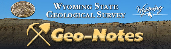
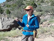
Three-year-old Noah was among the more than 700 people who attended July 9th’s Dino Day at the Wyoming State Museum in Cheyenne. The WSGS participated in the event, which was part of the museum’s Family Days outreach program. WSGS Director and Wyoming State Geologist, Dr. Erin Campbell, and staff Christina George and Jill Ottman handed out fossil bits, rock samples, posters, postcards, and headlamps to the many fossil, dinosaur, and rock enthusiasts who visited the WSGS table. It was the first in-person event the WSGS has participated in since 2019, and the agency looks forward to future collaborations with the state museum.

Dino Day staff

4 Maps are published under STATEMAP program, 3 more underway

The WSGS published new geologic maps in early summer of four quadrangles in the state—1:24,000-scale bedrock geologic maps of the Richards Gap quadrangle (Sweetwater County, Wyoming, and Daggett County, Utah) and Goat Mountain quadrangle (Albany and Laramie counties), 1:100,000-scale surficial geologic map of the west half of the Jackson Lake quadrangle (Teton County), and 1:100,000-scale bedrock geologic map of the Rock River quadrangle (Albany, Laramie, and Platte counties).

WSGS maps are available as free downloads and as hard copies for purchase from the agency’s sale site.

The maps were published with joint funding from the U.S. National Cooperative Geologic Mapping Program (STATEMAP) managed by the U.S. Geological Survey. The WSGS has participated in the program for more than three decades, producing more than 100 geologic maps.

To read more about each of the four mapping projects, see the news release.

After the completion of the maps listed above, WSGS geologists headed to the field this summer to gather data for another set of maps, detailed below.

1:24,000-scale bedrock geologic map of Oil Mountain 7.5' quadrangle, Natrona County

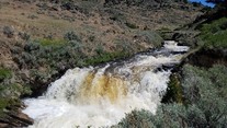
The Oil Mountain quadrangle is about 15 miles west of Casper and at the southeastern margin of the Wind River Basin. This project builds upon recent WSGS studies of subsurface geology in the nearby Powder River Basin as well as nearby mapping efforts in the Wind River Basin and recent work on similar stratigraphy in the Greater Green River Basin. The goal is to better characterize the mineral and energy resources of the Casper arch and southeastern Wind River Basin.

1:24,000-scale bedrock geologic map of Phantom Lake 7.5' quadrangle, Carbon County

The Phantom Lake quadrangle is on the western flank of the Medicine Bow Mountains, about 17 miles southeast of Saratoga. This project continues the WSGS’s larger effort to map the mining districts in the Medicine Bow Mountains, and will focus on documenting mineralization related to regional structure, lithology, and petrology trends. Extensive geochronology and geochemical analysis of units within the map area will assist in identifying mineralization and potential deposits of critical minerals in the map area, and better establish age relationships between the Precambrian units. The final product will compile, refine, and contribute to previous mapping efforts in the area and will be published as a map series.

1:100,000-scale surficial geologic map of east half of the Jackson Lake 30' x 60' quadrangle, Teton, Fremont, and Park counties

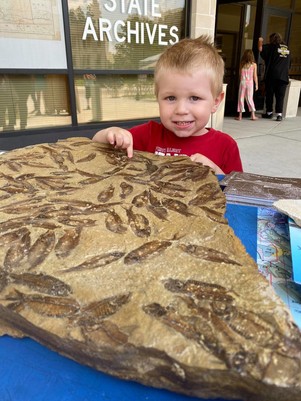
The map area encompasses the southwestern Absaroka Range, northern Gros Ventre Range, and easternmost Jackson Hole, and is crossed by the Gros Ventre and Buffalo Fork rivers. The project complements WSGS surficial geologic mapping of the west half of the quadrangle from 2020. This work will generate data related to landslides, possible Quaternary faults, and glacial geology, and will contribute to the understanding of the region’s Quaternary geologic history and active geologic hazards.

Goat Mountain quadrangle mapping

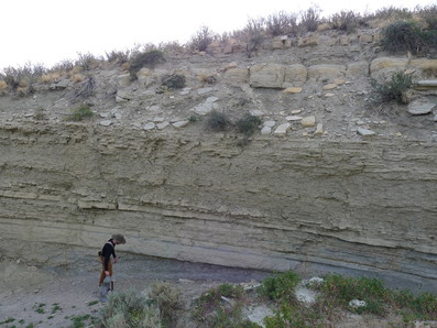
A geologist stands next to interbedded sandstones and mudstones in a cut bank exposure of the Sundance Formation on the Goat Mountain quadrangle.


Online Oil and Gas Map of Wyoming undergoes annual update

Since its launching in 2016, the Interactive Oil and Gas Map of Wyoming continues to be one of the most popular WSGS products, one reason being the annual updates geologists make to the online map as new information becomes available. This year’s changes involve redefining oil and gas field boundaries and attributes to include wells drilled and producing during the previous year, re-verifying oil refinery and gas processing plant attributes and status, and revising well layers. The 2021 update includes a new layer delineating the location of wildcat wells.

To learn about the latest update, see the news release.


Staff spotlight: David Lucke

David Lucke

A series recognizing staff and their contributions

David Lucke—GIS/IT Coordination, 15 years

What do you do at the WSGS? I work with GIS (Geographic Information System) to help provide spatial data to the public.

What makes your job interesting? It always makes me happy to see people succeed; when I provide resources for them, I feel accomplished.

How does your job help Wyoming? Maps! Not only geology but maps are also used for hunting, hiking, and tourism. Our geologic maps assist in providing revenue for Wyoming.

What are some of your favorite geologic features in Wyoming? Medicine Bow Peak. I can see the quartzite from my breakfast table. Mirror Lake and Lake Marie are some of my favorite kayaking spots.

Drop, cover, and hold on! Register for Great Wyoming ShakeOut earthquake drill

Last year, 1,483 earthquakes occurred in Wyoming, 27 of them with magnitudes greater than 2.5. Earthquakes have been felt in every county in the state, though most happen in the western third. Although the majority of earthquakes occur in remote areas and do not cause harm, it is still important to be prepared.

The Wyoming Office of Homeland Security and Wyoming State Geological Survey (WSGS) are encouraging residents to participate in the Great Wyoming ShakeOut earthquake drill at 10:21 a.m. on Oct. 21. The annual drill happens every third Thursday in October and provides an opportunity to practice how to be safer during large earthquakes. Registration is free and open to everyone, including schools, organizations, and businesses.

For more information, and to register, visit: https://www.shakeout.org/wyoming/.


Critical minerals in heavy-mineral sandstone in SW Wyoming report released, similar future work planned

A new WSGS study examines the mineralogy and geochemistry of a heavy-mineral sandstone deposit in southwestern Wyoming. The report focuses on the Upper Cretaceous Rock Springs Formation at Richards Gap, about 50 miles south of Rock Springs, and is a continuation of the agency’s work on the critical mineral resources in the state.

Heavy-mineral sand placer deposits, sometimes called “black sands,” are the world’s primary source for titanium and zirconium, as well as a potential source for hafnium, niobium, vanadium, and the rare earth elements. These elements are considered by the U.S. Geological Survey to be “critical minerals,” which are essential to the economy and security of the United States.

Rock samples analyzed in the recent WSGS study show the presence of abundant titanium, zirconium, and rare earth elements. However, the hardness of the deposit and other factors may compromise its economic potential. Learn more about the latest publication in the news release.

WSGS geologists have two more upcoming projects focused on critical minerals in heavy-mineral sand deposits. The aim of the first project is to thoroughly sample and analyze the geochemistry and mineralogy of several additional heavy-mineral sandstones in the Upper Cretaceous Rock Springs Formation, of the Mesaverde Group, in Sweetwater County.

The second project will have a statewide focus. The main goal is to conduct preliminary sampling and analysis of the heavy-mineral sand deposits for which data are scarce or nonexistent, as well as to augment older datasets with modern analytical methods, with a focus on the rare earth elements.

Formations investigated in the statewide project include Precambrian quartz-pebble conglomerates in the Medicine Bow and Sierra Madre ranges; the Cambrian Flathead Sandstone in the Bighorn Mountains and elsewhere; various Mesozoic sandstones through Wyoming, especially of the Mesaverde Formation/Group; and fluvial paleoplacers of the Eocene Wind River Formation, Oligocene White River Formation, and associated strata in central Wyoming.


Story map to celebrate Yellowstone National Park’s 150th anniversary

Yellowstone became the nation’s first national park on March 1, 1872—that’s nearly 150 years ago. While the park is arguably the biggest attraction to Wyoming, particularly the unique geology that makes Yellowstone “Yellowstone,” there’s much more geology to see in our great state. 

In celebration of the park’s upcoming sesquicentennial, the WSGS is creating a Story Map highlighting some of the roadside geology to see while on the way to the park. The map will provide an array of sites worth checking out, with each point on the map accompanied by information about the site’s geology, photos, and link to find additional information.

The WSGS will launch the map ahead of the park’s anniversary next spring, and it will be accessible from the agency’s website.


You asked ...

Q: Why was it diverted? This question was posed after the following post: This raging creek is the Bluegrass Tunnel diversion. Water diverted from the Laramie River goes through a half-mile tunnel completed in 1886 through the granite mountain in the background. After a short tumble down this small drainage, the water enters Bluegrass Creek, then Sybille Creek, and into the Wheatland Irrigation District.

A: The Bluegrass Tunnel diversion was created so that the Wheatland Irrigation District (formed in 1883) can irrigate the entire Wheatland Flats area. Without this tunnel, more water would flow down the Laramie River than Sybille Creek. The diversion allows for more even distribution of water across the whole area.

Questions for “You asked ...” are from social media followers. Be sure to follow the WSGS on FacebookInstagram, and Twitter for interesting tidbits about Wyoming geology.

Bluegrass Tunnel