
NEWS RELEASE: Wyoming State Geological Survey Publishes 4 New Geologic Maps
Wyoming State Geological Survey sent this bulletin at 06/15/2021 09:31 AM MDT
June 15, 2021
******FOR IMMEDIATE RELEASE******
Media Contact:
Christina George
(307) 766-2286 x231
christina.george@wyo.gov
The WSGS Publishes 4 New Geologic Maps
The Wyoming State Geological Survey (WSGS) released four new geologic maps of quadrangles in three corners of the state through the agency’s mapping program.
The four maps are:
- 1:24,000-scale bedrock geologic map of the Richards Gap quadrangle, Sweetwater County, Wyoming, and Daggett County, Utah
- 1:24,000-scale bedrock geologic map of the Goat Mountain quadrangle, Albany and Laramie counties
- 1:100,000-scale surficial geologic map of west half of the Jackson Lake quadrangle, Teton County
- 1:100,000-scale bedrock geologic map of the Rock River quadrangle, Albany, Laramie, and Platte counties
Maps are available as free downloads and as hard copies for purchase from the WSGS sales site. The WSGS received funding for the mapping projects through the U.S. National Cooperative Geologic Mapping Program (STATEMAP) managed by the U.S. Geological Survey. The WSGS has produced more than 100 maps during the more than three decades it has been participating in the program.
Richards Gap
The Richards Gap quadrangle is in the southern Greater Green River Basin, between the southern end of the Rocks Springs Uplift and the Uinta Mountains in Utah. It is about 34 miles south of Rock Springs along the Wyoming-Utah state line.
The map’s exposures of Upper Cretaceous through Eocene strata record some of the most significant geological events that occurred in southwestern Wyoming, including the retreat of an inland sea, the Laramide mountain-building event, and the formation of Lake Gosiute, which covered most of the Greater Green River Basin. In addition to stratigraphic and sedimentologic analyses of these formations, the map also focused on characterizing a heavy-mineral deposit in the Rock Springs Formation, one of many reported in the area. Petrologic and geochemical analyses of the deposit at Richards Gap will contribute to a better understanding of heavy mineral deposits in Wyoming, and is part of a broader effort by the WSGS to study the critical mineral potential of heavy-mineral deposits.
Goat Mountain
The Goat Mountain quadrangle is on the eastern margin of the Laramie Mountains in southeastern Wyoming. Geologists conducted bedrock mapping of the quadrangle as part of a larger effort to study the geology of the central part of the Laramie Mountains.
“The map is an excellent example of Laramide tectonics,” says WSGS geologist Robert Gregory. “Igneous and metamorphic rocks that were crystallized more than 1.4 billion years ago were thrust over strata that are 300 million years old and younger. Compression during what geologists call the Laramide orogeny also formed the Iron Mountain syncline, a prominent feature on the eastern part of the map.”
Another prominent feature on the map is Iron Mountain. Three companies mined magnetite-ilmenite, the ore from the Iron Mountain mine, between the 1950s and 1970s, producing more than 969,000 tons, most of which was used for ballast for the railroads.
Jackson Lake
The Jackson Lake quadrangle spans the Teton Range, Jackson Hole, and the northern Gros Ventre and southwestern Absaroka ranges in northwest Wyoming. This area includes most of Grand Teton National Park. Geologists mapped the surficial geology of the west half of the quadrangle in an effort to better understand the region’s geologic hazards and Quaternary geology. The mapping is intended to provide planners, land managers, and local governments with surficial geologic data to assist in land-use decision-making and geologic hazards assessments.
“This map covers a region of renowned natural landmarks with a rich history of geologic study,” says WSGS geologist James Mauch. “Our mapping focuses on the deposits, landforms, and surface processes that characterize this scenic and geologically active landscape.”
Project outcomes include refined landslide mapping using light detection and ranging (LiDAR) datasets, comprehensive mapping of Pleistocene glacial deposits that incorporates prior generations of mapping with recently published geochronology data, and surface mapping of the Teton fault and several other poorly understood Quaternary faults.
Rock River
The Rock River quadrangle map is a compilation project, meaning geologists compiled existing geologic mapping and generated new mapping where needed within the quadrangle. The map supplements several WSGS projects involving the central Laramie Mountains.
The quadrangle covers a large area of southeast Wyoming—from the town of Rock River in the southwest, nearly to Wheatland in the northeast. The Laramie Mountains bisect the area with the Laramie Basin on the west side and Denver Basin on the east side.
“The quadrangle’s portion of the Laramie Mountains contains a variety of Precambrian rocks,” says WSGS geohydrologist, Jim Stafford. “There are more than 10 distinct plutons, complexes, and intrusive groups that exist within the mapping area. The Archean-age Elmers Rock greenstone belt contains rocks that are over 3 billion years old.”
Future Work
Geologists are spending summer 2021 in the field collecting data for next year’s STATEMAP maps. Projects involve the eastern half of the Jackson Lake quadrangle in Teton, Fremont, and Park counties, Oil Mountain quadrangle in Natrona County, and Phantom Lake quadrangle in Carbon County.
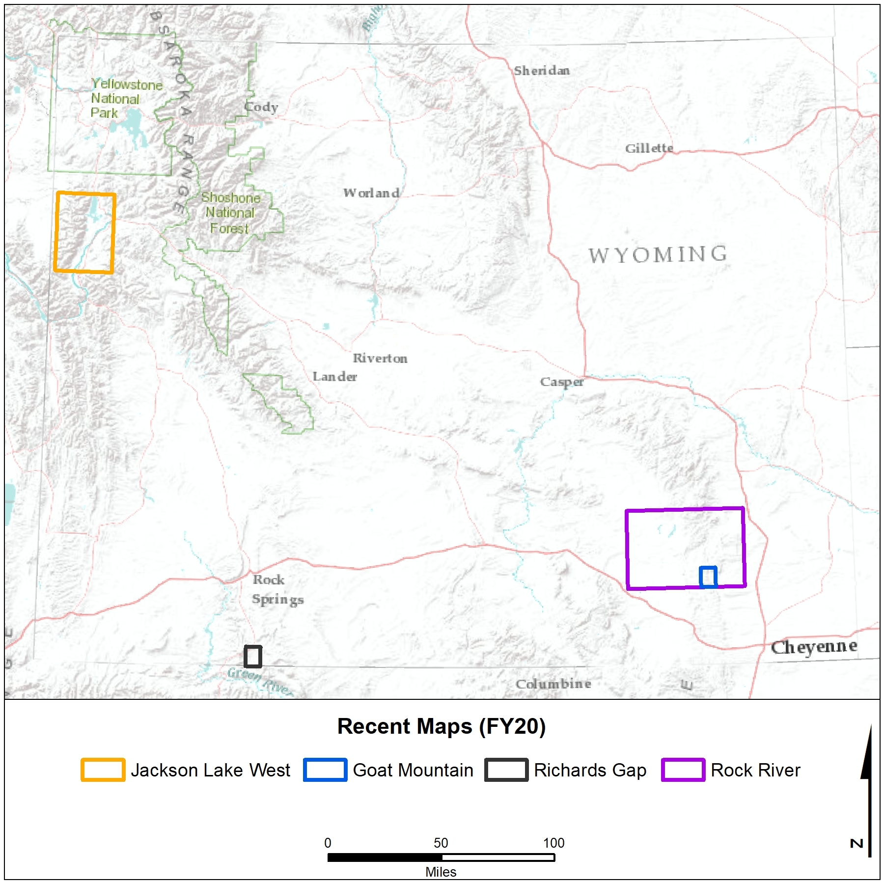
Caption: Generalized map showing location of the four quadrangles recently mapped.

|
Interpreting the past ~ providing for the future Email: wsgs-info@wyo.gov |
| STAY CONNECTED: | |||||||
|
|||||||
SUBSCRIBER SERVICES:
Manage Subscriptions | Unsubscribe All | Subscriber Help