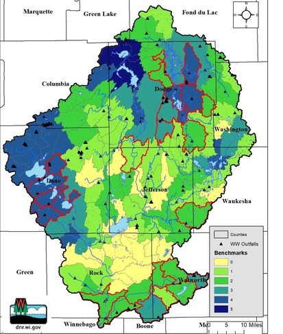
 This map of the Rock River Basin illustrates the number of TMDL Implemenation Benchmark activities ocurring across the 120 HUC12 subwatersheds of the Rock River Basin. An additional 24 Implementation Benchmarks have been added since 2020 and are highlighted in red.
TMDL Implementation benchmarks are formal water quality and/or conservation initiatives that, through grants, permits, and other regulatory requirements, trigger TMDL Implementation activities. These activities are tracked using DNR, DATCP, County, and other data sources and include:
- TMDL WPDES Permit activities
- Watershed based permit compliance (e.g. Water Quality Trading or Adaptive Management)
- Lake/River Grants
- Nine-Key Element Plans
- Farmer-Led Watershed Groups
The map above illustrates, by HUC12 subwatershed, the number of these benchmarks in each of the 120 HUC12 subwatersheds in the greater Rock River Basin (collectively representing the Upper Rock and Lower Rock HUC8 basins). Compared to the 2020 report, 24 additional benchmarks have been reached and are highlighted in red.
The new benchmark TMDL Implementation inititiatives include:
Dane County Executive Joe Parisi announced that Michels Construction, Inc. will be awarded the contract to begin Dane County’s next phase of “Suck the Muck,” taking place at Six Mile Creek in an area known as Mary Lake later this spring. The contract totals $981,460 and will further Dane County’s goal of removing algae-making phosphorus from the Yahara Chain of Lakes system. This stretch of stream contains areas of muck removal up to seven feet deep. It is estimated that approximately 25,000 tons (or about 1,800 dump truck loads) of material will be removed from this section of Six Mile Creek, including 60,000 pounds of phosphorus. Read more...
Sector Team Updates
The NPM Program announces the release of a new, online, self-paced Nutrient Management Farmer Education (NMFE) Curriculum. Since its original release in 1999, the NMFE Curriculum has been an evolving collection of instructional tools for educating farmers (and others) on improved nutrient management practices. The goal is to involve farmers in the design of their own nutrient management plans.
The year 2022 marks the release of a new platform and updated content for the NMFE Curriculum. An online, video-based instruction version allows for self-paced learning by users. The new curriculum is available at: https://nmfe.webhosting.cals.wisc.edu/. (Please allow a few minutes for the initial download.) Content of the digital curriculum is displayed in a modular format. Each module deals with a specific component of a nutrient management plan and features multiple, short, instructive videos along with linked resources.
Recently there have been changes to the Silurian Dolomite Areas layer in SnapMaps. These changes are based on recent research projects that have resulted in better quality depth to bedrock maps. Counties impacted by these changes include Kewaunee and Dodge Counties. These changes have been reflected in the Silurian Dolomite Areas layer in the SnapPlus program’s SnapMaps tool.
Farmers and producers in these counties that land apply manure are encouraged to update their manure spreading maps to ensure they have the best available data in their nutrient management plan. These map updates should be made prior to land applications, however the updated maps will be required to be submitted to the department at the next NMP Update.
For any questions regarding these updates, please contact Joe Baeten, DNR NER Regional Supervisor (Joseph.Baeten@Wisconsin.gov) or Aaron O'Rourke, DNR Nutrient Management Coordinator (Aaron.Orourke@Wisconsin.gov)
|

Upcoming Trainings with the Rock River Coalition
Clean Boats Clean Waters Workshop Wednesday, May 11, 5:30 – 7 PM | Virtual
Want to help spread the word about invasive species? Clean Boats Clean Waters volunteers visit popular boat launches to teach boaters how to prevent the spread of invasive species by cleaning and draining boats and gear. This virtual training will get you ready to start volunteering at your favorite boat launch, on your own schedule. Register here: https://secure.lglforms.com/form_engine/s/3bwZJFyLxzGvc0QKz7B5zA Contact: addie@rockrivercoalition.org
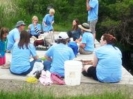
Volunteer Stream Monitoring Workshop Saturday, May 21, 9 AM – 2:30 PM | Burnett
Do you live by a stream or river? Looking for a way to protect streams near you? Become a volunteer stream monitor with the Rock River Coalition!From May to October, our 180+ stream monitors collect data vital to understanding the health of our streams across the Rock River Basin. By the end of this workshop, you’ll know how to measure water quality and be ready to adopt your own stream monitoring site. No experience is needed! Register here: https://secure.lglforms.com/form_engine/s/yvLyQT6N7xBj4gAaAEPmag Contact: addie@rockrivercoalition.org
Citizen Lake Monitoring Network Workshop Saturday, June 18, 9 AM – 12:15 PM | Beaver Dam
Learn how you can help your lake! Citizen Lake Monitors collect data on lake health that is used to identify water quality trends and establish restoration goals. The first half of this workshop will introduce you to lake monitoring and how to measure water clarity, a simple but important measure of water quality. Then we will learn about aquatic invasive species and how to look for them on your lake. Register: https://secure.lglforms.com/form_engine/s/wAfB8ab9Q9bsJhuhRgfU0Q Contact: addie@rockrivercoalition.org
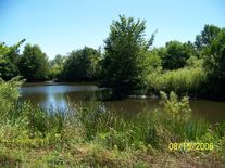
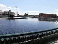
In 2021, Clean Lakes Alliance volunteers embarked on the 9th season of LakeForecast water quality monitoring. This work involved collecting nearshore condition reports at piers, beaches, parks, and access points around the five Yahara lakes. From May through September, volunteers took water quality measurements. They measured water clarity, recorded air and water temperature, identified the presence of green algae and cyanobacteria, and noted additional visual observations. Reports are entered into the LakeForecast app where all data are updated in real time. Highlights include:
- 77 nearshore monitoring stations covering all five Yahara lakes (Figure 1)
- All 25 public beaches monitored at least twice a week
- Offshore sampling on all five lakes, seven locations in total
- New program record of 101 volunteers
- Algal toxin (microcystin) testing at six beaches in partnership with UW-Engineering’s Water Systems and Society Research Group
- Recruited 37 new volunteers
Read more...
The Wisconsin Department of Natural Resources (DNR) is excited to announce that a Wisconsin family has rediscovered a rare cliff-dwelling fern not seen in 90 years.
Ben Redding, a DNR Rare Plant Monitoring Program volunteer, was hiking with his kids and their dog at a state natural area in Sauk County when they discovered a population of maidenhair spleenwort (Asplenium trichomanes). Their find and those of many more volunteers are featured in the program’s recently released annual report.
|
The Wisconsin Department of Natural Resources reminds anyone hitting the water this weekend to wear a life jacket.
Winds and summer-like temperatures are in the forecast for Saturday, making the water more inviting than ever after weeks of winter. While Saturday’s temperatures may flirt with summer, the water is cold and rough, and life jackets are a must before you shove from the shore for the year’s first paddle.
“Safety is an important part of water fun. Most drowning victims on Wisconsin waterbodies were not wearing life jackets,” said DNR Lt. Darren Kuhn, DNR Boating Law Administrator. “Putting safety first by wearing a life jacket and having respect for the water are two important things to remember when going to any Wisconsin river and lake to enjoy warm spring days.”
Nearly 80% of last year’s 25 boating fatality victims were not wearing life jackets. Of those, 91% were male, with an average age of 46. Read more...
|
The Wisconsin Department of Natural Resources (DNR) is seeking public comment on the draft Technical Standard 1056 Perimeter Sediment Control and Slope Interruption. The deadline to submit comments is May 13, 2022.
This standard represents the consolidation and updating of two existing technical standards: 1056 Silt Fence and 1071 Manufactured Perimeter Control and Slope Interruption Products. Consolidating these technical standards is proposed because the purpose and conditions where practices apply are the same. Updates emphasize the contributing drainage area limitations of these practices and several new figures. The DNR is now soliciting comments from the public in this Broad Review.
The revised draft Technical Standard 1056 was updated using the Modified Process framework of the Standards Oversight Council as outlined in the Technical Standards Process Handbook.
How To Submit Comments
- Review the draft Technical Standard 1056 Perimeter Sediment Control and Slope Interruption here.
- Submit comments via email to soc@wisconsinlandwater.org by 11:59 p.m. on Monday, May 2, 2022.
- Keep comments specific and directly related to this technical standard.
- You may insert your comments into the Adobe PDF document or indicate the page or line numbers to which your comments refer. If you have general comments applicable to the entire standard, please note them as such.
- Respond in the same order as the sections appear in the draft.
After the notice period is complete, all comments will be considered and responded to by DNR. Revisions may be made to the document, and the final updated technical standard will then be published and made available to internal and external stakeholders.
The DNR maintains, implements and develops Storm Water Construction and Post-Construction technical standards to assist with the compliance of Chapter NR 151, Wisconsin Administrative Code. The process established by the Wisconsin Standards Oversight Council is the process the agency uses to develop or revise technical standards pursuant to Subchapter V of NR 151. The DNR is a member of the Wisconsin Standards Oversight Council along with several other federal and state agencies and conservation organizations to ensure that technical standards used for soil and water conservation in Wisconsin are science-based and involve collaboration with other impacted agencies.
You can also view this published notice here.
|
Hosted by Kim Meyer, agronomist and watershed program coordinator with Yahara WINS, this podcast connects you to farmers and other experts around the topic of water quality. You will hear from farmers that are utilizing conservation practices on their farms in southern Wisconsin. You’ll learn about the farm, the farmer, the conservation practice that they have successfully implemented on their farm, as well as the challenges they’ve faced and how they have overcome these challenges. Beyond feeding our world, clean water is one of the many ecosystem services agriculture can provide. Agriculture is not the problem, rather, it is the solution to protecting and improving our local water quality.
|
|