 August 31, 2021
|
|
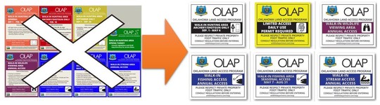 The old OLAP signs (left) will be gradually replaced with the new OLAP signs (right).
Please review the updated OLAP regulations in the 2021-2022 Hunting Regulations (LINK).
Unchanged Access Types:
- Walk-in Hunting Access: Archery/Shotgun Only (Sep. 1 - May 6)
- Walk-in Wildlife Viewing Access
- Walk-in Fishing Access (Annual)
- Walk-in Fishing Access (Seasonal: May 7 - Aug 31)
- Walk-in Stream Access
Discontinued Access Types:
- September Only Access
- Spring Turkey Access
New Access type (coming soon):
- Limited Access (requires daily permit), registration opens October 1 (see below for more details).
 |
|
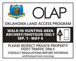
Walk-in Hunting Access: Archery/Shotgun Only
Access allowed Sep. 1 - May 6.
No shot size larger than T shot.
No shotgun slugs.
No centerfire, rimfire, or muzzleloading rifles.
Hunting only. All other activities are prohibited.
|
 |
|
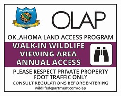
Walk-in Wildlife-viewing Access:
Access allowed year-round (annual).
Hunting is prohibited.
Fishing is prohibited, unless enrolled as walk-in fishing area or stream access area.
Removal of animals, vegetation, minerals, fossils, and artifacts is prohibited.
|
 |
|
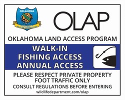
Walk-in Fishing Access: Annual Access
Access allowed year-round (annual).
Hunting is prohibited.
Catch and release only.
Limits of 3 rods per person, 3 hooks per line.
Swimming is prohibited.
|
 |
|
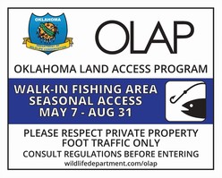
Walk-in Fishing Access: Seasonal Access
Access allowed May 7 - Aug 31.
If concurrently enrolled as a Walk-in Hunting Area, hunting is prohibited from May 7 - Aug. 31.
Catch and release only.
Limits of 3 rods per person, 3 hooks per line.
Swimming is prohibited.
|
 |
|
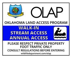
Walk-in Fishing Access: Seasonal Access
Access allowed year-round (annual).
If on foot or wading, sportspersons must remain within stream corridor.
Hunting is prohibited unless concurrently enrolled as a walk-in hunting area.
|
 |
|
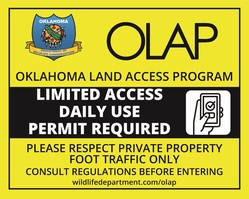
Limited Access (Opens October 1, 2021)
This option is currently in internal beta-testing and will open October 1, 2021. Users will register online for a daily permit via the GoOutdoors Oklahoma webpage and/or Mobile app. A separate OLAP email newsletter dedicated solely to this topic will be released in mid-September.
|
Please note that the colors for the walk-in area boundaries have changed. Public archery/shotgun walk-in areas are now gray rather than red. The new Limited Access tracts (opening Oct. 1) will be yellow. Other boundary colors remain similar/unchanged.
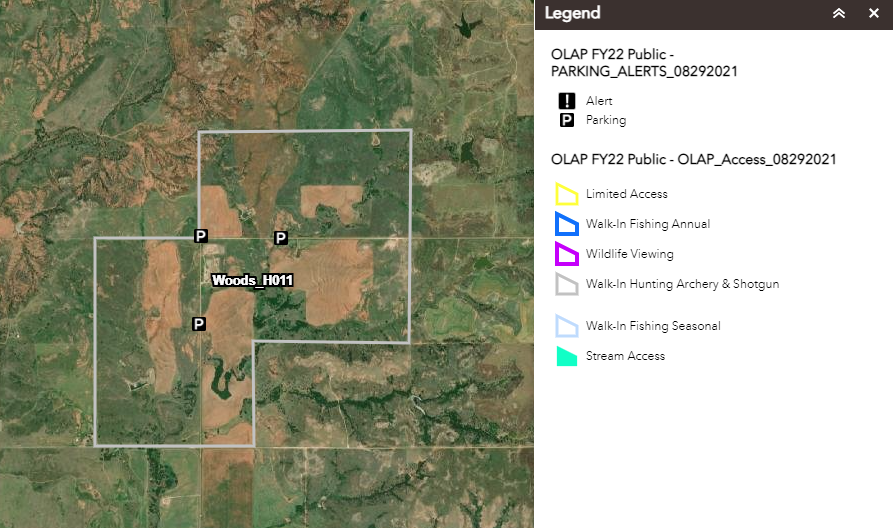
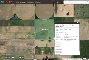
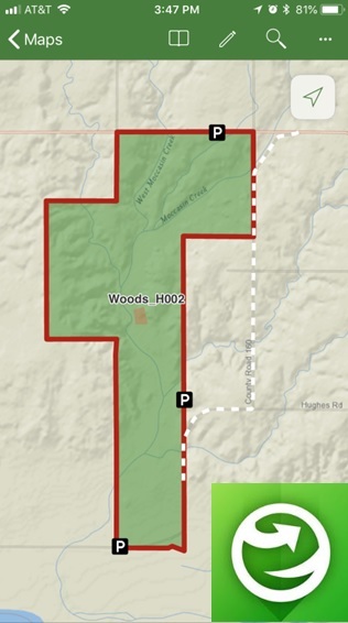
Remember to click on walk-in areas to bring up more information, including access types, dates, habitat information, specific comments/instructions, and photos. This function is available when accessing maps on a computer or via the mobile app (Explorer for ArcGIS). |
|
 |
|
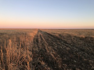
Reminder: Review the maps before entering the walk-in area. Get a good feel for the property boundaries, topography, changes in land use (farming or ranching), etc.
Boundaries may consist of a change from grassland to agriculture, a mowed strip (example pictured), etc. Some walk-in areas may not have fences for OLAP boundary signs, and it's the responsibility of hunters to know their location and the walk-in area's boundaries.
|
|
 |
No recent closings.
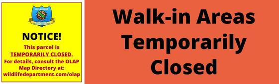
No temporary closings.
 |
|
Use the free ArcGIS Explorer App to bring the OLAP Walk-in Areas to your mobile device (data signal required). Once the app is installed on your device, search the Maps for "OLAP" and select the ODWC OLAP Web Map".
Click below to download the ArcGIS Explorer App on your Apple or Android mobile device.
CLICK HERE FOR APPLE DEVICES
CLICK HERE FOR ANDROID DEVICES
Digital maps can be accessed via browser and/or the Explorer mobile app. Direct link to online maps.
|
|
|
 |
|
Administered by the Oklahoma Department of Wildlife Conservation, The Oklahoma Land Access Program (OLAP) provides financial incentives to landowners who allow public access for hunting, fishing, stream access, and wildlife viewing opportunities on private lands. No additional permit is required by sportspersons to access OLAP walk-in areas, however hunting and fishing licenses are required, respectively, unless a person is exempt.
Consult regulations before entering OLAP Walk-in Areas. Visit the OLAP webpage to learn more.
|
|
|