|
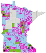
Note: This article is reprinted from the Vermillion River Watershed Summer 2025 E-news. See Vermillion River Watershed website for related information.
 See "Dakota County Lawn Watering Wisdom Program" video.*
With summer arriving, we love spending time outside and playing on nicely-trimmed green lawns (like Greg in the video). Keeping lawns green requires water, of course, but how much?
The vast majority of our watershed residents rely on groundwater for drinking and at-home uses, either through city suppliers or private wells. When you water your lawn, you're using that same groundwater supply. Groundwater is a limited resource, and it's not free either. Home irrigation systems, in particular, can be a big source of leaks if not maintained.
Fortunately, lawns only need about one inch of water per week, which can be fulfilled by rainfall for many weeks of the year. Even if we fall into another drought, you can still keep your lawn happy with less water and save yourself some money on utility bills to boot.
Watch the video for some lawn water conservation tips, and take the Water Wise Pledge to commit to doing whatever you can to save groundwater! If you have an irrigation system, we recommend a periodic audit to make sure it's working efficiently.

*This video is part of a campaign funded in part by a Groundwater Protection Accelerated Implementation Grant from the Minnesota Department of Health, allocated from the Clean Water Fund, one of four funds established by the Minnesota Clean Water, Land, and Legacy Amendment. Additional funds are provided by Dakota County, Dakota County SWCD, Vermillion River Watershed Joint Powers Organization (VRWJPO), Black Dog Watershed Management Organization, Eagan-Inver Grove Heights Watershed Management Organization, and Lower Mississippi River Watershed Management Organization.
|
Following a $9 million bonding appropriation from the 2025 Legislature, the Department of Natural Resources (DNR) is now accepting new and updated grant applications for the Flood Hazard Mitigation (FHM) Grant Assistance Program. Under this program, the state provides cost-share grants to local units of government for publicly-owned capital improvements projects designed to address long-term flood concerns.
This grant program helps fund a wide variety of mitigation projects including levees, floodwalls, pumping stations, flood storage facilities, diversion channels, water level control structures, or the acquisition and removal of flood prone or flood damaged structures. Feasibility studies are not eligible for use of bond funds.
Project proposers are encouraged to review the FHM Grant Prioritization Guidelines prior to completing an application. The most recently updated application form is available on the DNR FHM Program webpage. Although the application period is always open, only those applications submitted prior to August 11 using the new application form will be considered for this round of funding. Applications received after this date, as well as those not funded, will still be considered for future appropriations. Funding decisions for this most recent appropriation are expected to be finalized sometime in the fall.
For more information contact DNR Flood Hazard Mitigation Grant Program Manager Matt Bauman, 651-259-5691.
|
Local floodplain management ordinances require communities to obtain and retain documentation that lowest floor elevation requirements are met for all new buildings, substantially improved/damaged buildings and additions. This requirement is based on federal (44 CFR 60.3 (b), 5) and state (MN Rules 6120.5800, subpart 1) minimum requirements.
Related highlights and resources
- The FEMA Elevation Certificate is a good option for documenting the lowest floor, lowest adjacent grade, etc. It is mandatory for Community Rating System (CRS) communities to use the FEMA Elevation certificate. Verify the current (8/2023) version of the elevation certificate is being used. See New FEMA Elevation Certificates July 2023 Water Talk article.
- DNR has a sample Floodplain As-Built form that includes the Minnesota higher standard minimum requirement that there is fill at the Base Flood Elevation (plus stage increase) within 15-feet of residential buildings. (This is a Word document. All or portions of the sample can be used, and it can be modified to add community-specific information.)
- FEMA emphasizes that these elevation records must be retained indefinitely (as long as the building exists).
-
MN rules specify that the applicant submit to the local official “a certification by a registered professional engineer, land surveyor, or other qualified person designated by the local governing body that the finished fill and building floor elevations or other flood protection measures are in compliance with appropriate flood plain zoning provisions and other flood plain regulations.”
- See pages 46-49 in the Minnesota Floodplain Management Quick Guide for additional related guidance.
- When can LiDAR be used to document elevations versus a survey? If the building is high above the Base Flood Elevation (but in the FEMA mapped floodplain or within the shoreland district), or for some situations where accessory buildings are slab on grade, the two-foot elevation contours derived from LiDAR may document the minimum elevations are met. See the December 2021 Water Talk article Using LiDAR Data for Elevation Documentation.
|

DNR staff have had many inquiries about the future of FEMA.
We are, of course, monitoring the situation closely through a number of channels, including national updates from professional organizations like the Association of State Floodplain Managers or regional organizations (i.e., Greater New Orleans, Inc.). However, we do not have all the answers to the questions we receive.
For your reference, below is some background and status information that may be helpful.
A formal evaluation by the "FEMA Review Council" started recently, and is expected to provide recommendations by the end of 2025.
FEMA Review Council
The FEMA Review Council was established by Executive Order 14180, Council to Assess the Federal Emergency Management Agency. The goal of the council is to advise the President "on the existing ability of FEMA to capably and impartially address disasters occurring within the United States and shall advise the President on all recommended changes related to FEMA to best serve the national interest."
- The inaugural FEMA Review Council met on May 20 , 2025. A recording of the first meeting may be viewed online.
- The second meeting of the FEMA Review Council has been scheduled for Wednesday, July 9, at 3 p.m. ET / 2 p.m. CT.
- The meeting will consist of (1) Remarks and updates from Council leadership; and (2) Open panel discussion.
- The public may attend the meeting virtually with advanced registration no later than 5 p.m. ET on Tuesday, July 8. To register for the meeting or submit comments, please follow the instructions available in the Federal Register notice.
- The FEMA Review Council sought "potential programmatic and organization improvements to FEMA" through a Request for Information (RFI) entitled “Request for Public Input on Experiences With FEMA Disaster Responses." This RFI closed on May 15 and received 11,708 comments in total. All comments can be reviewed online.
- E.O. 14180 directs the council to "submit its report to the President within 180 days of the date of the Council’s first public meeting."
We plan to report on significant updates and outcomes in future Water Talk newsletters.
|
FEMA released an update of their Technical Bulletin 2 - Flood Damage-Resistant Materials Requirements (TB 2) in January 2025. The new TB 2 replaces the previous 2008 version.
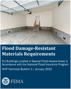
Since all construction below the Base Flood Elevation (BFE*) is susceptible to flooding, the National Flood Insurance Program (NFIP) requires the use of flood damage-resistant structural and finish materials below the BFE in Special Flood Hazard Areas (SFHAs*). This Technical Bulletin is intended to provide the current guidance on what constitutes materials resistant to flood damage and how and when these materials must be used to improve a building's ability to withstand flooding. TB 2 is referenced in ASCE24-24 Flood Resistant Design and Construction and the 2024 International Building Code (IBC) and International Residential Code (IRC).
|
Major updates in TB 2
- A brief description of the processes used to identify whether materials are flood damage-resistant, including recently adopted international standards available to assist in the determination.
- An updated classification of materials. This version of Technical Bulletin 2 simply rates materials as acceptable or unacceptable for flood damage resistance.
- The flood damage-resistance materials table in the previous TB 2 (2008) has been divided into two tables - one for Structural Materials and another for Finish Materials - to make the table more manageable.
* The Base Flood Elevation is the 1% annual chance flood elevation, often called the "100-year flood." The Special Flood Hazard Area is the area shown on FEMA maps that is, in general, the 1% annual chance floodplain.
Note: This article is adapted from a FEMA news release.

Have a tricky floodplain management situation? Want to get the latest timing for FEMA map updates?
Talk with FEMA and DNR Floodplain Program representatives during monthly virtual Minnesota Floodplain Management Office Hours. Hours are 10-11 a.m., typically on the fourth Thursday of the month (but a few are adjusted to avoid holidays, etc.).
Upcoming monthly hours (Note: all are 10 a.m. - 11 a.m. Central Time)
Where: Teams. No registration is required. Select a date to see a Teams meeting and join us.
These office hour dates and links are also available on the DNR Floodplain Training and Education page.
|
Important Dates to Note:
(since May 2025 Water Talk and upcoming in next couple months)
|
|
 |
Preliminary Maps
- Murray Countywide - Sept. 15, 2025 (anticipated)
- Aitkin Countywide - Sept. 30, 2025 (anticipated)
Local Officials Meetings and Open Houses
- Becker County (outside of Ottertail HUC8) Discovery - July 9, 2025 (2 p.m-3 p.m.)
- Anoka Countywide (outside Mississippi HUC8) Kickoff - August/September 2025
- Dodge County Better Data LOMR Flood Risk Review - August/September 2025
- Rock County Revised Prelims Flood Risk Review - August/September 2025
- Twin Cities HUC-8 Flood Risk Review (Capitol Region, South Washington, and Vadnais Lakes) - August/September 2025
90-Day Appeal Periods
None
Letters of Final Determination (LFDs)
- Wabasha Countywide - Late August/early September 2025
Effective (Six months after LFD date)
None
Additional Map Update Information:
|