Monument men, surveying Michigan's land
By KATHLEEN LAVEY
Michigan Department of Natural Resources
Meridian Road. Baseline Road. Townline Road. Rangeline Road. Section Street.
These road and street names refer all the way back to the early 1800s, when the U.S. Congress established a General Land Office and created the Public Land Survey System.
Early land surveyors systematically divided Michigan into a grid of 1-mile squares, marked with wooden corner posts at half-mile intervals, following a north-south meridian, an east-west baseline, township lines, range lines and section lines.
The posts – known as monuments – would be the basis for documenting ownership of land and establishing cities and villages, roads, streets, bridges and the boundaries of public and private lands.
Life for a surveyor back in those days was not one of luxury. Michigan was vast, forested and swampy with no roads, no GPS and no easy ways for the surveyors to get where they were going.
It wasn’t uncommon for surveyors from southern Michigan to make their way to the western Upper Peninsula by walking to Saginaw Bay, where they’d catch a steamer to Sault Ste. Marie. There, they might hook up with a canoe-paddling voyageur for a ride west before walking inland to commence their surveying work. Now that’s a rough commute.
“The logistics of what they had to do to survey some of the areas of our state is just amazing,” said Jeremy Pipp, a surveyor with the Michigan Department of Natural Resources who is based in the U.P. town of Norway. “You’ve got to appreciate these extraordinary individuals, enduring these hardships, and completing their assigned work.”
Pipp is one of seven land surveyors and four technicians who mark as many as 1,000 boundary corners in a year on 4 million acres of state forest land. They’re called in to mark boundaries for timber sales and resolve property line disputes between the state and private property owners.
|
“We want to define the boundaries for the benefit of the department, which also benefits the adjoining land owners and the public,” Pipp said. “Good boundaries make for good neighbors.”
The DNR puts monuments on its corners using galvanized steel pipes, capped with an aluminum disc stamped with the land surveyor’s license number and the corner’s location within the Public Land Survey System.
Mirroring the work of the original surveyors, DNR surveyors mark (blaze) nearby trees, inscribe them and provide measurements as to how far they are from monuments. These “bearing trees” or “witness trees” help surveyors locate the monument again when needed. All the information is recorded in the county Register of Deeds’ office.
State surveyors are responsible for finding and re-marking the sites of the original boundary monuments put in place during the 1800s. That task often involves a good bit of old-fashioned sleuthing, which might start by looking up land records at the county courthouse and end by searching for clues out in the woods after riding a four-wheeler or a snowmobile to the area.
“It’s a nice mold of art, science, archaeology, mathematics and geometry all mixed into one,” Pipp said. “You gather all of this information and say, ‘What does this mean and how does this all come together?’”
|
The original wooden posts from those early surveys have weathered away over time, and often all that remains is a depression in the ground or, just below ground, the pointed base of an original survey post.
“Underground a post point can be preserved like the day they put it in,” Pipp said.
Finding one of those is “fantastic,” Pipp said.
“Someone drove a post into the ground and took some notes nearly 170 years ago, and through your retracement skills you were able to recover this monument,” he said.
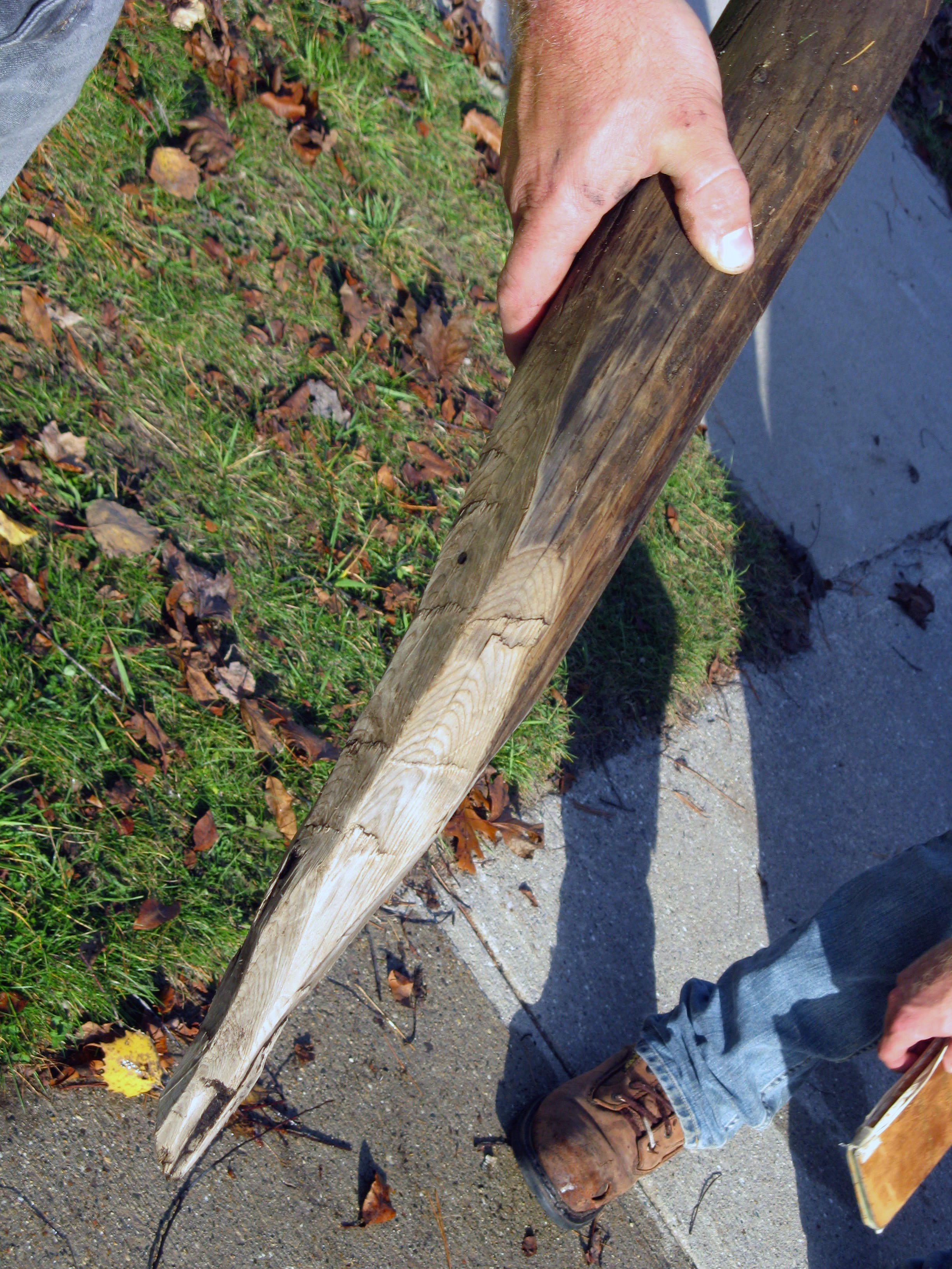
In 2012, state surveyor Matt Dontz and a student assistant found an original monument post set in 1850 – a sharpened cedar log – immersed in water that protected it from the elements.
“At that moment I knew I was living the highlight of my surveying career to date and possibly my entire career,” Dontz wrote about the incident.
His quest started with handwritten copies of original land office notes in Montmorency County, north of Atlanta in the northeast Lower Peninsula. Those notes led to a stream in a swampy area, where the original stake was found.
John Nutkins, who works out of the DNR’s Newberry office, has been surveying for 19 years. He also has found an original post or two, but said it is more common to find the bearing trees nearby. Those include originals and trees that were marked in the 1950s, ‘60s and ‘70s.
“Actually, you see quite a few of them; it’s neat,” he said. “It’s the ones that haven’t been found by somebody else yet that you get really excited about.
Besides marking the grid lines for townships, ranges and sections, the original surveyors also were charged with evaluating the environment in the area where they were working.
A 19-point list of things to put in field notes included:
- A description of the land surface, “whether rolling, broken or hilly.”
- The soil, “whether first-, second- or third-rate.”
- Trees listed in order of prevalence.
- A description of all rivers, creeks and smaller streams.
- All lakes and ponds.
- All minerals and ores and “all diggings therefore.”
- All settlements, roads and trails.
Many of Michigan’s early state surveyors were meticulous, as is evident by comparing record measurements with those made with modern equipment. Other surveyors weren’t quite as precise, which can mean more detective work for today’s surveyors trying to trace old lines.
|

Michigan’s state surveyors these days use a combination of old-school and modern techniques. Surveying has continued to evolve to use GPS, and some surveyors are using technology such as drones. But the heart of the profession is the same: to ethically determine and mark property lines.
“Some of the (early) surveyors were really diligent conducting their original surveys, and some were not,” Pipp said. When the original points are elusive, “you’ve got to try and come up with a hypothesis and find evidence to support that. The goal is to be in harmony with the original survey.”
Where does it all start?
Michigan’s grid of townships, ranges and sections originates from a location southeast of Leslie, now memorialized in the 108-acre Meridian-Baseline State Park.
The park straddles Ingham and Jackson counties and contains Michigan’s two initial points. It’s about a 1.5-mile round-trip hike to the historic points.
The park is on the west side of Meridian Road, just north of Territorial Road. The exact coordinates of the historic point, for anyone interested, are: LAT 42.422854000000001 LONG -84.364743000000004.
|
Becoming a surveyor
To become a licensed surveyor in the state of Michigan, jobseekers must:
- Obtain a college degree in surveying (Michigan Technological University and Ferris State University offer them in Michigan).
- Complete four years of experience for those with a bachelor’s degree or three years for those with a graduate degree in surveying.
- Pass two national examinations and one state-specific examination.
- Apply for a license and be of good moral character.
- Pass written and practical tests.
- Work in the field for three years for those who have a master’s degree and four years for those with a bachelor’s degree in surveying.
Learn more about professional surveying through the Michigan Society of Professional Surveyors at MISPS.org.
|
Check out previous Showcasing the DNR stories in our archive at Michigan.gov/DNRStories. To subscribe to upcoming Showcasing articles, sign up for free email delivery at Michigan.gov/DNR.
/Note to editors: Contact: John Pepin, Showcasing the DNR series editor, 906-226-1352. Accompanying photos and a text-only version of this story are available below for download. Caption information follows. Credit Michigan Department of Natural Resources, unless otherwise noted.
Text-only version of this story.
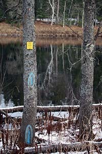
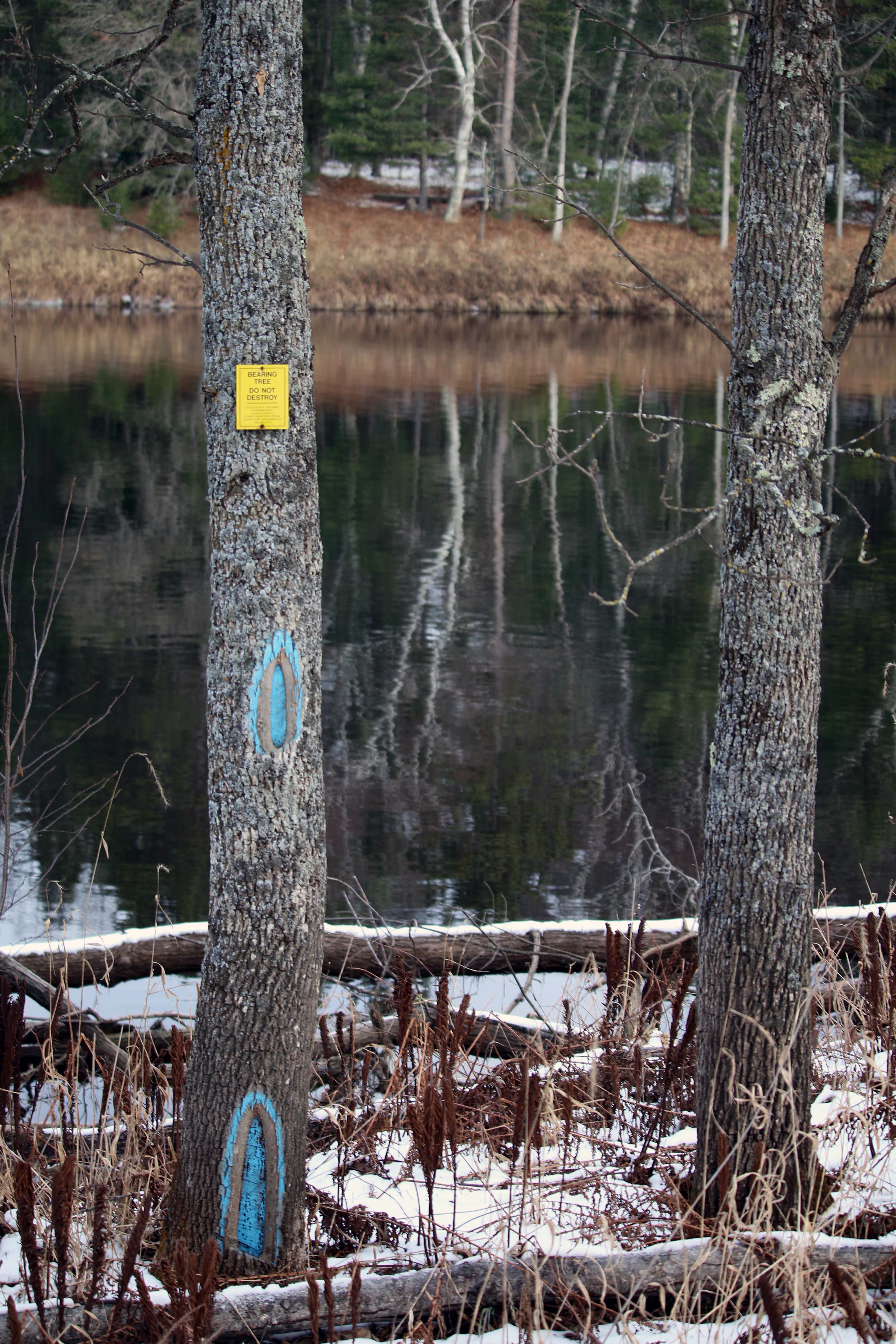
Boundary: A bearing tree is a marked tree used to ensure a corner could be found if the monument marking it was destroyed. Surveyors mark trees with prescribed marks, noting the tree’s species, size (diameter), and location relative to the corner.
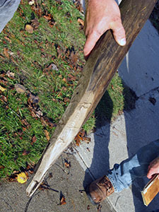
Corner: A corner post from Michigan’s original survey is shown. This post was set on July 30, 1850, and was unearthed in 2012.
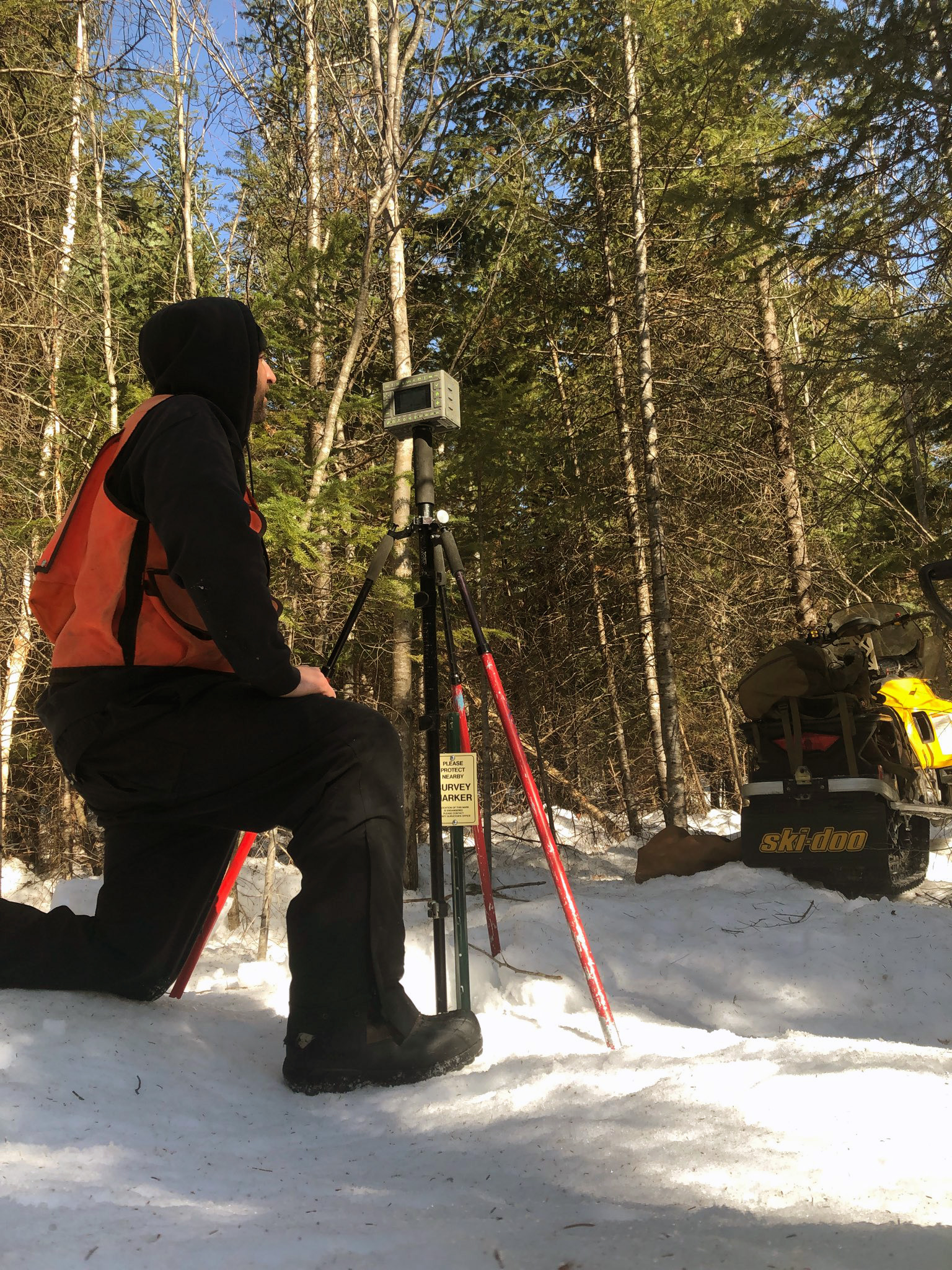
Nutkins: Professional surveyor John Nutkins uses a Global Navigation Satellite System receiver to collect location information on an existing corner monument.
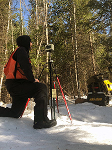
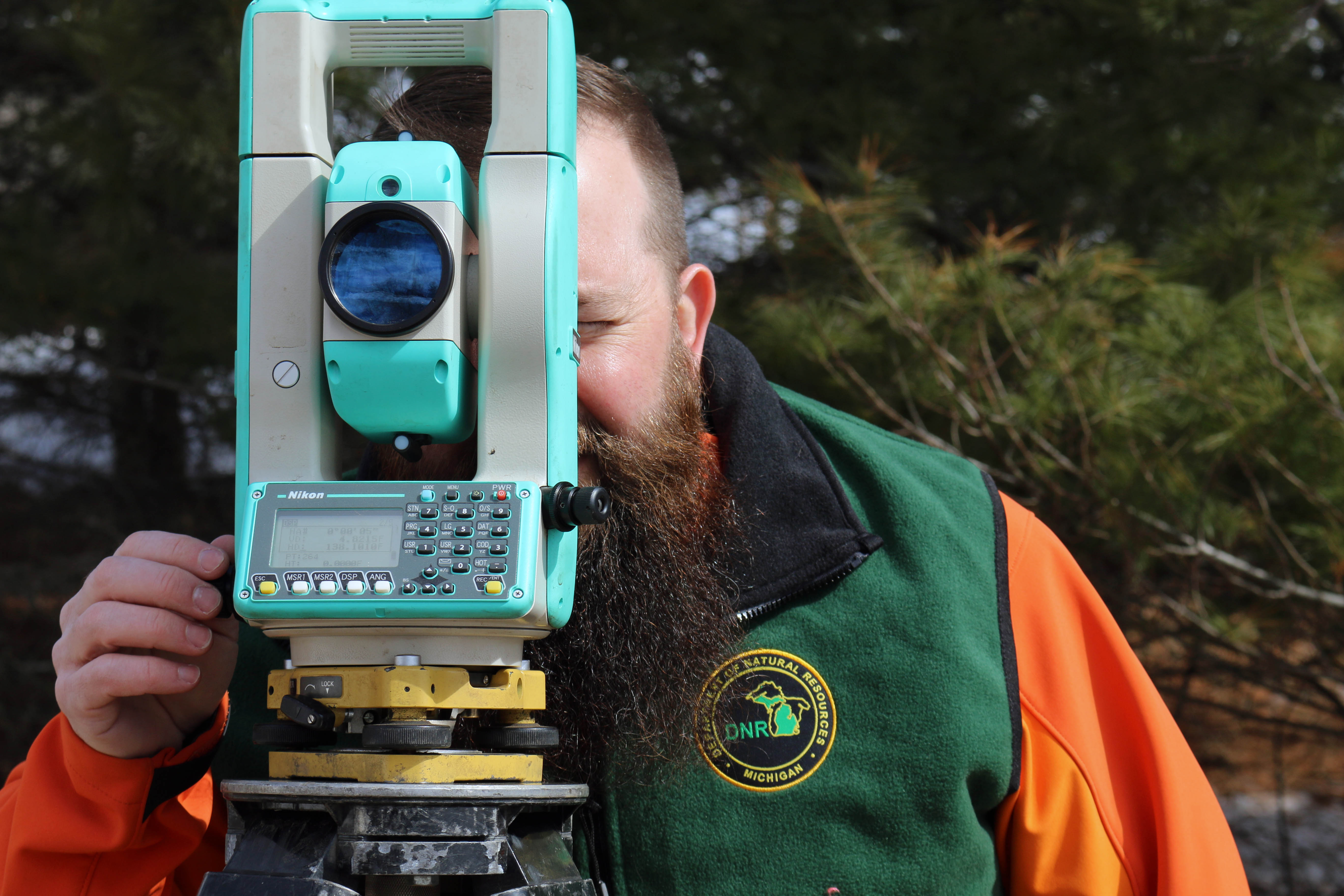
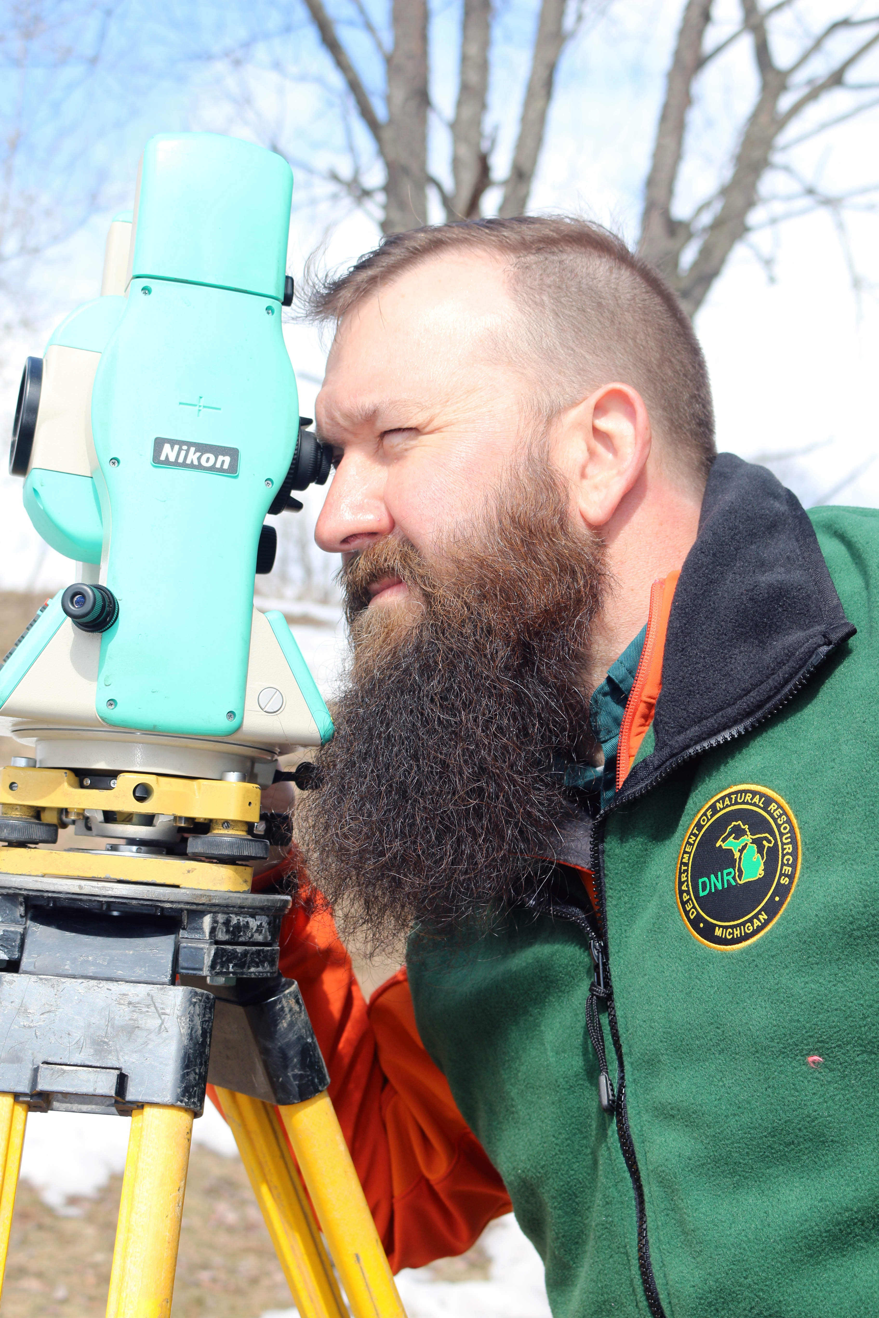
Pipp and Pipp-2: Professional surveyor Jeremy Pipp uses a Total Station, an electronic theodolite (transit) integrated with an electronic distance meter, to measure angles and distances.
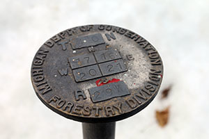
Post: A Michigan Department of Conservation corner monument from the 1950s is shown. Corner monuments constructed from materials such as steel, brass, and aluminum are used to increase durability and longevity as compared to traditional wooden post monuments.
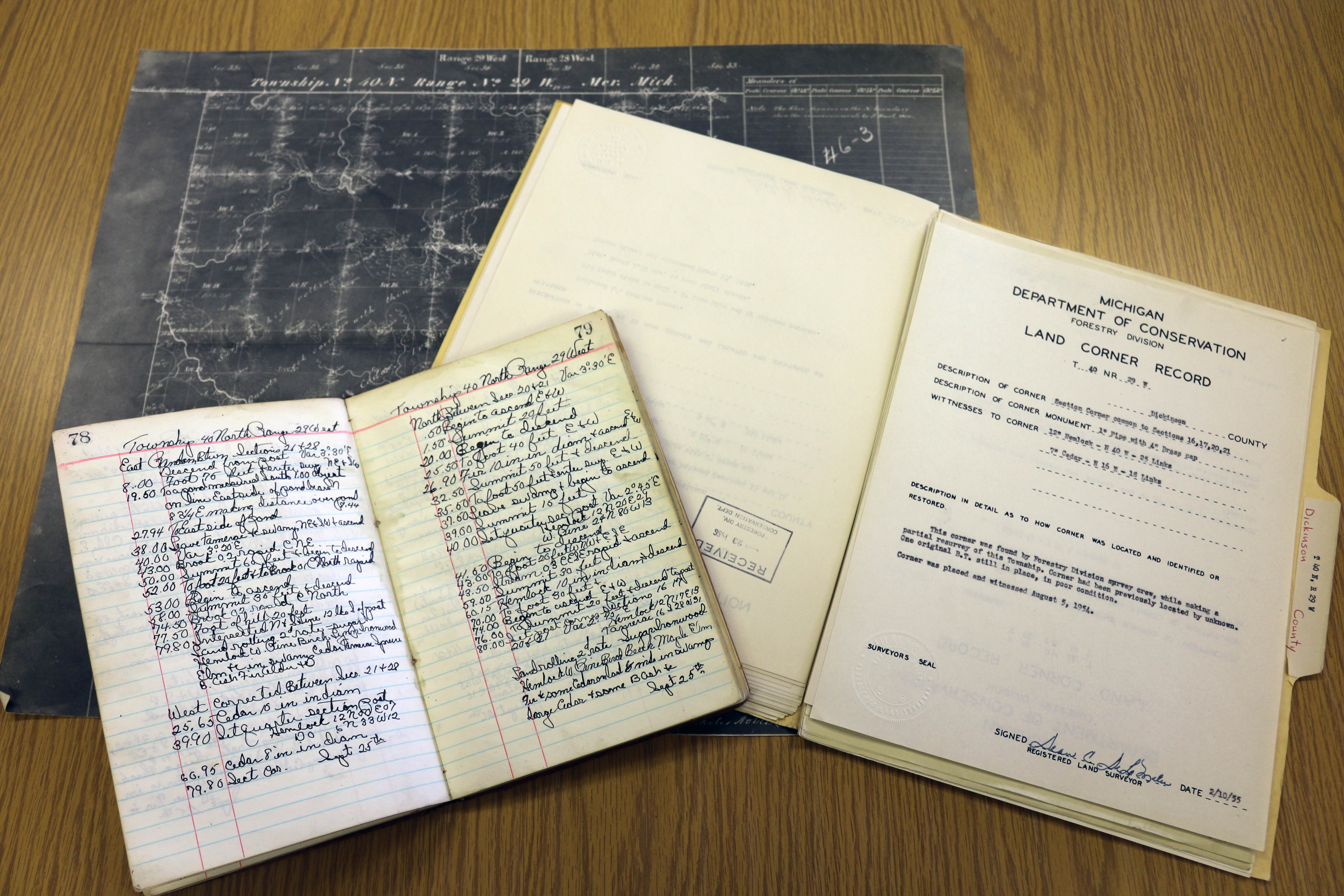
Records: General land office plat maps, original surveyor’s field notes and existing corner records are used to determine property lines.
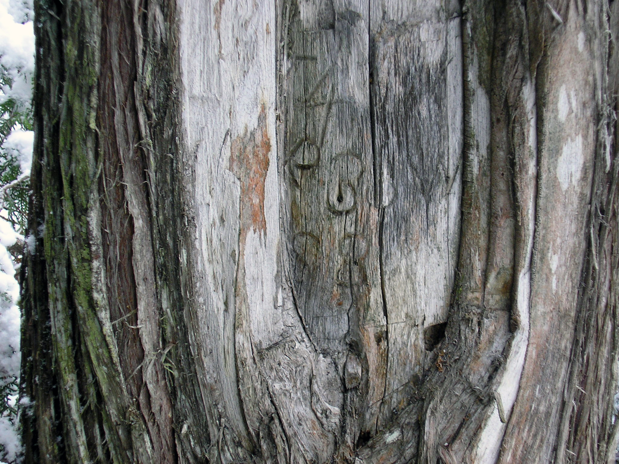
Tree and Tree-2: A tree shows township, range and section markings./
|


