|
|
February 2024 | Land Trust eNews
|
|
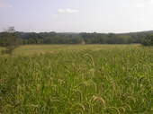
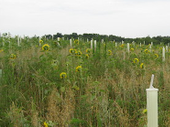
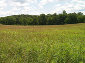
Maryland Environmental Trust Spotlight |
|
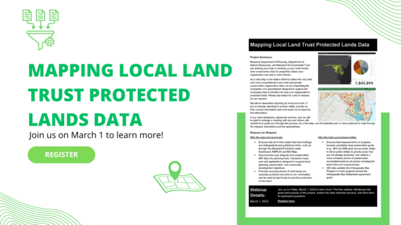 Mapping Local Land Trust Protected Lands Data
Join the Maryland Department of Planning, Maryland Department of Natural Resources, and Maryland Environmental Trust for a free webinar on March 1, 2024 to learn more about a collaborative effort to collect and map the most comprehensive land trust and private conservation organization protected lands data.
MDP, DNR and MET are seeking your help in sending us your most recent land preservation data for properties where your organization has sole or joint interest. Accurate Protected lands data ensures that measurements of progress towards cumulative land conservation goals (e.g., 40x40 goal) are accurate, helps to direct public dollars to priority areas that are not already protected, and reflects a more complete picture of preservation accomplishments by all parties including the local land trusts and conservancies.
This webinar will discuss the goals and purpose of the project, explain the data collection process, and allow time for participant questions. Learn more.
This event is free, but registration is required. Please register by COB on February 23.

Land Trust Monitoring Reports
THANK YOU to all land trusts who submitted their co-held easement monitoring reports to MET for CY2023! Co-held reports are being processed.
If you have not yet submitted your land trust's co-held monitoring reports please contact Michelle at michelle.grafton@maryland.gov.
|
|
|
National Invasive Species Awareness Week: Invasive Species Webinars
Multiple dates | Online
The North American Invasive Species Management Association (NAISMA) hosts educational webinars on priority invasive species issues the week of NISAW and the 3rd Wednesday of each month. The 2024 NISAW webinar series is listed on the NISAW events page. Learn more.
Invasive Species: Understanding the Problem & Finding Ways to Address the Issue Together
Past event | Online recording
The Chesapeake Bay Trust hosted a virtual meeting on Invasive Species on December 5, 2023. Participants learned more about common invaders across the watershed and the problems they pose. A recording of the convening, presentation slides and resources shared throughout the event were posted online. Learn more.
New Issue of Branching Out is Available Online!
Online | Free
Branching Out, Maryland's Forest Stewardship Education newsletter, is published four times per year by University of Maryland Extension. Branching Out provides educational information and current news and events. In the latest issue you can read about native trees of Maryland, invasives in your woodlands and upcoming webinars. Also, don't forget to check out the events calendar and brain tickler challenge. Learn more.
|
|
Tools, Tech and Tutorials |
|
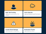 MyCoast: Maryland
 allows you to communicate flooding and storm damage in your community. It is a portal to collect and analyze photos which are linked to precipitation, riverine, and tidal data to create reports that help government agencies, business owners, and residents understand impacts in your community and encourage action to reduce localized flooding.
|
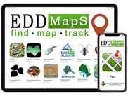 EDDMapS: Invasive Species Mapping
EDDMapS is a web-based mapping system for documenting invasive species and pest distribution. EDDMapS aggregates data from other databases, organizations and volunteer observations to create a national network of invasive species and pest distribution that is shared with educators, land managers, and beyond.
|
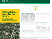 Experimental Network for Assisted Migration and Establishment Silviculture
The USDA Forest Service Pacific Northwest and Southwest Research Stations have initiated a study to evaluate the selection of seed sources and post-disturbance stand establishment practices to provide guidance on what tree seed sources to use and how to plant them to maintain functional forest ecosystems in the future.
|
|
Share Your News
If you would like to share relevant conservation news, success stories, announcements or events with Maryland's land trusts and conservation partners through this publication, please contact Michelle Grafton by the first of each month at michelle.grafton@maryland.gov.
|
|
|
|