|
Statewide Fire Update
This report is published weekly during fire season and covers the fire situation on land protected by the Idaho Department of Lands, Clearwater-Potlatch Timber Protective Association (CPTPA), or the Southern Idaho Timber Protective Association (SITPA), current fire statistics, the status of major fires and fire restrictions.
Use these links to jump to a section:
|
|
IDL Fire Situation
IDL Protection Only as of August 23
.
| Total Acres Burned, Year to Date* |
|
| Total Number of Fires, Year to Date |
|
| Total Human-Caused Fires, Year to Date |
- 109 Human-Caused
- 46 Undetermined
- 96 Natural
|
*Acres reflect what has burned within the IDL protection area and do not reflect ownership.
(RETURN TO TOP OF PAGE)
|
|
IDL Fire Suppression Expenses
As of Monday, August 19, 2024, IDL has spent a total of approximately $29.7 million on fire suppression activities. Approximately $2.6 million of that is reimbursable to IDL for assisting other agencies on their fires, leaving a total estimated net obligation to the General Fund of $27 million so far this year.
The total obligation above includes the 2024 contracted aircraft costs and prepositioned contract engines to assist with resource scarcity. These engines are assigned across the state to boost initial attack resources.
Information on estimated fire suppression expenses incurred by U.S. Forest Service, Bureau of Land Management, and other agencies in Idaho may not be available until after the fire season.
(RETURN TO TOP OF PAGE)
|
|
Statewide Acres Burned by Ownership
|
SURFACE OWNER
|
ACRES
|
|
Idaho Department of Lands
|
26,787
|
|
Other State Lands
|
2,843
|
|
Private
|
99,381
|
|
Bureau of Land Management
|
176,698 |
|
Forest Service
|
135,967 |
|
Other Federal
|
7,505 |
|
Tribe
|
897
|
|
Undetermined
|
847
|
|
Total Acres
|
450,925 |
(RETURN TO TOP OF PAGE)
Current as of August 23, 2024
|
|
Status of Major Fires on IDL Protection
Flat Fire
Southwest Forest Protective District
Location: About 1 mile northeast of Pioneerville in Boise County, Idaho
Reported: August 5, 2024
Cause: Lightning/Natural
Acres Burned: 3,732 Acres
Containment: 53%
Personnel: 431
Fuels: Timber with grass and understory
Management: Great Basin Complex Incident Management Team 6
InciWeb: https://inciweb.wildfire.gov/incident-information/idids-2024-flat
Incident Facebook: https://www.facebook.com/IdahoDepartmentofLands
Highlights: Yesterday was another productive day and fire containment continues to increase. The fire has remained within its footprint, the increase in acreage is from more precise mapping of the perimeter. The northern side of the fire, along the previous 2016 Pioneer fire, has provided lower fire intensity and slowed the rate of spread allowing crews and equipment to continue to improve containment lines. Although it has slowed fire intensity, it has also slowed firefighter progress as the many snags (standing, dead trees) in the burn scar have to be mitigated to allow for firefighter safety.
Along the eastern edge of the fire, resources are going direct (along the fire edge) where possible, although steep terrain along with snags also dictates an indirect line (not along the fire edge) be established. Unburned pockets of fuel inside the fire continue to put up light smoke.
With relative humidity reaching as low as 7% and wind gusts to 30 MPH yesterday, the control lines held. Overall fire behavior has been minimal. Mop up progresses both along and deeper into the fire, as it continues to be monitored and patrolled. Fireline repair work has begun in areas where possible. This jump starts the naturalization of disturbed areas so as to control erosion, breakdown of organic matter and visually improve areas of bare earth that stopped fire progression.
Fire Behavior and Weather: A low-pressure system approaching today will bring winds with gusts predicted to 28 MPH. Warm and dry conditions experienced yesterday will moderate as temperatures begin to lower and relative humidity increases through the next few days. There is a chance of wetting rain for today predicted to be a 10% chance.
(RETURN TO TOP OF PAGE)
|
|
IDL Incident Management Team Fires to Date
Flat Fire
- The Southwest Forest Protective District received management of the fire on August 8. Management was transferred to the North Idaho Gold Team on August 16. On August 19 the Great Basin Complex Incident Management Team 6 assumed command of the fire. The current acreage for the fire is 3,732 acres.
Gwen Fire
- Ponderosa Forest Protective District/Nez Perce Tribe transferred management to the Rocky Mountain Complex Incident Management Team Three (Bill Wall I.C.) on July 28. The fire was transferred back to local managers on Saturday, August 3.The final acreage for the fire was 28,820 acres.
Cherry Fire/Steelhead Fire
- Craig Mountain Forest Protective District transferred management to the IDL Type 3 Team (Nate Rogers I.C. and Graydon Galloway IC3 trainee) on July 30. Management was transferred back to the district on August 2. Cherry Fire was 53 acres and the Steelhead Fire was 59 acres.
Texas Fire
- Ponderosa Forest Protective District transferred management to an Northern Rockies Team 8 on July 18. Management was transferred back to the district on Thursday, July 25. The fire was 1,565 acres.
Billy Creek Fire
- Craig Mountain Forest Protective District transferred management to the Northern Rockies Team 1 (Brent Olson I.C.) on July 7. Management transferred back to the district on Friday, July 12. The fire was 3,185 acres.
(RETURN TO TOP OF PAGE)
|
|
Status of Major Fires Outside IDL Protection
Middle Fork Complex
Snag Fire
Dollar Fire
Bull Trout Fire
Wapiti Fire
Boulder Fire
Goat Fire
Wolf Creek Fire
Limepoint Fire
Cliff Mountain Fire
Payette Wilderness Fires
Burnt Creek Fire
Shepp Fire
Cracker Jack Complex
Ace Butte
Anchor Fire
Wye Fire
|
|
|
(RETURN TO TOP OF PAGE)
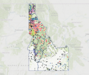
Statewide Fire Map
(RETURN TO TOP OF PAGE)
Fire Restriction Information
 |
|
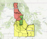
IDL's Fire Restriction Finder webpage includes a GIS-enabled map that highlights fire restrictions announced by the responsible jurisdictions. It also includes helpful definitions of Stage 1 and 2 restrictions, along with answers to Frequently Asked Questions.
|
Fire Restrictions Currently in Place
Online Fire Restriction Resources
(RETURN TO TOP OF PAGE)
Fire Information News Feed
 |
|
The Fire Information Newsfeed webpage displays the latest information about active wildfires within the more than 9 million acres protected by IDL, CPTPA and SITPA. The Fire Information News Feed automatically checks for updates published by IDL and the incident management teams managing fires on our protection every 60 seconds. |
(RETURN TO TOP OF PAGE)
Fire Outlook
Northern Rockies Coordination Center Outlooks (North Idaho):
Great Basin Coordination Center Outlooks (Southern Idaho):
(RETURN TO TOP OF PAGE)
|
|
|
|
|