|
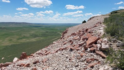
The Wyoming State Geological Survey (WSGS) published a report and two maps exploring the potential for critical mineral resources in the central Laramie Mountains of southeastern Wyoming. The two-year project focused on geologic mapping and geochemical analyses to investigate several overlapping mineral systems in the study area.
The publications are:
The report and pair of maps were part of an integrated effort funded partially through the U.S. Geological Survey’s Earth Mapping Resources Initiative (Earth MRI), which aims to improve knowledge of the country’s geology and to identify areas with potential critical mineral resources.
The mountains have potential for base- and precious-metal deposits—copper, nickel, gold, and silver—as well as critical minerals such as titanium, vanadium, tungsten, chromium, and rare earth elements. There is also potential for molybdenum, platinum group element metals, and graphite.
In the news release announcing the new publications, WSGS geologist and lead author, Patty Webber, said, “These maps and accompanying report show our interpretation of some very complicated geology.
“This region is defined by the suture zone between two cratons, which formed about 1.7 billion years ago. It was subsequently intruded by the Laramie Anorthosite Complex and the Sherman batholith around 1.4 billion years ago,” Webber added. “Deciphering the geologic history through mapping and detailed study is key for understanding the enrichment potential of precious, base, and critical minerals, as well as contributes to the understanding of the formation of the North American craton.”
Critical mineral research is a significant focus at the WSGS, with ongoing work including a statewide survey of heavy mineral sandstones; mapping, geochronology, and geochemistry in the Medicine Bow Mountains; and geochemistry of the Phosphoria Formation in western Wyoming.
Wyoming’s oil and gas production was, for the most part, back to normal in 2022, according to the latest summary report on oil and gas from the WSGS. The goal of this annual report from the Energy and Minerals division is to inform the general public about recent events and trends in the oil and gas industry.
One of the most positive items in this year’s report was that oil production in 2022 was greater than had been originally predicted. At the beginning of last year, the Consensus Revenue Estimating Group (CREG) estimated a statewide total of 85 million barrels of oil, but in October CREG revised its forecast, adding an extra five million barrels to Wyoming’s production. By the end of the year, it was clear that Wyoming was on track to meet or slightly exceed that revised prediction.
The summary report also discussed oil production throughout the state in finer detail. In reviewing production by county, the report noted that 60 percent of Wyoming’s oil comes from just two counties, Converse and Campbell counties, in the Powder River Basin. In addition, Laramie County, in the northern Denver Basin, contributes more than 10 percent of the state’s total.
As for natural gas, production in Wyoming either held steady or declined in 2022. Sublette, Sweetwater, and Fremont continued to be the top producing counties.
In addition to providing a recap of last year’s production, the report mentioned a few recent developments to keep an eye on going forward. For one, some changes had been made to the Bureau of Land Management oil and gas lease sale process in 2022, including a new royalty rate. Although only one sale took place in 2022, the future might bring a return to quarterly sales. When the report was published, the BLM had announced preliminary parcels for its second- and third-quarter lease sales this year.
Also new in oil and gas last year was record-breaking market volatility due in part to global supply disruptions. With unpredictable day-to-day oil and natural gas prices, it can be difficult for oil and gas companies to plan for the long term. Exactly how this will play out for operators in Wyoming is uncertain, but, as the report concludes, “If anything is certain, it is that Wyoming’s oil and gas industry will continue to adapt to an always changing, often unpredictable world.”
Wyoming is rich with minerals. A new interactive map under development at the WSGS will make it easier to research the state’s vast mineral resources.
“Our new online map will serve as a central location to find and research relevant mineral and mining information from both state and federal agencies, as well as host data collected by the WSGS for mineral-related publications,” says Jim Stafford, a geohydrologist and map developer at the WSGS.
The new product will revamp and expand the Survey’s 2018 Mines and Minerals Map. For example, the new map will offer data from the U.S. Geological Survey, such as the Topographic Mine and Prospect and Coal Quality databases, as well as the Wilderness Area Mineral Resource reports.
Several static WSGS maps that have been made interactive will be included as well, and there will be a series of layers showing study areas for WSGS publications.
“The goal with this map is to make mineral-related data more accessible and interactive to the public,” Stafford says. “We also plan to routinely update it as new data become available.”
The new map will launch later this year.
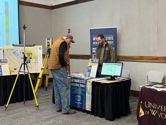
WSGS geohydrologist Jim Stafford participated in GIS Day at Laramie County Community College in Cheyenne in November. More than 100 high school and college students, as well as local educators, attended to learn more about GIS (Geographic Information Systems). Speakers talked about what GIS is, and current and future uses and applications. The WSGS was one of the many participant tables displaying different fields of professional GIS use. The WSGS answered questions about general GIS use, GIS in geological mapping, and GIS careers in science fields.
|