
NEWS RELEASE: Wyoming Geological Survey Releases Report, Maps on Central Laramie Mountains
Wyoming State Geological Survey sent this bulletin at 10/31/2022 09:27 AM MDT
October 31, 2022
Media Contact:
Christina George
christina.george@wyo.gov
Report, 2 Maps Focus on Central Laramie Mountains
The publications are part of a program assessing critical mineral resources
The Wyoming State Geological Survey (WSGS) published a report and pair of maps of the central part of the Laramie Mountains. The publications offer new data that are helpful for assessing critical mineral resources in Wyoming.
Report of Investigations 79, “Preliminary Investigation of the Critical Mineral Potential of the Central Laramie Mountains, Wyoming,” and the 1:24,000-scale King Mountain and Ragged Top Mountain quadrangles in Albany and Laramie counties were completed as part of a multi-year integrated project funded partially through the U.S. Geological Survey’s (USGS) Earth Mapping Resources Initiative (Earth MRI) program.
According to the USGS, “The goal of Earth MRI is to improve knowledge of the geologic framework in the United States and to identify areas that may have the potential to contain undiscovered critical mineral resources.”
“Collaboration between the USGS and WSGS is beneficial to Wyoming,” says Dr. Erin Campbell, WSGS Director and State Geologist. “Earth MRI is a unique program within the USGS that allows state surveys to contribute local knowledge to a national effort of securing a stable supply of minerals critical to the United States.”
The Laramie Mountains have potential for base- and precious-metal deposits such as copper, nickel, gold, and silver, as well as critical mineral resources, including titanium, vanadium, tungsten, chromium, and some of the rare earth elements. There is also potential for molybdenum, platinum group element metals, and graphite.
This two-year project focused primarily on geologic mapping and geochemical analyses in order to investigate multiple overlapping mineral systems within the Laramie Mountains. The report summarizes the analytical methods, data, and interpretations for both the maps and the greater project area.
“These maps and accompanying report show our interpretation of some very complicated geology,” says WSGS geologist Patty Webber. “This region is defined by the suture zone between two cratons, which formed about 1.7 billion years ago. It was subsequently intruded by the Laramie Anorthosite Complex and the Sherman batholith around 1.4 billion years ago. Deciphering the geologic history through mapping and detailed study is key for understanding the enrichment potential of precious, base, and critical minerals, as well as contributes to the understanding of the formation of the North American craton.”
The King Mountain and Ragged Top Mountain maps, in addition to Report of Investigations 79, are available as free downloads; the maps are also available as hardcopies for purchase. The geochemical and geochronological data collected as part of this project are available in digital table format as appendix tables within the report; raw analytical data are also available online.
Critical mineral research is a significant focus at the WSGS, with ongoing work including a statewide survey of heavy mineral sandstones; mapping, geochronology, and geochemistry in the Medicine Bow Mountains; and geochemistry of the Phosphoria Formation in western Wyoming.
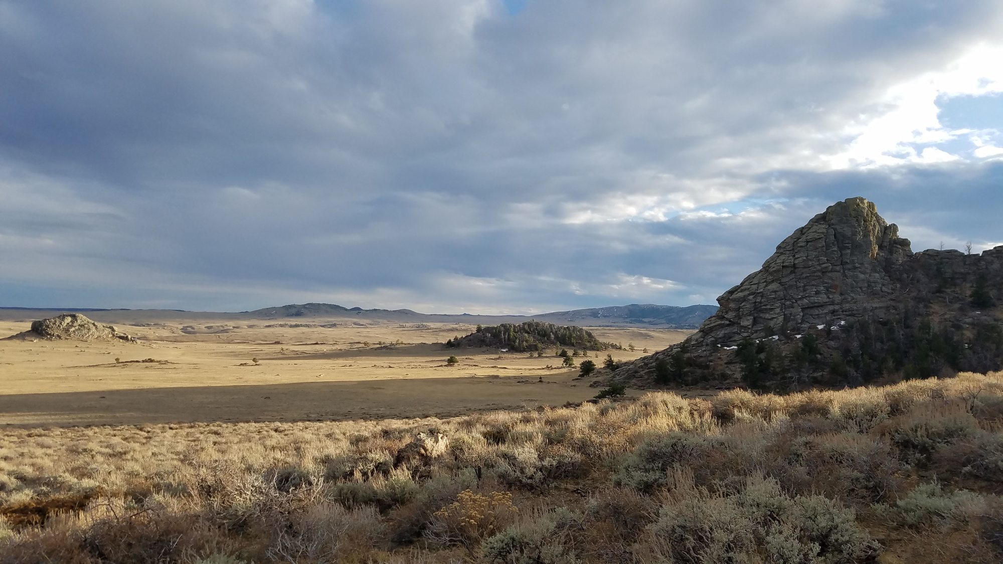
Caption: Photograph highlighting some of the Paleoproterozoic Horse Creek complex in the central Laramie Mountains. Lake Hill, on the far right, is composed of Ragged Top granodiorite, the small hills in the midground are porphyritic granite and granodiorites, and Sherman Hill in the background is Horse Creek anorthosite. (WSGS photo)

|
Interpreting the past ~ providing for the future Email: wsgs-info@wyo.gov |
| STAY CONNECTED: | |||||||
|
|||||||
SUBSCRIBER SERVICES:
Manage Subscriptions | Unsubscribe All | Subscriber Help