
NEWS RELEASE: Wyoming Geological Survey Publishes Series of Summary Reports
Wyoming State Geological Survey sent this bulletin at 01/03/2019 10:40 AM MST |
|
Having trouble viewing this email? View it as a Web page.
|
January 3, 2019
******FOR IMMEDIATE RELEASE******
Media Contact:
Christina George
(307) 766-2286 x231
christina.george@wyo.gov
WSGS Publishes 2018 Summary Reports
Reports Cover Wyoming’s Oil and Gas, Coal, Critical Minerals, and Geologic Hazards
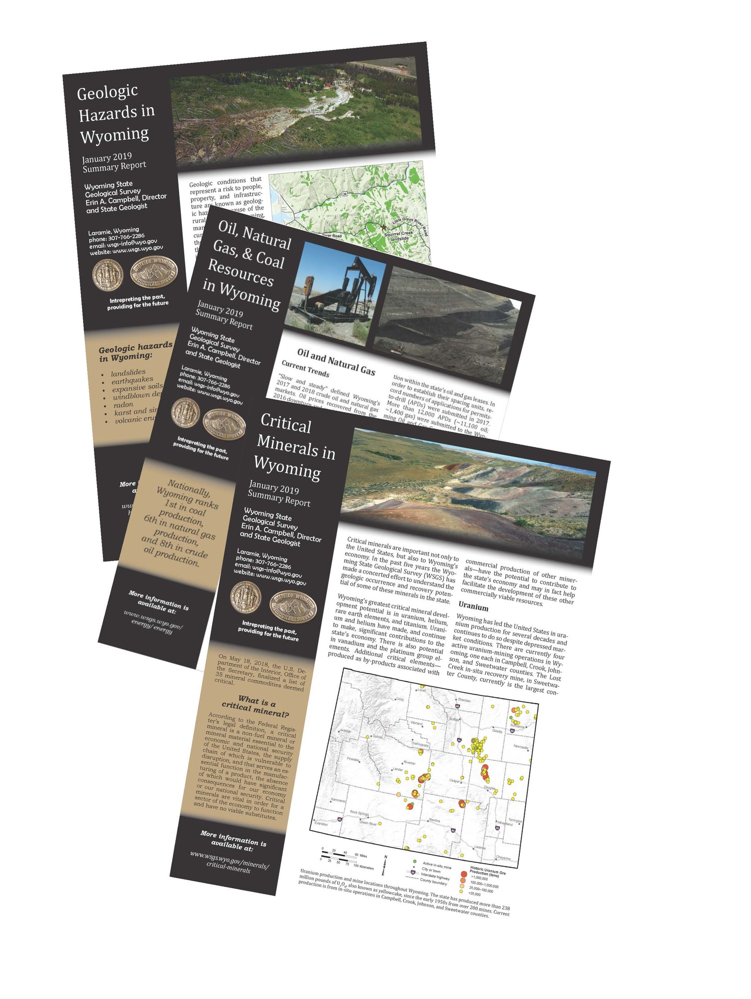
The Wyoming State Geological Survey (WSGS) published a series of summary reports highlighting issues and opportunities related to the state’s geology in 2018. The three publications provide synopses of Wyoming’s oil, natural gas, and coal industries; critical mineral resources; and geologic hazards.
“There are many important geologic issues in Wyoming, and these summaries of 2018 provide residents, elected officials, and state government with a snapshot of energy and mineral resources in Wyoming, as well as the geologic hazards that exist,” says WSGS Director, Dr. Erin Campbell.
Summary reports are available free of charge at the WSGS office on the University of Wyoming campus in Laramie and on the agency’s website. The summary reports are brief overviews of important geologic topics from 2018; more in-depth information is available through WSGS publications and by contacting the agency and its staff of geologists.
The crude oil, natural gas, and coal report recaps current trends in the industries, such as production levels for 2018 and comparisons to recent years. It includes information about exploration and development in the Powder River Basin and other oil and gas development projects throughout the state. The coal portion of the report summarizes where Wyoming coal production was distributed in 2018 and how it has varied through time.
The critical minerals summary report reviews Wyoming’s development potential of minerals deemed critical by the U.S. Department of the Interior. Of the 35 minerals or mineral commodities on the list, Wyoming’s highest development potential is in uranium, helium, and rare earth elements. Additional information can be found on the WSGS Critical Minerals in Wyoming webpage.
The geologic hazards report provides a short overview of some of the notable landslides that occurred in Wyoming in 2018, including the Porcupine Creek landslide in Lincoln County that dammed the Greys River and destroyed a U.S. Forest Service road. Earthquakes in a recent 12-month period and faults were also summarized in the publication. Learn more from a new WSGS interactive online map, Wyoming Geologic Hazards Map.
“Geologic hazards are an important part of the Survey’s mission and have the potential to affect nearly everyone living in Wyoming,” says Seth Wittke, WSGS hazards, mapping, and water resources manager.
The summary reports additionally note some WSGS projects that will be completed and available to the public in early 2019. “The intent of these reports is to help those living and working in Wyoming begin the new year fully informed about the most crucial and timely geologic topics facing the state,” says Director Campbell.
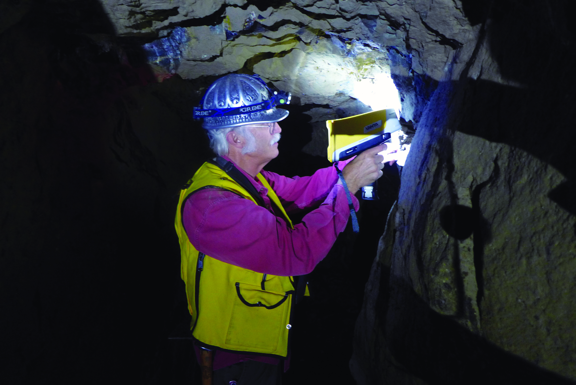
Caption: WSGS geologist uses a handheld X-ray fluorescence analyzer to check chemistry of veins in an underground mine at South Pass City. This tool is helpful in determining the presence of critical and economic elements. (photo credit: Wyoming State Geological Survey)
This is a test for the Survey news release system.

|
Interpreting the past ~ providing for the future Email: wsgs-info@wyo.gov |
| STAY CONNECTED: | |||||||
|
|||||||
SUBSCRIBER SERVICES:
Manage Subscriptions | Unsubscribe All | Subscriber Help