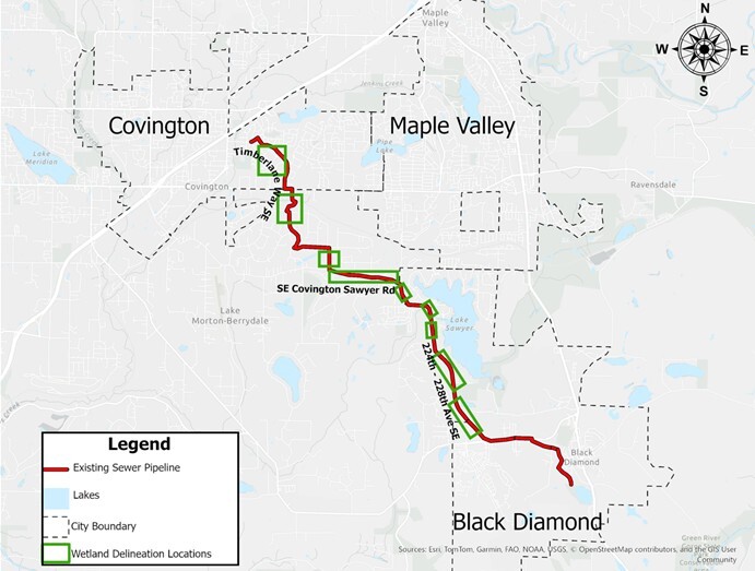
Wetland sampling along the regional sewer pipeline planned for April 10 through April 15.
King County, Washington sent this bulletin at 04/09/2025 02:34 PM PDT
|
About King County Wastewater Treatment DivisionThe King County Wastewater Treatment Division protects public health and the environment by collecting and cleaning wastewater while recovering valuable resources for a thriving Puget Sound region. We provide services to 18 cities, 15 local sewer districts, the Muckleshoot Indian Tribe, and nearly 2 million people across a 424-square-mile area in King, Snohomish, and Pierce counties.
|
|||||||
|
You’re receiving this newsletter because you signed up for information and updates from King County’s Wastewater Treatment Division. Update your preferences or unsubscribe. If you have questions about this service, you may contact us directly or search FAQs here. View King County's privacy policy. This service is provided to you at no charge by King County, WA. |

Having trouble viewing this email? View it as a Web page.