|
Summer continues to bring new energy and action across the Chehalis River Basin. From early-season monitoring efforts to community science projects, the work to restore salmon habitat, reduce flood damage, and strengthen the Basin’s future is picking up speed.
In the past few weeks, the Chehalis Basin Board and its partners have advanced key parts of the long-term strategy. At the same time, local residents are getting more involved than ever through new tools like iNaturalist, helping track invasive weeds and protect native plant communities.
This issue includes updates on three important efforts happening this season:
- New iNaturalist projects that turn everyday observations into valuable data
- A closer look at the Comparative Analysis Framework guiding Board decisions
- And a snapshot of the continued restoration being done across the Basin.
Whether you’re working in the field, at a community meeting, or just exploring the outdoors, there are more ways than ever to stay connected to this work.
We’re excited to share a fun and helpful new way to support noxious weed tracking and public engagement in the Chehalis Basin.
If you’re not already familiar, iNaturalist is a crowdsourced species identification system and organism occurrence recording tool. It’s simple enough for beginners and powerful enough for experienced observers. Whether you're hiking, gardening, or just out in nature, you can help monitor species and track environmental changes right from your phone.
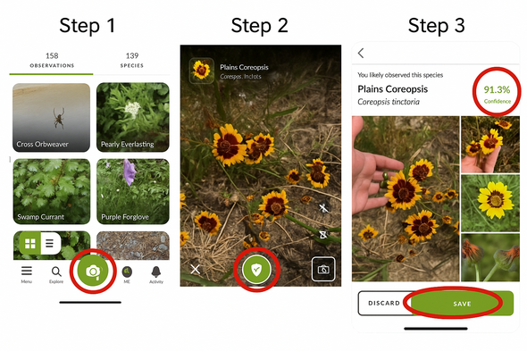
How to Use iNaturalist
-
Download the iNaturalist app, create an account, and tap the green camera icon to start an observation.
- Take a photo of the plant or organism (or upload from your camera roll).
- iNaturalist will provide ID suggestions with confidence percentages. You can upload the suggested ID or search manually.
- All your observations are saved to your profile, so you can view and manage them anytime.
What Are iNaturalist Projects?
Projects on iNaturalist let us group a set of observations based on selected species and specific places. Once a project is set up, any observation matching its criteria - no matter when it was made - gets automatically included.
King County Noxious Weed Board has launched two new iNaturalist projects have for the Chehalis Basin:
Why These Projects Matter
These tools are more than just a fun way to share nature with friends - they are tools to collect data, for early detection, early detection, and long-term tracking. Anyone can post observations, and others can verify or comment on them, or message observers directly for more details.
Here is how your input helps:
- Early Detection Rapid Response (EDRR): iNaturalist is a valuable tool for EDRR- key to stopping new infestations before they spread. A recent blog post from the King County Noxious Weed Board (linked in the email) shared how one user’s report of a rare invasive species helped trigger a rapid local response.
- Tracking Spread Over Time: Observations can be filtered by year and species, helping us visualize trends.
Tell your friends, family, kids, grandparents, coworkers—or even your local farmer’s market produce vendor- to use iNaturalist. The more people using the app in the Chehalis Basin, the more effective these projects become for all of us.
Just download the app, snap a photo, and contribute to protecting our ecosystem.
As the Chehalis Basin Board advances its work to reduce flood damage and restore aquatic species, a new decision support analysis is helping ensure those decisions are grounded in data, equity, and long-term resilience. The Comparative Analysis Framework provides a consistent, transparent way to evaluate and compare different combinations of options that the Board will consider to select a single, long-term strategy.
These options include a mix of flood control and restoration actions such as levee construction, land acquisition, channel modifications, and habitat restoration. The framework is designed to help the Board understand how different approaches perform across multiple areas of importance, highlighting trade-offs and opportunities to strengthen outcomes.
What Does It Evaluate?
The Comparative Analysis Framework identifies 15 “Evaluation Categories,” which are broad topical areas that capture the key values, interests, and impacts of the Chehalis Basin Strategy options, with the goal of representing a comprehensive set of environmental, economic, social, and cultural considerations relevant to ecosystems and communities in the Basin. The Evaluation Categories are organized in four focus areas—environmental outcomes, economic outcomes, social/cultural outcomes, and “additional considerations” that are relevant for decision-making, such as costs and feasibility. For each Evaluation Category, the Board determined relevant goals, and the Comparative Analysis Framework identifies “Evaluation Factors” that are qualitative and quantitative metrics for assessment performance of each option with respect to the stated goals.
How Is It Being Used?
By applying consistent scoring criteria across different scenarios, the framework enables the Board and partners to:
- Compare performance side-by-side
- Focus discussions on shared values and goals
This structured approach helps move beyond opinions or individual priorities and supports thoughtful, evidence-based decisions.
What’s Next?
With the Comparative Analysis Framework in place, the Board is ready to start comparing different options of independent projects to one another. Over the next few months, experts will be running computer models and collecting data, and starting to answer some of the questions raised by the Framework. In early 2026, the Board will use the Framework to come to a decision on a long-term Chehalis Basin Strategy.
This is a critical milestone in shaping a long-term strategy that is balanced, adaptive, and informed by community values. As climate risks grow and ecosystem recovery remains urgent, tools like the Comparative Analysis Framework will play a vital role in guiding the future of the Chehalis River Basin.
Stay tuned for more updates as this work progresses.
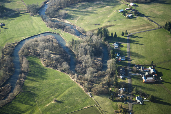
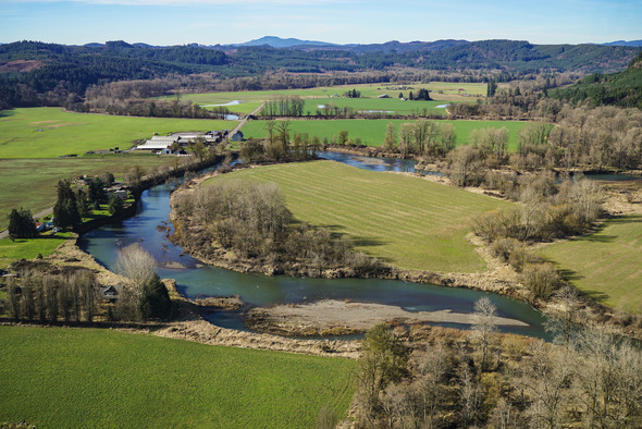
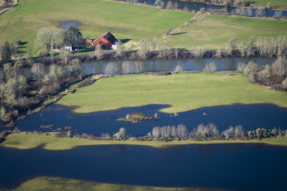
Summer is a busy season for habitat restoration in the Chehalis Basin. Across the region, partners are breaking ground on projects that reconnect rivers and streams, improve water quality, and help fish and wildlife thrive.
Right now, crews are working on nearly a dozen fish passages, stream restoration, and habitat enhancement projects across Grays Harbor, Lewis, Thurston, and Pacific counties. These efforts are supported in part by funding from the Aquatic Species Restoration Plan (ASRP), a core component of the long-term Chehalis Basin Strategy.
Some highlights from this summer’s work:
-
Restoring habitat for salmon and lamprey: In Pacific County, culverts that block fish from migrating are being removed and replaced with bridges that allow water and wildlife to move freely. Meanwhile, in the Newaukum River near Chehalis, engineered log jams and channel improvements are reconnecting side channels and improving conditions for spawning salmon.
-
Reviving degraded streambanks: Along Lincoln Creek in Lewis County, riparian restoration is underway to stabilize eroded banks, shade the stream, and support water quality. This work is especially important for building resilience in places hit hard by past floods.
-
Partnering with landowners for long-term solutions: Much of this summer’s restoration is taking place on private land—thanks to the trust and participation of local landowners. Their partnership is essential to making restoration work scalable and sustainable throughout the Basin.
These are just a few of the projects moving forward under the ASRP this season. Each one plays a role in the long-term effort to protect native aquatic species—especially salmon, steelhead, and lamprey—and to create a more resilient watershed for future generations.
To learn more about the Chehalis Basin Strategy and the Office of Chehalis Basin’s role in this work, visit: officeofchehalisbasin.com
Coastal Interpretive Center:
Field Site Tour at John’s River
- August 4 at 11:00 am - 12:00 pm
Join Miles, CIC Summer 2025 Water Quality and Habitat college intern for a tour of one field site on the south side of the Grays Harbor Estuary. He’ll show how he monitors for invasive species and talk about their impact on local ecology. Click here to register.
Field Site Tour at Bill’s Spit
- August 12 at 12:00 pm - 1:00 pm
Join Miles, CIC Summer 2025 Miles, CIC Summer 2025 Water Quality & Habitat college intern for a tour of one field site on the western part of the Grays Harbor Estuary. He’ll show how he monitors for water quality in this highly tidal environment. Click here to register.
These tours are free, however online registration is required.
|
Follow us on social media and never miss the latest news, project updates, and coming events:
|
|
|