|
You may be surprised to learn that one of the Historic Records Center's most frequented documents is not from the 18th or 19th century but rather from the 1980s. In this month’s edition of Found in the Archives, we will look at the Fairfax County 1860 Map and accompanying 1860 Biographies, which were put together in the 1980s by the hard work of two historians, Beth Mitchell and Edith Sprouse.
Many researchers who come into the Historic Records Center are interested in learning about the history of their property or seek to learn more about where their family lived. One of the best ways to learn this information is to perform what is called a chain of title. A chain of title involves using all of the deeds to a property to trace the ownership back as far as one can go. This can take a lot of work, and since historic deeds are not tied to addresses it can be difficult to make sure you are still looking at the correct property.
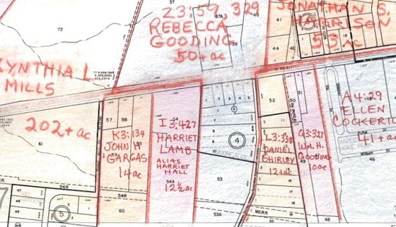
Beth Mitchell’s 1860 Map is one of the main ways researchers here check their work or jump back in time when performing a chain of title. This map features a colored pencil outline of all the landowners of Fairfax County in 1860 over top of a 1981 map of the county. The map is sorted by Tax Map number, which all modern parcels are assigned, and each parcel includes the name of the land owner and references the court record by which they received the property (a deed, a will, or a court case). The 1860 map was inspired by an earlier 1760 map of landowners in Fairfax County, since the county had changed so drastically over the century.
The companion to this map are the 1860s Biographies, compiled by Edith Sprouse, which provides biographical information for each landowner featured on the 1860 Map. The biographies contain information taken from numerous sources all in one place. Before this project, researchers would have to spend hours looking through dozens of record types to find all this information that is now available on one single page. The biography for just one person can include birth dates and locations, marriage records, tax information, family information including relatives and their ages, voting records, and even what they did for work. Not all individuals have the same amount of information known about them, but even establishing they were a landowner can be very telling.
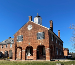
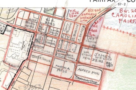
One person we can highlight researching with the map and biographies is Harriet Lamb. Harriet Lamb was a free black woman who owned land in the City of Fairfax. Featured on the 1860 Map, we can see that she owned a 12 ½ acre parcel that she received in Fairfax County Deed Book I-3 page 427. There is also a note that she went by the alias of Harriet Hall. By checking the referenced Deed Book on the map, we can learn Harriet purchased her land in September of 1844 for $120. Her biography entry does not contain a vast amount of information, but a free black woman being the sole owner of a parcel of land in 1860 is still notable and unique.
 Fairfax County 1860 Map, 56-2
 Fairfax County 1860 Biography, Harriet Lamb
An example of an individual with a large amount of information in his biography is Benjamin D Utterback. Utterback owned land in what is now the Centreville area of Fairfax County. From his biography, we can learn that he and his wife Susan, had eight children, and that Benjamin was a merchant and their eldest child William was working as a clerk at 18 years old. We can also see that Benjamin was a Justice of the County Court in August of 1860, he voted for secession from the Union in 1861, owned three slaves, and was the Postmaster at Centreville in 1865. The Biography also sites an 1893 Fairfax Herald article stating that Utterback, “Died in Centreville on Monday last, age 85. He was a native of Fauquier Co but lived in Fairfax over 50 years.”
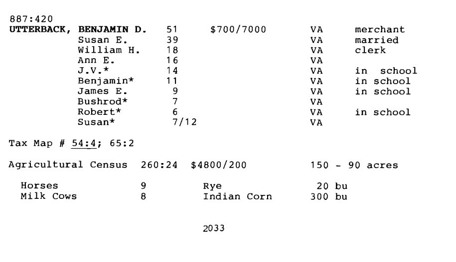  Fairfax County 1860 Biography, Benjamin D Utterback
The 1860 Map can also be used to look at the ownership of notable locations in Fairfax County. Below, you can see the landowners of Downton Fairfax City, as well as John A. Washington owning the Mount Vernon Estate.
Fairfax County 1860 Map, 57-4
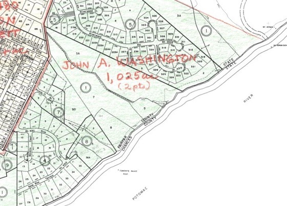 Fairfax County 1860 Map, 110-4
Here at the Historic Records Center, we are thankful for the countless hours of work these women put into creating the 1860 Map and the 1860 Biographies. We utilize these resources on a weekly basis, and they provide invaluable information that can be easily accessed in one place. The 1860 Map is available for in person viewing and research at the Historic Records Center, as well as at the Virginia Room in the City of Fairfax Library. Fairfax County has also made it available digitally, and can be viewed below.
|