OPUS Projects 5 has added an [ Upload GNSS Vectors ] function to incorporate high efficiency real-time kinematic (RTK) surveys into geodetic control projects. This update, along with new Requirements for Use in the 2023 GPS on Bench Mark Campaign will guide users in using high-efficiency GPS methods to maintain NGS datasheets and improve transformation models relating the nation’s existing NAVD 88 heights to the next GPS-based vertical datum.
Users can now upload GNSS vectors into their OPUS Projects, including vectors derived from either a single-base RTK setup or from a real-time network (RTN), for evaluation, quality assessment, and inclusion in a least squares network adjustment.
Use the new GNSS Vector Exchange (GVX) file format to transfer data from various manufacturer hardware to OPUS Projects 5:
- ask your GPS vendor about new converters to GVX file format.
- explore GVX sample data.
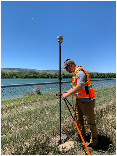
Ben Gavin, NGS, observes kinematic GPS.
These observations can be completed in minutes, versus hours for traditional static GPS.
Learn more about OPUS Projects 5 via recorded webinars
|