Census & NOAA Announce Center of Population for 2020
To celebrate Geography Awareness Week, NOAA’s National Geodetic Survey (NGS) worked with the U.S. Census Bureau as they announced that the 2020 Census Center of Population—the geographic center of the U.S. population—is near Hartville, Missouri. The center of population helps social scientists quantify how fast and in what direction the U.S. population is moving, see this data visualization from U.S. Census.
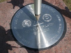
Every decade since 1960, Census and NGS have placed commemorative survey monuments in publicly accessible locations near the actual center of population. In Spring 2022, NGS and local partners will install the 2020 Center of Population mark and conduct a high-accuracy GPS survey to tie this and nearby survey marks to the National Spatial Reference System, the nation’s coordinate system.
|
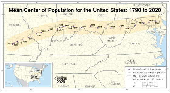 U.S. Census Bureau, 2020 Census
Looking Back: Historical Maps, Charts and Diagrams
At NOAA, we get to do some of the most amazing geographical science in the world, including: studying storms on the sun and their impacts on the Earth; weather modeling and forecasting; fish habitats and migration; coastal tide and water level monitoring; and measuring and defining the shape of the Earth.
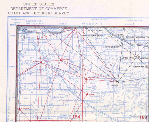
You can read about the history of NOAA and NGS in special publications as well as viewing many of the historical photographs. The artistic ability manual cartographers displayed in creating maps and nautical charts from these surveys in the past is a thing of beauty. To explore these beautiful resources yourself, view and download historical geodetic control diagrams as well as historical maps and charts on NOAA websites.
Looking Ahead: New GIS and Geospatial Resources
Today, mapping has evolved, and geographic information systems (GIS) play a major role in managing, analyzing, and mapping geospatial data. GIS Day was founded to recognize this importance, and it is celebrated on the Wednesday of Geography Awareness Week each year. From historical maps to the latest data visualization techniques, there’s plenty to celebrate for Geography Awareness Week.
|