|
NGS Releases New Mark Recovery Tool and BETA Mark Information Page
NGS has released a new tool to support crowdsourced data collection and is testing a new web-friendly way to access and visualize NGS datasheet information.
New Mark Recovery Page
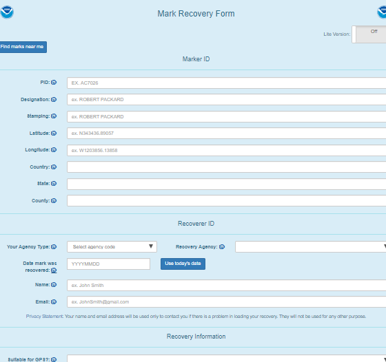
NGS relies extensively on crowdsourced information to update the status of geodetic survey marks throughout the country. To facilitate this task, NGS has recently developed a mobile-device friendly Mark Recovery Form that takes advantage of features available on mobile devices, such as Global Positioning System (GPS), mapping, and cameras. The form makes it easy to submit survey mark photographs, which provide visual data on the mark's condition. In addition, the form allows the submitter to note whether the mark is suitable for GPS observations.
Bench mark hunting is a fun, outdoor adventure that anyone can participate in. You can pick your search targets from our map of prioritized bench marks and submit your pictures and recovery notes with this new Mark Recovery Form.
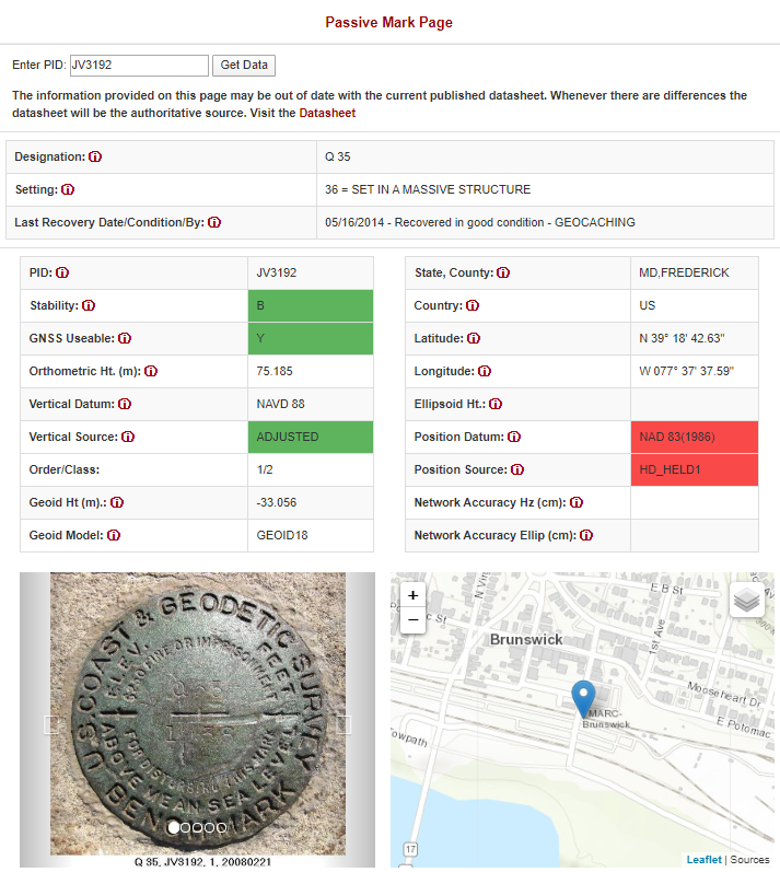
New BETA Mark Information Page released for user feedback
As part of NGS’ National Spatial Reference System (NSRS) modernization efforts, NGS is developing new options for displaying the information about survey marks traditionally presented on NGS datasheets. The new mobile- and web-friendly BETA Mark Information Page color codes the data based on quality, adds photos and a map for better field use, and includes contextualized help features and links to more information. NGS is seeking feedback on this product and on the ways users would like to interact with NGS datasheet information in the future modernized NSRS.
Please try out the the BETA Mark Information Page and tell us what you think at ngs.feedback@noaa.gov
|