|
|
|
NGS has completed its release of NOAA CORS Network (NCN) ITRF2014 epoch 2010.00 and NAD83 (2011) epoch 2010.00 coordinates, referred to as Multi-Year CORS Solution 2 (MYCS2).
As a reminder, NGS has reprocessed all NOAA CORS Network and some IGS stations using data collected between 1/1/1996 and 1/30/2017. These new coordinates are integrated into numerous NGS products and services, highlighted below.
Release Notes:
- All NOAA CORS Network (NCN) products, tools, webpages, and documentation are updated, including NCN station pages, NCN data download tools, Position and Velocity files (coord.txt), and RINEX file headers.
-
OPUS-S, OPUS-RS, and OPUS-Projects are updated to provide users coordinates in the updated frames.
- The MYCS2 NAD 83 (2011) epoch 2010.00 coordinates are now available in NGS Datasheets and related products such as NGS Data Explorer, archived shapefiles, and output from DS World.
-
GPS satellite orbit files available for download are also updated to be consistent with the ITRF2014 frame.
- There will be limited support for the IGS08 and older NAD83 (2011) epoch 2010.00 NCN coordinates through December 2019. Old coordinates are on the datasheets as superseded, for use in BETA OPUS processing (https://beta.ngs.noaa.gov/OPUS/), and displayed on NCN station short-term plots (short_08).
Send questions to NGS.CORS@noaa.gov or your Regional Geodetic Advisor.
GEOID 18
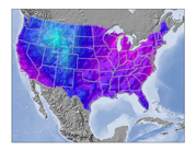
NGS has transitioned the GEOID18 model from BETA to production.
The coincident release of MYCS2 NAD83 coordinates and GEOID18 will minimize the changes to NGS’ OPUS products.
Subscribe to GPSonBM News to get more information on GEOID18.
|
|
|
|
In Case You Missed It:
Why upgrade coordinates and models?
CORS ITRF2014 Coordinates
The CORS reprocessing campaign resulted in updated coordinates and velocities that address many changes since CORS coordinates were last updated in 2011, including but not limited to:
- Geophysical Processes (e.g., earthquakes, subsidence, plate motion),
- Equipment Changes, and
- New CORS with longer data sets since 2011.
Note: any changes after 1/30/2017 are not reflected in the updated coordinates because the reprocessing dataset had closed.
GEOID18
The majority of improvements in this hybrid geoid model comes from additional GPS on Bench Marks (GPSonBM) data pinning the model to the surface of NAVD 88, but there are also improvements in the underlying gravimetric geoid model.
These improvements include:
- better elevation data and improved digital elevation modelling techniques,
- new gravity data from satellite gravity missions,
- new airborne gravity data from the NGS GRAV-D program, and
- improved geoid modeling techniques.
These improvements will be realized more directly in the future when NGS switches to a purely gravimetric geoid model with the new datums in 2022.
|
|
|
|
Stay Informed of Future Product Updates
|
|
|
|
|
|