|
Using Uncrewed Vehicles to Advance Ocean Research
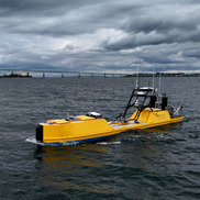
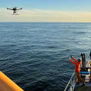
When traditional research vessels can’t safely reach parts of the ocean, the science doesn’t stop. Uncrewed surface vehicles give scientists access to the ocean with fewer constraints, rewriting what is possible in oceanographic and fisheries research and addressing longstanding research questions. These autonomous platforms already support hydrographic surveys, nautical charting, and ocean mapping, but the benefits don’t end there. Today, these technologies are helping scientists answer complex ecological and oceanographic questions. They’re collecting critical, high-accuracy, and time-sensitive data across nearly every mission area. This year, there were three uncrewed surface vehicle missions in the Northeast—two operated by Chance Maritime Technologies and one using DriX.
|
Autonomous Underwater Robot Expands Our Ability to Survey the Seafloor
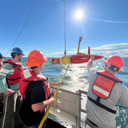
Autonomous underwater robots are enhancing how we study the seafloor through a collaboration between our science center and the Woods Hole Oceanographic Institution. These torpedo-shaped long-range autonomous vehicles weigh about 250 pounds and can be launched from a small boat. They propel themselves through the water and capture thousands of high-quality images, allowing researchers to survey areas that are otherwise difficult or impossible for traditional vessels to reach. They complement our Habitat Camera Survey, providing critical information that helps scientists generate more accurate population estimates for Atlantic sea scallops. By expanding our survey capabilities, this technology strengthens fisheries stock assessments that guide sustainable fisheries management.
|
Reducing Risks to North Atlantic Right Whales with Advanced Technology
Cooperative Research Investigates Atlantic Mackerel Abundance Under Changing Ocean Conditions
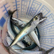
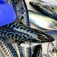
Atlantic mackerel have long followed a predictable seasonal migration, but recent shifts have caught the attention of both scientists and fishermen. Following years of decline, recent reports suggest a potential uptick in mackerel populations, often appearing in unexpected locations. This shift coincides with unusual oceanographic conditions, including a pulse of cold, fresh northern water entering the Northeast U.S. Shelf since 2023. Researchers are investigating whether these changing conditions are influencing mackerel distribution or signaling a true population recovery or both. Through the Atlantic Mackerel Cooperative Research Initiative, NOAA is partnering with fishermen to study these environmental drivers and better understand how our changing ocean impacts the species.
|
Funding Opportunity for Commercially-Permitted Fishing Vessels
State of the Ecosystem Reports for the Northeast U.S. Shelf
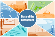
The 2026 State of the Ecosystem reports, a synthesis of ecosystem information produced for the New England and Mid-Atlantic Fishery Management Councils, are now available online. The reports include a summary of ecosystem-level fishery management objectives, an assessment of risks to meeting management objectives, and an overview of the 2025 oceanographic conditions and fishing industry observations. New this year are seasonal and decadal bottom temperature forecasts from a regional oceanographic model.
|
Spring 2026 Northeast Ecosystem Monitoring Survey Completed
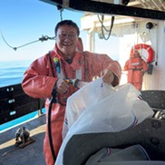
The Spring 2026 Northeast Ecosystem Monitoring Survey sailed on the NOAA Ship Pisces from Newport, Rhode Island, from June 1—June 10, 2026. The survey traveled more than 703 nautical miles off the coast of New Jersey, a portion of Georges Bank and north to the western Gulf of Maine. The survey team conducted and/or collected plankton tows at 65 planned stations and conductivity, temperature, and depth profiles at 15 planned stations. We prioritized sampling areas important to the Atlantic mackerel egg index. This survey remains the most comprehensive long-term program exploring marine resources and oceanographic conditions in the Northwest Atlantic.
|
2026 Spring Ecosystem Monitoring Survey in Photos
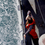
Our team of scientists aboard the 2026 spring Ecosystem Monitoring Survey recorded moments experienced throughout our time at sea. The new photo gallery gives you the opportunity to see what we saw. Meet the science team and look over our shoulders at the wonders just off our shores, from the mighty humpback whale to the tiny pteropod. This survey remains the most comprehensive long-term program exploring marine resources and oceanographic conditions in the Northwest Atlantic.
|
Measuring Success: Squid Electronic Size Monitoring Update
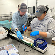
Our Squid Electronic Size Monitoring Program reached a new milestone in 2025, measuring over 84,000 shortfin squid. This accomplishment was only possible through collaboration between researchers and commercial squid processors across the Northeast. Working directly with the industry, the team not only doubled previous sampling numbers for shortfin squid but also successfully piloted methods for measuring longfin squid. The data collected are essential for developing novel stock assessment methods. This project continues to demonstrate that cooperative research is a critical tool for documenting the population changes of highly dynamic, short-lived, and commercially important species.
|
Blog: Survey Crashers—Encountering Unexpected New Faces in the Gulf of Maine
Blog: The Unexpected Catch—Friendship at Sea
Director's Message

During Technology Week, we showcased examples of how cutting edge technology is transforming the way that we study the ocean throughout the Northeast Fisheries Science Center’s research portfolio. Using uncrewed surface vehicles and long-range autonomous underwater vehicles, we are overcoming traditional operational limits and surveying previously inaccessible areas. These autonomous platforms are enhancing our long running fisheries surveys and expanding our ability to gather high-quality data, leading to more accurate stock assessments and a deeper understanding of our marine environment.
This technology is already hard at work across our mission areas. From using active acoustics to measure the abundance of fish and plankton to employing real-time passive acoustic monitoring, drones and satellites to track endangered North Atlantic right whales, these innovations are providing us with a clearer picture of fisheries and ocean health. By rewriting the rules of what is possible in fisheries research, these tools allow our scientists and partners to collect ocean data with fewer constraints and answer complex questions more effectively than ever before.
|
|
|
Upcoming Events
Sept 12: Milford Lab Open House
Sept 22—23: Management Track Assessments Peer Review Meeting for American Plaice and Gulf of Maine Haddock
Nov 16—17: Flatfish Biology Conference
Jan 11—13, 2027: 46th Milford Aquaculture Seminar
Sep 18: Funding opportunity for commercially-permitted fishing vessels (acoustics for Atlantic Mackerel Cooperative Research Initiative)
|
|
|
|
|