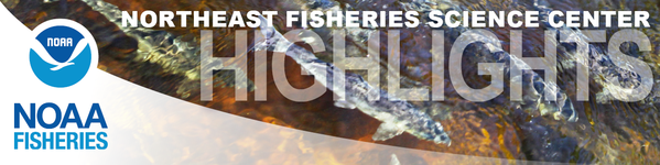
Prey Data Can Improve Right Whale Models
A new collaborative study finds that incorporating copepod aggregation maps into North Atlantic right whale models could improve those models’ predictions, providing a better understanding of where endangered whales gather. The study used data from our science center’s Ecosystem Monitoring Survey to pinpoint areas where there were enough copepod prey to meet the whales’ feeding needs. Scientists added those “prey fields” to the right whale distribution model. They evaluated which prey fields boosted the predictive power of the model across the region and during each season. The distribution model performed best when scientists added data representing dense aggregations of Calanus finmarchicus, along with two smaller copepod species. This study highlights the importance of collecting long-term oceanographic and marine mammal data.
|
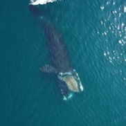
Pilot Regional Industry-Based Bottom Trawl Survey Contract Awarded
The Atlantic States Marine Fisheries Commission has awarded the Virginia Institute of Marine Science and F/V Darana R team with the contract to conduct Phase 1 of the Pilot Regional Industry-Based Bottom Trawl Survey (RIBTS). The proposal review committee included several members of the Northeast Trawl Advisory Panel Working Group, including fishing industry representatives. After extensive discussion and deliberation, they determined that the VIMS/Darana R team had the best experience and capabilities to achieve the goals of the research. The pilot survey will be used to define the operational requirements for a full scale, shelf-wide, multispecies, industry-based bottom trawl survey that will complement our federal Bottom Trawl Survey conducted aboard the NOAA Ship Henry B. Bigelow.
|
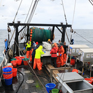
Woods Hole Science Aquarium Update
During a safety inspection in 2023, an issue with our science aquarium’s foundation was discovered. To repair the foundation, we’ve made the difficult but necessary decision to close our doors this month and begin releasing and/or rehoming most of our collection prior to construction. Construction will begin in October and is estimated to last 8 months. Rehoming includes our:
- Harbor seal Bubba who will go to a new permanent home at Fort Wayne Zoo in Indiana
- Diamondback terrapin Stumpy who will temporarily go to the Marine Biological Laboratory’s Marine Resources Center building in Woods Hole, Massachusetts
- Octopuses Ink and Blot who will be moved to the Marine Biological Laboratory’s Marine Resources Center building in Woods Hole, Massachusetts
After construction is complete, we will gradually reopen as various systems come back online, habitats are reestablished, and animals are reintroduced. We will share updates on our website and social media channels as things progress.
|
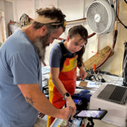
Meet our 2025 Summer Students
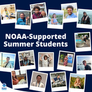
This year, science center staff mentored 19 students supported through various NOAA internship and fellowship programs! These students worked on research projects ranging from ocean acidification, feeding and food web dynamics, and microplastics, to fish and fisheries, aquaculture, and protected species. Some projects involved technologies and techniques such as passive acoustics, mass spectrometry, GIS, and computer coding.
|
Geospatial Artificial Intelligence For Animals
Geospatial Artificial Intelligence for Animals is a pioneering initiative that plans to use cutting-edge satellite technology and artificial intelligence to detect whales and other marine mammals from space. Developed by NOAA’s Northeast and Alaska Fisheries Science Centers in partnership with public and private collaborators—including the U.S. Geological Survey, Microsoft AI for Good, and the Naval Research Laboratory—GAIA is revolutionizing how we monitor marine species across vast and remote ocean regions.
|
NOAA Fisheries Atlantic Shark Surveys Storymap
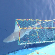
Since 1973, NOAA Fisheries has conducted and funded shark surveys in the U.S. Atlantic Ocean and Gulf of America in partnership with state agencies and universities. A new storymap explains how these surveys bring us the critical information we need to manage sharks sustainably. While ensuring shark survival, scientists collect data on size, abundance, habitat use, and movement information before releasing them.
|
2026 Cooperative Research Summit: Charting the Course Together
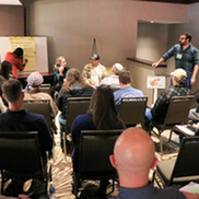
Our Cooperative Research Branch will host the 2026 Northeast Cooperative Research Summit on February 26, 2026, in Riverhead, New York. Gear up for a full day of shared knowledge, innovation, and partnership. This annual event convenes our region's fishermen, scientists, managers, and fishing community representatives. The summit will communicate new and ongoing cooperative studies and inspire collaboration to address emerging research priorities. Network with like-minded peers, explore fresh research avenues, and be part of shaping the future of cooperative research in the Northeast! Registration required. The deadline to register is November 7, 2025.
|
Stock Assessment Model Advancements
We are using an updated version of our Woods Hole Assessment Model to better understand and manage fish populations in the Northeast United States. In a new publication, our scientists describe how the model enhancements improve our ability to see how fish move between different areas and how environmental factors impact their population. When our scientists applied the model to black sea bass data, they found that bottom water temperature may be linked to the number of young black sea bass joining the population in northern areas of their range.
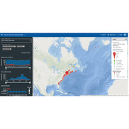
Passive Acoustic Reporting System Templates
The new version 1.2 passive acoustic reporting templates provide a streamlined method for collaborators to submit passive acoustic recording metadata and species detection data from a wide range of passive acoustic deployments and analyses. Submitted detection data are archived in NOAA Fisheries’ Makara Database and displayed on the Passive Acoustic Cetacean Map, with permission from the data owner. The online map tool allows users to view passive acoustic detection results from a variety of technologies and analysis goals all in one place. This provides quick and comprehensive results to researchers and managers as data become available.
|
Blog: Squid Project “Squids Their Stride” in 2025
A new blog by fish biologist Mary Kate Munley shares how she and others working with the captain and crew of the F/V Dyrsten hit their stride this summer during the shortfin squid project. This is year two of the project and the team ran like a well-oiled science machine. The goal of this project is to better understand how ocean conditions and processes influence the variability of shortfin squid catch in the Mid-Atlantic.
|
Director's Message
Last month I said that science is a process and the best available science continues to improve over time. This month, I will share an example. For decades bluefin tuna were defined as two stocks (separate units): a Western Atlantic stock, which spawns in the Gulf of America, and an Eastern Atlantic stock, which spawns in the Mediterranean Sea. This was the best available science. In 2016, a paper led by scientists at our center reported the discovery of a bluefin tuna spawning ground in the Slope Sea—an area off the Northeast U.S. continental shelf, between the shelf break and the northern wall of the Gulf Stream. This paper was based on opportunistic sampling of larval bluefin (days to weeks old). Scientists developed plans for a dedicated effort to sample adults and larvae in the Slope Sea. Fast forward to 2024, Congress appropriated funds and directed NOAA to conduct research and collect data to validate the proposed new spawning grounds.
This summer, scientists completed two surveys in the Slope Sea. One survey looked for spawning adults on a commercial longliner, the F/V Eagle Eye II and the other looked for larvae on the NOAA Ship Pisces. Both were successful. On the longliner, external examination of adult bluefin indicated near-spawning condition. On the NOAA ship, scientists caught thousands of bluefin tuna larvae. Next steps include analyzing DNA from both larval and adult bluefin tuna to estimate the population (stock) size and to better understand population (stock) structure. This work confirms significant bluefin tuna spawning outside of previously known spawning areas. This new best available science will start to be used in bluefin tuna management. Bluefin tuna is one of many examples illustrating that scientific understanding is not fixed - it continues to evolve over time. This is also an excellent example of the value of industry, academics, and government working together to produce science that helps ensure the long-term economic and biological sustainability of our nation's fishery resources.
|
|