|
Note to LMA 1/LMA 3 lobster permit holders: The LMA 1 Restricted Area created by the 2021 modifications to the Atlantic Large Whale Take Reduction Plan includes a 61-square-mile sliver of LMA 3 as highlighted in the map below. We estimate that only one vessel may be displaced for a small number of trips in this sliver area based on a review of vessel trip reports from the last ten years.
The regulations state that the LMA 1 Restricted Area is bounded by the points identified on the map connected by rhumblines, which do not exactly align with the LMA1/LMA 3 boundary.
The previously released outreach maps did not include this sliver area. We apologize for the error.
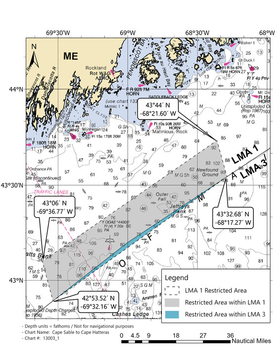 The LMA 1 Restricted Area closure, including the LMA 3 sliver area, is now in effect, and will remain closed through January 31, 2022.
The LMA 1 Restricted Area was created to protect endangered right whales from the risk of entanglement from buoy lines in an area of high co-occurrence. Therefore, fishing with traditional persistent buoy lines is not allowed in this area from October 1 through January 31 each year, when right whales are in this area. See recent right whale sightings and acoustic detections on our WhaleMap.
|