|
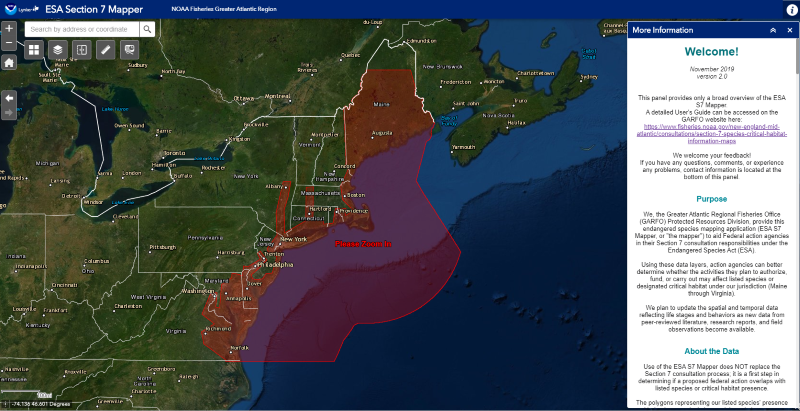
We are happy to announce that the newest version of our Section 7 Mapper is now available on our website. This user-friendly, GIS-based mapping application is geared toward federal action agencies that are required to consult with us on projects that may affect endangered marine species and their habitats in the Greater Atlantic Region.
The Section 7 Mapper allows users to draw their project action area (area encompassing all project effects) and generate a printable report that summarizes the ESA-listed species and critical habitat in that area. Beyond a list of species, the report also notes the life stages of those species, the essential behaviors we expect them to be undertaking, and the anticipated time of year they will be present.
Originally launched in April 2018, the new features in Version 2.0 include:
- Updated species and critical habitat information.
- A new “swipe” widget to easily slide back and forth between the basemap and Section 7 GIS layers.
- Ability to toggle on/off individual GIS layers for listed species/critical habitat.
Find out more about the Section 7 Mapper.
|