|
|
Reminder: Closed Area 1 North Seasonal Closure for All Vessels Begins February 1
Reminder: On February 1, the Closed Area I (CAI) North seasonal closure goes into effect, through April 15. See below for map and coordinates.
The closure applies to all commercial and recreational vessels except:
- Vessels that are transiting;
- Vessels fishing with exempted gears (spears, rakes, diving gear, cast nets, tongs, harpoons, weirs, dip nets, stop nets, pound nets, pots and traps, purse seines, surfclam/quahog dredge gear, pelagic hook and line, pelagic longlines, or single pelagic gillnets);
- Vessels participating in the mid-water trawl exempted fishery; and
- Vessels fishing with scallop dredges.
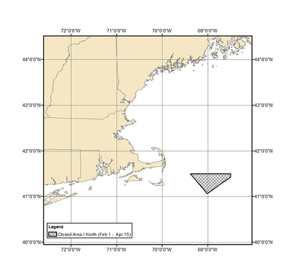
Closed Area I North Coordinates
|
Point
|
N lat.
|
W long.
|
|
CIN1
|
41°30′
|
69°23′
|
|
CIN2
|
41°30′
|
68°30′
|
|
CIN3
|
41°26′
|
68°30′
|
|
CIN4
|
41°04′
|
69°01′
|
|
CIN1
|
41°30′
|
69°23′
|
Questions? Contact our Sustainable Fisheries Division, 978-281-9315
|
|
|
|
|