|
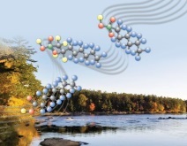
Movement of Nutrients in the Illinois River Basin
USGS scientists estimated nutrient sources in the Illinois River basin from 2000 to 2020. Nitrogen from agricultural headwaters was delayed, sometimes by years, in its movement to streams. This delayed movement was at times the largest source of nitrogen to the mainstem Illinois River. However, the primary source of phosphorus was from treated wastewater.
For more information, read the paper or contact USGS scientists Noah Schmadel.
|
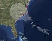
Millions Potentially Rely on Groundwater Contaminated with Forever Chemicals
Potential Health Impacts to Fish from Forever Chemicals in Pennsylvania Streams
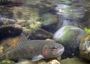
Scientists measured PFAS at existing stream sites, estimated the effects of PFAS on fish at those sites, and then predicted potential effects at more than 110,000 stream sections across Pennsylvania. The results rank areas of potential adverse effects on fish that can be used by water and wildlife resource managers to prioritize fish sampling for effects on fish populations and human consumption guidance.
For more information read the paper or contact USGS scientist Joe Duris.
|
USGS Scientists Describe a Promising Approach to Study Hurricane Effects on Water Quality
USGS scientists completed a strategic review of current knowledge of hurricane impacts on water quality. The team described capabilities in water science throughout the USGS and made suggestions for improving water quality monitoring infrastructure to assess the impacts of extreme storms.
For more information, read the report or contact USGS scientist MaryLynn Musgrove.
|
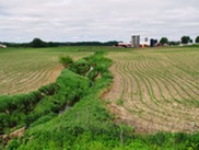
Scientists Identify the Interaction of Wildfire and Legacy Mining as a Risk to Water Supply
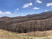
Mining and wildfire, when they occur on the same landscape, may lead to elevated metal concentrations in downstream surface waters. Multiple mechanisms are responsible for this increased hazard, including increased erosion, remobilization of previously deposited metal-contaminated floodplain sediment by higher post-fire flood flows, and increased metal transport from underground mines. USGS scientists noted that combinations of multiple factors may substantially degrade water quality, particularly after extreme climate events.
For more information, read the paper or contact USGS scientist Sheila Murphy.
|
Scientists Solve a 12,000-year Discrepancy in Devils Hole Climate Record
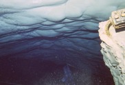
Devils Hole, a calcite-lined cavern in Nevada, is important to scientists because the age of the calcite can be used to estimate water-table levels and water recharge over time. The water table in Devils Hole varies cyclically between glacial and warm periods, exposing some of the calcite. New water-table information based on calcite both above and below the current water table, showed that the calcite above the water table indicated lowering of the water table to near modern levels about 12,000-years earlier than previously thought, which corresponds to an earlier period of decreased moisture and perhaps decreased vegetation.
For more information, read the paper or contact USGS scientist Tyler Coplen.
|
USGS Releases National Water Availability Assessment
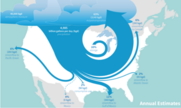
The USGS recently completed a pioneering scientific overview of water availability, which offers new insights on where there is an imbalance between water supply and demand in the United States. This assessment includes 3 products: a comprehensive report, a user-friendly online data companion, and an interactive data visualization website.
For more information, read the press release or contact one of our scientists.
|
|
|
About the USGS Water Mission Area
Water information is fundamental to national and local economic well-being, protection of life and property, and effective management of the Nation’s water resources. The USGS works with partners to monitor, assess, conduct targeted research, and deliver information on a wide range of water resources and conditions including streamflow, groundwater, water quality, and water use and availability.
|
|
|
|