|
Drought and a Changing Hydroclimate May Lead to Reservoir Vulnerability
A team of scientists identified periods of unusually low reservoir storage, potentially from drought, at 250 reservoirs across the conterminous United States. The maximum amount of water stored is decreasing across US reservoirs and periods of unusually low storage are becoming longer, more severe, and more variable in western and central US reservoirs.
For more information read the paper or contact USGS scientist Caelan Simeone.
|
Unequal Access to Water
Everyone needs water. People experience water insecurity when they don’t have access to enough clean water to meet their day-to-day needs. People may be more or less vulnerable to water insecurity due to a variety of things like health, living conditions, socioeconomic status, and exposure to drought or pollution. The USGS recently published a paper and website available in English and Spanish on Unequal Access to Water identifying key factors related to water insecurity in the Western U.S.
For more information, contact USGS scientist Oronde Drakes.
|
50th Anniversary of the Safe Drinking Water Act

The Safe Drinking Water Act is the key federal law for protecting public water supplies from harmful contaminants. While the USGS is a fact-finding research organization with no regulatory responsibility, we have supported the EPA, states, and water professionals on this landmark legislation by producing data on the quality of drinking water sources, science on how contaminants reach drinking water wells, information on protecting and managing drinking-water supplies, and maps showing how land use in urban and agricultural areas affects the quality of water used as a source of drinking water.
For more information, click on the links above or contact the director of the USGS Earth Systems Processes Division, Sandra Eberts.
|
Finer is Not Always Better
Snowmelt affects runoff, groundwater recharge, streamflow, aquatic ecosystems, and vegetation productivity. Estimating how much snow is in the mountains is usually done with computer models that divide the landscape into square patches. But how big should these patches be? USGS scientists determined that larger patches are sufficient for predicting streamflow.
Find out more by reading the article or contacting USGS scientist Theodore Barnhart.
|
USGS Scientists Contribute to Global Climate Report
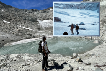
Three USGS Water Mission Area scientists contributed to the latest annual summary of the global climate, published by the American Meteorological Society. The contribution, an analysis of global lake volume, is part of a chapter that covers trends and anomalies across major climatic variables including temperature, precipitation, evaporation, water storage, vegetation, and ozone, and will be a valuable contribution to understanding the status and trajectory of our global climate system.
For more information, read the report or contact USGS scientists, Merritt Harlan, Michael Meyer, or Tyler King.
|
PFAS in Pennsylvania Watersheds
USGS scientists sampled PFAS (forever chemicals) in an urban watershed to guide the scientific community and water managers in southeast Pennsylvania that are tasked with reducing PFAS transport to surface waters.
For more information, read the paper or contact USGS scientist Emily Woodward.
|
|
|
About the USGS Water Mission Area
Water information is fundamental to national and local economic well-being, protection of life and property, and effective management of the Nation’s water resources. The USGS works with partners to monitor, assess, conduct targeted research, and deliver information on a wide range of water resources and conditions including streamflow, groundwater, water quality, and water use and availability.
|
|
|
|