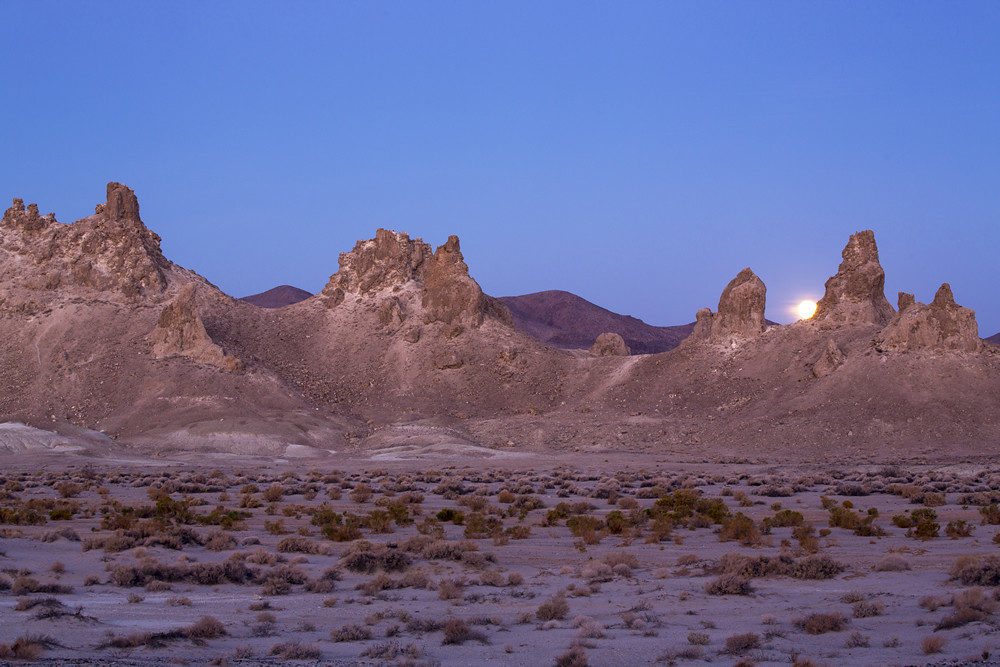
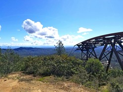
Trona Pinnacles, Ridgecrest Field Office
|
|
ISSUE 1030 - January 6, 2023
|
|
|
BLM suspends wild horse and burro adoptions due to icy conditions
Wild horse and burro adoptions at the Bureau of Land Management Litchfield Wild Horse and Burro Corral near Susanville have been temporarily suspended, as icy conditions have made it unsafe to move the animals into the loading area. (BLM CA News Release)
|
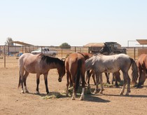
BLM wild horses evacuated from R3C
Due to weather, the BLM and Sacramento County Sheriff’s Office safely evacuated 29 horses from the Rio Cosumnes Correction Center (R3C). These horses are part of a training program where offenders work with the horses to train them for adoption. Sixteen of the horses who have yet to begin their gentling were taken to the Ridgecrest Corral, and the remaining 8 horses were moved to a private, BLM-approved facility. (BLM CA Facebook)
|
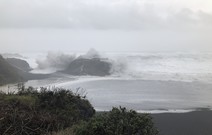
NWS Issues a large surf warning
Large Surf Warning was issued by the National Weather Service in Eureka, including at Black Sands Beach at King Range National Conservation area.
Check our website for any site closures and disruptions during this time, as things may change daily. (BLM CA Facebook)
|
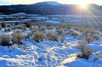
Know before you go
Winter storms had significant impacts on Northern California this week, including flooding, mudslides, damaging winds and power outages. The BLM encourages visitors to check our website for any site closures and disruptions to recreation areas, as things may change daily. (BLM CA Facebook)
|
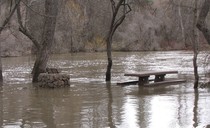
The Cosumnes River Preserve is closed
Due to flooding, the Cosumnes River Preserve is still closed. Please stay safe and dry this week.
Photo captured by Val Versis on 12/24/22. (CRP Facebook)
|

Solar energy program public meeting
As part of its ongoing effort to support responsible renewable energy development on public lands, the Bureau of Land Management is holding a public scoping meeting in Sacramento on January 18th to solicit feedback on the recently announced programmatic environmental impact statement for the BLM’s utility-scale solar energy planning. (BLM CA News Release)
|
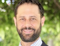
Zachary Ormsby named new Central Coast Field Manager
The Bureau of Land Management announces Zachary Ormsby as the new Central Coast Field Manager. Ormsby brings nearly 20 years of natural resource management experience to the position where he will oversee management of approximately 315,000 acres of public lands in 12 counties stretching from the Pacific Coast to the San Joaquin Valley. (BLM CA News Release)
|
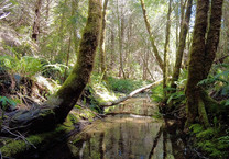
Significant stream habitat added to King Range National Conservation Area
The King Range National Conservation Area on the California North Coast now includes 80 additional acres of important stream and forest habitat. This acquisition of lands was made possible through funding from the Land and Water Conservation Fund. (BLM CA News Release)
|

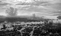
New Study: Vegetation Trends Across BLM Allotments Over 30 years
Keeping a close eye on plant life across millions of acres of public lands allotments is an overwhelming challenge in and of itself. The challenge is amplified by drought, aridification, and increasing environmental as well as social challenges. (Partners in the Sage)
|
Expansive plan to reduce wildfire risks near communities seeks public comments
The Bureau of Land Management is seeking public comments on a plan to expedite fuels reduction treatments and fire protection efforts near high fire-risk areas on public lands in 44 counties throughout California and northwest Nevada. (BLM CA News Release)
|
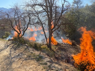
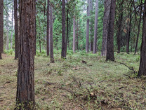
Fuels project near Redding
Starting Monday, January 9 through January 20, fire crews will conduct pile burning projects on the west side of Redding. Smoke may be visible from Grant Elementary School, Happy Valley Elementary School, and State Route 229, depending on the project area. (BLM CA Facebook)
|
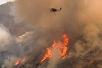
Year-to-Date wildfires and acres burned
Some year-to-date statistics as of December 31, 2022, about human-caused wildfires. The top five states with the most human-caused wildfires in fire year 2022 include Texas, California, North Carolina, Georgia and Florida. (NIFC Facebook)
|
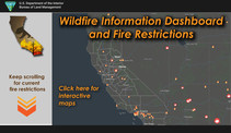
Fire Restrictions & Fire Information
Have you checked out BLM California's Wildfire Dashboard? At a glance you'll be able to get updates on large fires in California, view smoke impacts, check fire restrictions and find other helpful wildfire links. Bookmark it now!
Fireworks are not allowed on BLM-managed public lands.
|
Now hiring for BLM California
Bureau of Land Management California is looking to fill multiple jobs across the state. For all current vacancies, visit USAJOBS.
Featured Job: Geologist
Location - Barstow Field Office, CA
Salary: $54,067 - $85,971 per year
Position closes Jan 18th
Apply today!
|
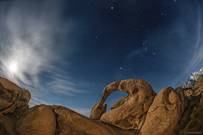
We hear you! Starting this week, we will expand our question of the week to topics beyond wildlife, including geology, botany, etc. Please let us know if there's something you would like to learn more about.
The rounded, oddly shaped contours of the Alabama Hills form a sharp contrast to the glacially carved ridges of the Sierra Nevada are due to…

- A combination of natural chemical weathering and wind erosion.
- The Alabama Hills are formed from sand stone.
- Earthquakes.
- The Rounded rocks were man made for the movie set of the original Star Trek movie.
|
Biden-Harris Administration invests more than $84 Million in 36 Drought Resiliency Projects (DOI News Release)
|
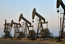
BLM to hold virtual information forum on Draft Waste Prevention Rule
The Bureau of Land Management is hosting a virtual information session regarding proposed new regulations to reduce the waste of natural gas from venting, flaring, and leaks during oil and gas production activities on Federal and Indian leases. (BLM News Release)
|
|
|
|
Question of the Week Answer
If you answered 1, you are correct!
The rounded, oddly shaped contours of the Alabama Hills form a sharp contrast to the glacially carved ridges of the Sierra Nevada. While both land forms consist of the same granitic rock, the fantastic shapes of the hills were formed by a combination of natural chemical weathering and wind erosion.
Chemical weathering is caused by rain water reacting with the mineral grains in rocks to form new minerals (clays) and soluble salts. These reactions occur particularly when the water is slightly acidic.
If you visit the hills please remember to leave no trace and leave the awesome rocks as you found them.
Alabama Hills Photo: BLM
Source: BLM.gov The Geological Society
|