Trinidad Head, Arcata Field Office.
|
|
ISSUE 958- July 9, 2021
|
|
|
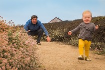
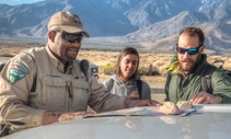
July 7th is #FatherDaughterTakeAWalkDay
We are visiting California public lands. Did you know....Bureau of Land Management - California manages Piedras Blancas Light Station as a historic park & wildlife sanctuary. It's named for the distinctive white rocks that loom just offshore, home to seabirds, sea lions and elephant seals. Learn more here. (BLM CA Facebook)
|
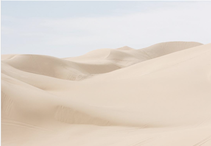
17 Amazing Road Trips That Are An Easy Drive From San Diego
We’ve been hunkered down for too long – it’s time to make some fun plans, and a road trip may be just the ticket! Lucky for us, there is no shortage of amazing road trips that are a short drive from San Diego including Imperial Sand Dunes. This BLM-managed recreation area feels like are a whole other planet (Theresandiego.com)
|

The night sky over Alabama Hills
Check out this gorgeous night sky above California's Alabama Hills. This formation of rounded rocks and eroded hills is set between the jagged peaks of the Sierra Nevada and the geologically complex Inyo Mountains. Both geologic features were shaped by the same uplifting occurring 100 million years ago. (BLM Instagram)
|
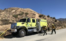
Firefighters are needed more than ever to keep Americans safe
Please #DoYourPart to prevent #wildfire. It’s important to be aware of any local fire restrictions & take extra precautions before venturing out on #publiclands. #WildfirePrevention #RecreateResponsibly (BLM Twitter)
|
BLM initiates Whitewater Canyon closure due to increased wildfire risk
The Bureau of Land Management will temporarily close public lands in and near Whitewater Canyon, in Riverside County, due to the potential threat of wildfire. The public safety closure will begin on Friday, July 2 and will remain in place until October 31. (BLM CA News Release)
|
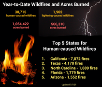
Year-to-date statistics for wildfires and acres burned
There have been 30,715 human-caused wildfires for 1,054,422 acres burned, and 1,902 lightning-caused wildfires for 566,310 acres burned. #Fireyear2021 (NIFC Twitter)
|
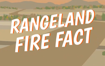
BLM California Fire Restrictions
BLM California fire restrictions or temporary public land closures reduce the risk of wildfires and protect the public. Often times, these preventative measures focus on human-related activities, such as campfires, off-road driving, equipment use and recreational target shooting, since human-related activities are the number one cause of a wildfires. Many BLM California offices have issued seasonal fire restrictions. (BLM CA Web)
|
What is Longest River in California
(a) San Joaquin River
(b) Klamath River
(c) Sacramento River
(d) None of These
Keep scrolling to find out!
|
|
Secretary Haaland Announces Task Force to Strengthen Trust and Collaboration Between Law Enforcement and Communities
Secretary of the Interior Deb Haaland today announced the establishment of a new departmental law enforcement task force to implement the highest standards for protecting the public and provide necessary policy guidance, resources, and training to agency personnel. (DOI News Release)
|

This Week at Interior July 9, 2021
Secretary Haaland announces the establishment of a new departmental law enforcement task force; Laguna Atascosa National Wildlife Refuge in Texas is about to get 5,000 acres bigger; and a midnight sun shines in our social media Picture of the Week! (DOI Video)
|
|
Question of the Week Answer
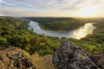
Answer: Sacramento River
California’s largest river, the Sacramento, provides 31 percent of the state’s surface water runoff.
Once called “the Nile of the West,” the Sacramento River drains the inland slopes of the Klamath Mountains, the Cascade Range, the Coast Ranges and the western slopes of the northern Sierra Nevada. The river stretches some 384 miles from its headwaters near Mount Shasta to the Sacramento-San Joaquin Delta.
The Sacramento River Bend Area, managed by Redding Field Office, is a valuable historic and natural resource that presents many recreational and educational opportunities. From the lush riparian areas surrounding the Sacramento River and it's tributaries to the expanse of the rolling hills of blue oak savanah, the Sacramento River Bend Area offers diverse habitat for bald eagles, osprey, migratory and song birds, deer, and salmon. The area also offers numerous recreation opportunities for hunting, camping, hiking, boating, picnicking, and wildlife viewing.
|