|
View as a webpage
|
 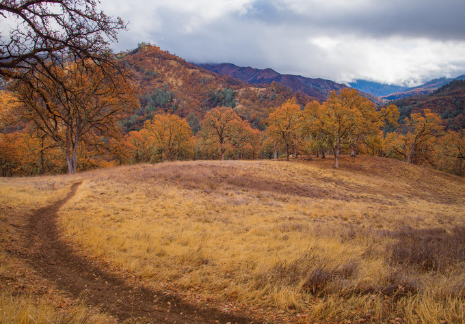 Berryessa Snow Mountain National Monument, Ukiah Field Office
Photo by Jesse Pluim, BLM
|
|
ISSUE 932 - December 17, 2020
|
|
|
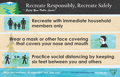
Recreate Responsibly!
This holiday season, if you choose to head outdoors onto public lands, be sure to recreate responsibly and follow all local and state public health guidelines. You can still have fun while being respectful of others and staying safe!
For some helpful tips on how to recreate responsibly, visit our website!
|
Follow us for #12daysofPublicLands highlighting amazing California public lands on Facebook and Twitter!
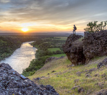
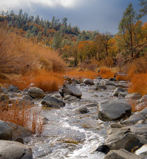
Sacramento River Bend Outstanding Natural Area
This area offers many types of activities to get outdoors. From hunting, camping, and hiking to horseback riding, cycling, boating, picnicking and wildlife viewing, there’s always something new to do! The lush riparian areas surrounding the Sacramento River and its tributaries to the rolling hills of the blue oak savanna, make the Sacramento River Bend area a perfect place to enjoy a little California Fall weather. Be sure to bring along your face covering to use when at trailheads or in parking areas, and always recreate responsibly! (BLM CA Website)
|
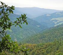
Berryessa Snow Mountain National Monument
The monument, jointly managed by the BLM and Forest Service, encompasses nearly 331,000 acres of public land in the heart of northern California’s Inner Coast Range. Rising from near sea level in the south to over 7,000 feet in the mountainous north, and stretching across nearly 100 miles and dozens of ecosystems, the area possesses a richness of species that is among the highest in California and has established the area as a biodiversity hotspot. A part of the BLM’s National Conservation Lands, the Monument offers a wide range of outdoor activities, including hiking, hunting, fishing, camping, off-highway vehicle use OHV, horseback riding, mountain biking and rafting. (BLM CA Website)
|
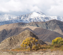
San Gorgonio Wilderness
The San Gorgonio Wilderness is located on the eastern slope of the San Bernardino Mountains with topography rapidly changing from low, rolling foothills and canyons to steep, rugged mountains. Elevations range from 2,300 to 5,500 feet. Because of this elevation gradient, the wilderness reflects a unique transition between desert, coastal and mountain environments, including the different types of vegetation representative of each elevation. There are 81 miles of trails in the National Forest portion of the Wilderness, and approximately 20 miles of the Pacific Crest National Scenic Trail in the Bureau of Land Management portion. (BLM CA Website)
|
 |
|
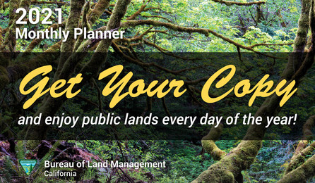
Still a few left! Enjoy the beauty of California public lands all year long!
We manage 15.2 million acres of public lands in California - nearly 15 percent of the state’s land area - and 1.6 million acres in northwestern Nevada. This year’s monthly planner features stunning public lands across the state with impressive employee photography.
Get your FREE 2021 calendar while supplies last HERE!
|
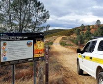
BLM Central Coast Field Office eases fire restrictions
The Bureau of Land Management Central Coast Field Office is easing seasonal fire restrictions on Friday, Dec. 18, on approximately 300,000-acres of public land thanks to a reduction in the potential for wildland fire. The easing of seasonal fire restrictions applies to public lands managed by the Central Coast Field Office in Alameda, Contra Costa, Fresno, Merced, Monterey, San Benito, San Joaquin, San Mateo, Santa Clara, Santa Cruz and Stanislaus counties. (BLM CA News Release)
|
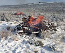
Crews from Applegate Field Office conduct pile burns
Scenes of fire and ice played out on public lands in far northern Washoe County, NV, as crews from our Applegate Field Office took advantage of good burning conditions to complete part of the Board Corral pile burn project. The crews ignited piles of brush and juniper over more than 60 acres. The piles were created in work to reduce fuel loading, improving wildlife conditions and reducing wildfire risk. Great work from the field! (BLM CA Facebook)
|
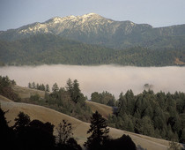
BLM names Michael Holt as manager of King Range National Conservation Area
The Bureau of Land Management has selected Michael Holt as manager of the King Range National Conservation Area (NCA) on California’s North Coast. The King Range NCA covers about 68,000 acres of dramatic mountain and coastal landscape stretching for 35 miles. It includes about 48,000 acres of wilderness and numerous trails including the Lost Coast Trail, the nation’s longest coastal wilderness trail. It is the nation’s first NCA, established in 1970. (BLM CA News Release)
|
BLM to conduct prescribed burning projects at Lacks Creek, west of Hoopa
Fire crews from the Bureau of Land Management will be conducting a prescribed fire in the Lacks Creek Management Area near the community of Hoopa in Humboldt County from Tuesday, Dec. 15, through Thursday, Dec. 24 between 10am-4pm each day. Smoke will be visible from residences along Bair and Stover roads, and there may be light residual smoke for one to two days after the piles are burned. Burning will be conducted only when weather and fuel moistures allow for safe and successful burning. (BLM CA News Release)
|
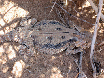
What type of habitat does the Flat Tailed Horned lizard prefer?
A. Sandy, desert hardpan or gravel flats
B. Marshy grasses with lush undergrowth
C. Along the seashore, near tidepools
D. In treetops, blending in with tree bark
Keep scrolling to find out!
|
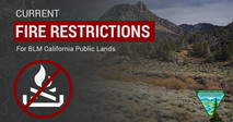
Don't let your guard down just because it's cold! Some fire restrictions still in effect
There's still fire danger in some parts of the state. Avoid activities that could spark a wildfire! Here’s an interactive MAP showing all current fire restrictions. Be sure to bookmark it for future use!
Target shooting and other fire restrictions remain in effect for some areas of BLM-managed public lands in California. Find specific restrictions by field office on our Fire Restriction webpage. Restrictions on target shooting do not prevent hunting with a valid hunting license, as hunting on BLM public lands is managed by the California Department of Fish and Wildlife. Please visit the State website for more information.
|
|
|
|
Question of the Week Answer
The answer is A.
Typical habitat is sandy desert hardpan or gravel flats with scattered sparse vegetation of low species diversity. Most common in areas with a high density of harvester ants and fine windblown sand, but rarely occurs on dunes. The historic range of this lizard is throughout most of the Colorado desert from the Coachella Valley south through the Imperial Valley and west into the Anza-Borrego desert, south to extreme NE Baja California, extreme SW Arizona and NW Sonora, Mexico.
Source: California Herps
|
|
|
News.Bytes is a publication of the Bureau of Land Management in California.
Bureau of Land Management
California State Office
2800 Cottage Way, Suite W1623
Sacramento, CA 95825
(916) 978-4600
Send comments to the News.Bytes Team | Subscribe to News.Bytes | Unsubscribe
|
     
|
|
|