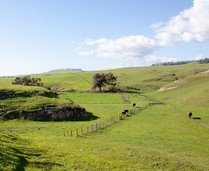
20th Anniversary Santa Rosa & San Jacinto Mountains National Monument
Celebrate the 20th Anniversary of the Santa Rosa & San Jacinto Mountains National Monument and National Public Lands Day by getting outdoors and joining this special BioBlitz event. Take part in a 24-hour session October 23-24, to record plants and animals in the desert, foothills, or mountains in the Santa Rosa and San Jacinto Mountains. Event flyer (BLM CA News Release)
|
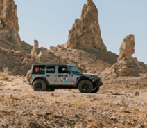
Check out this 8-day women's off-road navigation challenge!
Using only maps, compasses, and road signs to navigate, the Rebelle Rally, the first of its kind in the U.S., was the ultimate challenge of precise navigation skills for participants. This Special Recreation Permit event gave participants the opportunity to travel and compete in a beautiful environment across roughly 1,200 miles through Nevada and California on legal, open routes, many of which were on BLM public lands. The course stretched through the Ridgecrest Field Office area and ended in the Imperial Sand Dunes Recreation Area. (BLM CA Facebook)
|
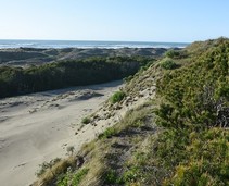
357 acre, including Dog Ranch, to be conserved on Samoa Peninsula
Friends of the Dunes has completed a deal with Security National, the Humboldt Bay Harbor Recreation and Conservation District, the Wildlife Conservation Board, the California Natural Resources Agency, and the California State Coastal Conservancy to acquire the Samoa Dunes and Wetlands for the purposes of conservation and public access. The Samoa Dunes and Wetlands is a 357-acre coastal dune and bayfront property that includes the former Dog Ranch. (Mad River Union)
|
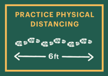
Staying safe while still having fun
Please continue to recreate responsibly when heading outdoors this weekend! Keep six feet between you and others not in your household. Share the trail and make room to allow people to pass. Not feeling 100%? Save your outdoor adventures for another day! (BLM CA Website)
|
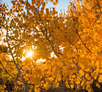
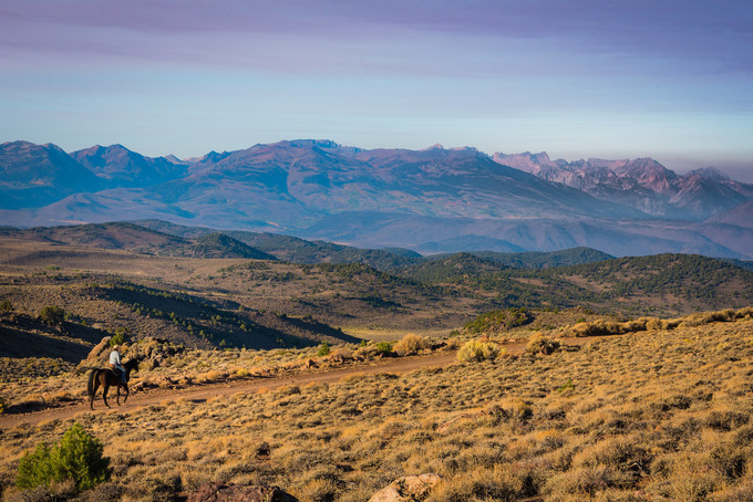
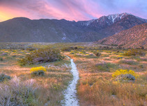
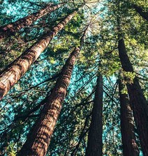
Stunning fall foliage found in the Bodie Hills!
The Bodie Hills region totals 121,500 acres of BLM lands, adjacent to Forest Service and privately owned land. There are three BLM Wilderness Study Areas within the Bodie Hills: Bodie, Bodie Mountain and Mt. Biedeman. California’s Eastern Sierra region is a dramatic transition zone between the snow-capped granite spires of the Sierra Nevada and the endless sagebrush covered uplands of the Great Basin. A visit at the right time of year will reward visitors with a diversity of wildflowers or stunning fall foliage. (BLM CA Flickr)
|
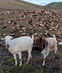
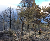
Goats helping to reduce fire hazards at the Fort Ord National Monument
The Central Coast Field Office at Fort Ord National Monument (FONM) will be hosting bands of goats from Goats R Us for the next six months. This week they brought the first band of 600 goats to the Monument, with another 1,400 to join them soon. They are knocking down dry weeds, brush, and grass to reduce fire hazards and will continue their work until next summer! Currently the goats are working adjacent to residential neighborhoods along State Route 68 on the Monument. This will be the fourth year that goats have grazed at FONM under a partnership arrangement to reduce fuel loadings in this urban setting. Last year, 2000 goats were used to help reduce fire hazards on 2,700 acres of wildland urban interface (BLM CA Facebook)
|
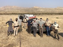
BLM team cleans up the Panoche Hills
A team from the Bureau of Land Management Central Coast Field Office completed a work-day in the Panoche Hills to remove trash from a popular recreational target shooting site. Over the course of three areas, ten employees from the Field Office collected over 2,000 pounds of trash! Remember to Pack It Out when you Recreate Responsibly this Fall! (BLM CA Facebook)
|
Some public lands affected by the Slink Fire reopened in Mono County
The Bureau of Land Management Bishop Field Office has reopened a portion of public lands in Mono County that were closed due to the effects of the Slink Fire. The updated Emergency Closure Order reduces the area closed to public entry to the fire perimeter located north of Mill Creek, west of U.S. Highway 395, south of State Highway 89, and east of the Alpine County line in Little Antelope Valley and the southern portion of Slinkard Valley. (BLM CA News Release)
|
BLM eases some fire restrictions for public lands in NE California
The Bureau of Land Management’s Applegate and Eagle Lake Field Offices in northeast California are easing some fire restrictions on public lands, again allowing use of open-flame devices such as camp stoves and barbecues. Other fire restrictions, such as a prohibition on all campfires, including in developed campgrounds and recreation sites, will remain in place until weather conditions reduce fire dangers. Valid California campfire permits are required for use of stoves and other open-flame devices. They are available free online and at BLM, Forest Service and CAL FIRE offices. (BLM CA News Release)
|
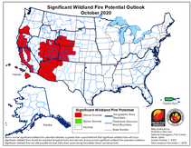
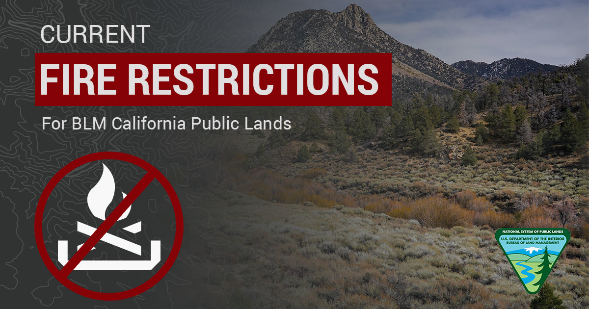 BLM California has issued season fire restrictions due to increased wildland fire danger in the state. Here’s an interactive MAP showing all current fire restrictions. Be sure to bookmark it for future use!
Due to high fire danger, fire restrictions were increased on BLM-managed public lands to prohibit use of all open flames, including campfires, BBQ’s and stoves in Northern and Central California, in addition to the statewide fire prevention order and local district fire and target shooting restrictions. For information about Southern California, see restrictions listed for California Desert District on our Fire Restrictions website: https://go.usa.gov/xGpn8
Seasonal target shooting restrictions are in effect for the Redding Field Office, portions of the California Desert District and all of Central California District. The target shooting restrictions do not apply to individuals with a valid State of California hunting license participating in hunting seasons in areas established by the state.
Berryessa Snow Mountain National Monument and adjacent areas
San Joaquin River Gorge Recreation Area
Case Mountain Recreation Area
Panoche and Tumey Hills vehicle closures extended
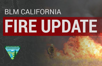
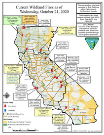
California state fire update
Critical fire weather remains in effect across much of Northern California, with firefighters on high alert for the possibility of new fast moving wildfires. Over 6,000 firefighters remain committed to 19 wildfires in California, 12 of which remain major incidents. Yesterday, firefighters responded to 11 new initial attack wildfires across the State, all of which have been contained.
Several Red Flag Warnings issued by the National Weather Service remain in effect across Northern California due to critical fire weather. Strong winds are likely to continue through Friday evening across portions of interior northern California stretching from Redding down to Vacaville, as well as through the parts of the Sierra Foothills. These areas could experience wind gusts of up to 45mph. A Red Flag Warning went into effect last night for many parts of the Bay Area. This warning is in effect through Friday afternoon for gusty winds and low humidity in the North Bay Mountains, areas of the East Bay Hills, the Diablo Range and the Santa Cruz Mountains. A Red Flag Warning has also been issued for portions of Northwest California starting early Thursday through Friday due to gusty winds. Learn more about these warnings in this short video. Officials are urging the public to ensure they are prepared for wildfires, as well as take all precautions outdoors to prevent sparking a wildfire. (Cal Fire)
|
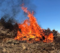
BLM plans prescribed burning for fall, winter months in NE California
The Bureau of Land Management’s Applegate Field Office will conduct prescribed burning projects through the fall and winter months, as weather conditions and resource availability permit. Pile burning and a broadcast burn will take place only when weather allows for safe and successful burning. Residents in and around the northeast California communities of Alturas, Cedarville, Madeline, Likely, Fort Bidwell, Tulelake and Dorris may see smoke, as will people in the Vya area of northwest Nevada. The BLM expects smoke impacts to be minimal. (BLM News Release)
|
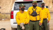
Crews from Mexico continue to assist wildfire efforts
Five Mexican crews, 104 total firefighters, are still in southern California working on the SQF Complex Fire through next week. Thank you, Mexico! (BLM Fire Facebook)
|
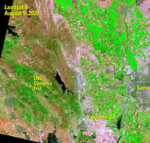
Fire science critical for combating wildfires out west
It has been a harrowing equation out West over the past few months: Abundant fuel + hot temperatures + winds = large, fast-moving wildfires. At one point San Francisco was bathed in an eerie orange glow that evoked comparisons to post-apocalyptic times. The Beachie Creek Fire in Oregon spread massively over a single night, from 500 acres to over 159,000 acres due to a windstorm with wind gusts as high as 50 miles per hour. People living in Portland, Oregon, were immersed in dense smoke with record poor air quality that on some days was listed as the worst air quality on Earth. (USGS News Release)
|
This non-profit is hard at work designing new forests to cure California's wildfire curse
After recent devastating fires in California, the Bureau of Land Management is teaming up with a specialist non-profit forest management organization to re-engineer the typical Californian forest to be more fire resistant. For decades in California, forest restoration consisted of planting pine trees like rows of cabbages. The theory behind it was that sunlight would be especially limited on the forest floor, preventing a flood of grass shrubs and weeds from taking over the ground in between the trees. This “Pines in Lines” strategy also created the perfect forest as far as fires were concerned, as it allowed the fires enough fuel to reach the canopies, and places to spread in every direction. (Good News Network)
|
For the latest info on current wildfires in CA, visit these helpful websites:
- Inciweb
- Cal Fire
- National Fire Situational Awareness Tool
Remember to follow your local fire & law enforcement agencies on social media for updates specific to your area and heed all evacuation warning & orders.
While fire activity remains high, please visit our social media pages to get the latest fire map every day:
Facebook or Twitter
|
|