|
View as a webpage
|
 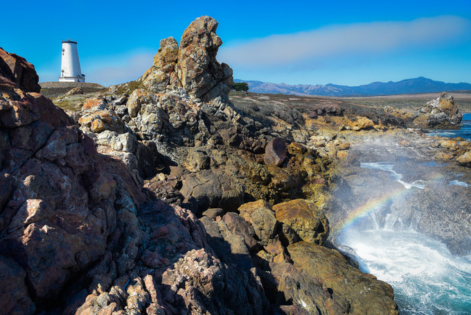 Piedras Blancas Light Station, Bakersfield Field Office
Photo by Jesse Pluim, BLM
|
|
ISSUE 922- October 1, 2020
|
|
|
Thanks to our National Public Lands Day volunteers!
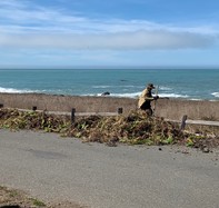
Huge thanks to the group of volunteers who turned out for National Public Lands Day in the King Range National Conservation Area, completing projects to beautify day use areas and a trailhead for the Lost Coast Trail in the community of Shelter Cove. These Shelter Cove community volunteers have become dedicated to these projects and will be assisting with on-going maintenance including watering and weeding at both project sites. We hope to return to hosting more frequent volunteer days in the future, continuing to engage the community in their public lands. (BLM CA Facebook)
|

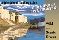
Tuolumne Wild & Scenic River 36th anniversary
This week we celebrated the 36th anniversary of the Tuolumne Wild and Scenic River! The Tuolumne originates from snowmelt off Mounts Dana and Lyell in Yosemite National Park before traversing BLM public lands further downstream. The river contains some of the most noted whitewater in the high Sierras and is extremely popular with rafters. Class IV and V rapids, chutes, and pools by the score create the ultimate river adventure, a journey both exciting and pristine. The world-famous Tuolumne is where the ambitious earn their stripes. (BLM CA Website)
|
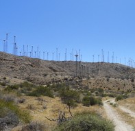
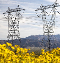
The BLM approves Mesa Wind Repower Project near Palm Springs
The Bureau of Land Management Palm Springs-South Coast Field Office announced the approval of the Mesa Wind Repower Project, located on public lands 11 miles northwest of the City of Palm Springs in Riverside County. The right-of-way holder, Brookfield Renewables, proposes to repower the existing 30-megawatt wind project, which was built in 1983. The repowering of the project involves the removal of approximately 460 older generation turbines, and the installation of up to nine new wind turbine generators. (BLM CA Website)
|
The BLM authorizes Lugo-Victorville project to upgrade telecommunications facilities
The Bureau of Land Management approved the Southern California Edison Lugo-Victorville Remedial Action Scheme project allowing for the installation of telecommunications facilities within three Southern California Edison rights-of-way that cross public lands in California and Nevada. The decision approves the installation of 85 miles of new telecommunications fiber optic cable between the Pisgah Substation in San Bernardino County, California, and the Eldorado Substation in Clark County, Nevada. The project will enhance interstate telecommunications connections and integrate multiple generation facilities. (BLM CA Website)
|
Educational resources available online
Are you looking for something to do with children while stuck indoors? Check out the California Educational Resource webpage to download activities for all ages. Take a virtual nature walk, explore a National Monument, or find whole lesson plans. (BLM CA News Release)
|
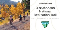
Fall Foliage Week at the Bizz Johnson Trail
Autumn is one of the most popular seasons to visit the Bizz Johnson Trail. As the changing foliage of cottonwoods turn the river bottoms golden yellow, willows along the river take on various tones of red and golden yellow, and oaks scattered through the landscape add accents of bright orange. (BLM CA Website)
|
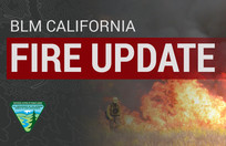
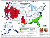
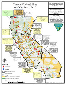
California state fire update
According to Cal Fire, full containment was announced on two of the largest lightning complexes that began in August. The LNU Complex and the SCU Complex are 100% contained as of this morning. As crews prepare for another round of Red Flag Warnings, over 17,000 firefighters remain on the lines of 24 major wildfires across the state. Crews across the State also responded to 23 new wildfires yesterday, bringing full containment to all. Since the beginning of the year, there have been over 8,100 wildfires that have burned well over 3.9 million acres in California. Currently, over 96,000 residents are evacuated across the state. Sadly, yesterday it was announced that another victim was found on the Zogg Fire, bringing the total number of fatalities statewide to 30, and 7,500 structures have been destroyed.
|

No drones in fire zones!
Even a tiny drone can cause a serious or fatal accident if it collides with firefighting aircraft. In most situations, if drones are spotted near a wildfire, firefighting aircraft must land due to safety concerns, which then prolongs firefighting operations. (BLM Fire Facebook)
|
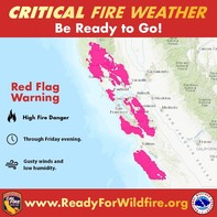
Red Flag Warning - stay alert!
A Red Flag Warning is in effect for portions of western California until Friday for gusty winds and low humidity. This is critical fire weather so use caution outdoors and follow all fire restrictions in place. The National Weather Service issues Red Flag Warnings & Fire Weather Watches to alert fire departments of the onset, or possible onset, of critical weather and dry conditions that could lead to rapid or dramatic increases in wildfire activity.
To learn more about Red Flag Warnings and what to do during those times, visit the Cal Fire website.
|
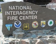
NIFC mobilizes Mexican fire crews and additional fire support from Canada and the U.S. military
The National Interagency Fire Center in Boise, Idaho has requested additional fire personnel and equipment from Canada and the U.S. Military to assist with wildfire suppression efforts in California and Oregon, along with five crews totaling 100 firefighters and four agency representatives from Guadalajara, Mexico. (Sierra News)
|
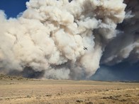
National Fire News
Firefighters and support personnel continue to work toward containment goals on 70 large fires the have burned more than 4million acres. Yesterday, the Mullen Fire, displayed extreme fire behavior and burned an additional 23,400 acres. (NIFC Twitter)
|
For the latest info on current wildfires in CA, visit these helpful websites:
- Inciweb
- Cal Fire
- National Fire Situational Awareness Tool
Remember to follow your local fire & law enforcement agencies on social media for updates specific to your area and heed all evacuation warning & orders.
While fire activity remains high, please visit our social media pages to get the latest fire map every day:
Facebook or Twitter
|
Current Fire Restrictions & Closures
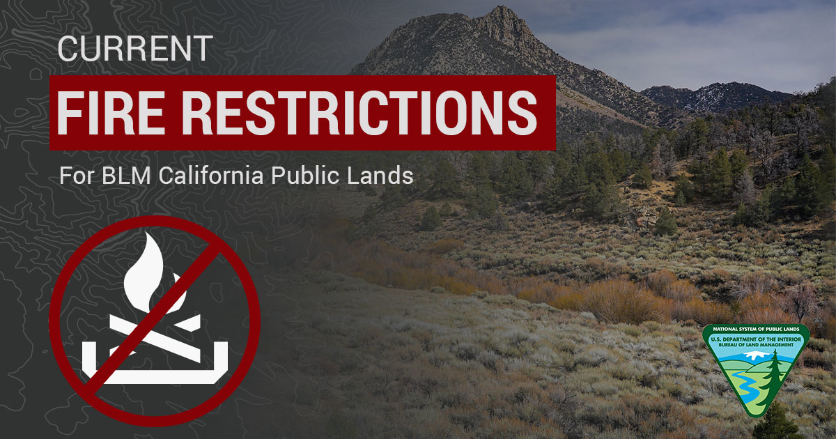 BLM California has issued season fire restrictions due to increased wildland fire danger in the state. Here’s an interactive MAP showing all current fire restrictions. Be sure to bookmark it for future use!
Due to high fire danger, fire restrictions were increased on BLM-managed public lands to prohibit use of all open flames, including campfires, BBQ’s and stoves in Northern and Central California, in addition to the statewide fire prevention order and local district fire and target shooting restrictions. For information about Southern California, see restrictions listed for California Desert District on our Fire Restrictions website: https://go.usa.gov/xGpn8
Seasonal target shooting restrictions are in effect for the Redding Field Office, portions of the California Desert District and all of Central California District. The target shooting restrictions do not apply to individuals with a valid State of California hunting license participating in hunting seasons in areas established by the state.
Berryessa Snow Mountain National Monument and adjacent areas
San Joaquin River Gorge Recreation Area
Case Mountain Recreation Area
|
Reducing wildfire risk and protecting structures
Last year, the National Park Service received an additional one million dollars in funding to reduce wildfire risk to structures, facilities, and infrastructure. The NPS Natural Resources Stewardship and Science and Visitor and Resource Protection’s Fire and Aviation Management Program associateships selected Crater Lake and Yellowstone National Parks as the as the focus areas for this risk reduction investment. (NPS Website)
|
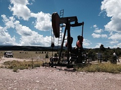
The BLM announces annual adjustment to drilling permit fee on public lands
The Bureau of Land Management announced today that it is adjusting for inflation the fee required by law to process oil and gas drilling permits on public and Indian lands, effective Oct. 1, 2020. The adjustment reflects the percentage change in the Bureau of Labor Statistics’ seasonally adjusted Consumer Price Index. That adjustment will increase the fee from $10,230, to $10,360. (BLM News Release)
|

ICYMI: Trump Administration continues to improve endangered species conservation
To ensure transparency, the proposed regulations would require that all decisions for critical habitat, as well as any exclusions, be made in the light of day, and that decision makers consider input from state, local, and tribal governments, in addition to any interested member of the public, including private landowners and those federal and public land users who are directly impacted by the proposed critical habitat designations. (DOI News Release)
|

NIST awards more than $4 million to small businesses for innovations in AI, wildfire forecasting and more
The U.S. Department of Commerce’s National Institute of Standards and Technology has awarded 19 small businesses in 12 states a total of more than $4.4 million in grants to support innovative technology development. The competitively selected proposals were submitted in response to a call for innovative products addressing specific technical needs. (NIST Website)
|
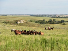
The BLM to award contracts for seven new wild horse off-range pastures
As part of an ambitious, multi-pronged strategy to reduce overpopulation of wild horses and burros on public lands, the Bureau of Land Management announced today that it will award the first of seven contracts for new wild horse off-range pastures in Kansas, Nebraska, Oklahoma, and Washington. (BLM News Release)
|
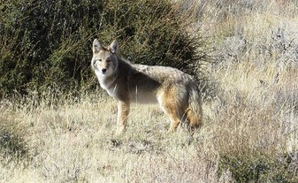
What is the average lifespan of a coyote?
1. 5 years
2. 9 years
3. 14 years
4. 19 years
Keep scrolling to find out!
|
30-day protest period for Cotoni-Coast Dairies proposed plan ends Oct. 26
The Bureau of Land Management Central Coast Field Office has released its Cotoni-Coast Dairies proposed Resource Management Plan Amendment and Environmental Assessment for the California Coastal National Monument that will provide management direction for Cotoni-Coast Dairies public lands in Santa Cruz County. Today’s announcement begins a 30-day protest period and 60-day Governor’s consistency review. (BLM CA News Release)
|
|
Question of the Week Answer
The answer is 3! The average lifespan of a coyote in the wild is up to 14 years. The coyote appears often in the tales and traditions of Native Americans—usually as a very savvy and clever beast. Modern coyotes have displayed their cleverness by adapting to the changing American landscape. These members of the dog family once lived primarily in open prairies and deserts, but now roam the continent's forests and mountains. They have even colonized cities like Los Angeles, and are now found over most of North America. Coyote populations are likely at an all-time high.
These adaptable animals will eat almost anything. They hunt rabbits, rodents, fish, frogs, and even deer. They also happily dine on insects, snakes, fruit, grass, and carrion. Because they sometimes kill lambs, calves, or other livestock, as well as pets, many ranchers and farmers regard them as destructive pests.
Source: National Geographic
|
|
|
News.Bytes is a publication of the Bureau of Land Management in California.
Bureau of Land Management
California State Office
2800 Cottage Way, Suite W1623
Sacramento, CA 95825
(916) 978-4600
Send comments to the News.Bytes Team | Subscribe to News.Bytes | Unsubscribe
|
     
|
|
|