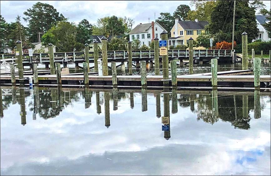
 Water covers a parking lot at the Onancock wharf during a September 2020 king tide. Photo by David Martin.
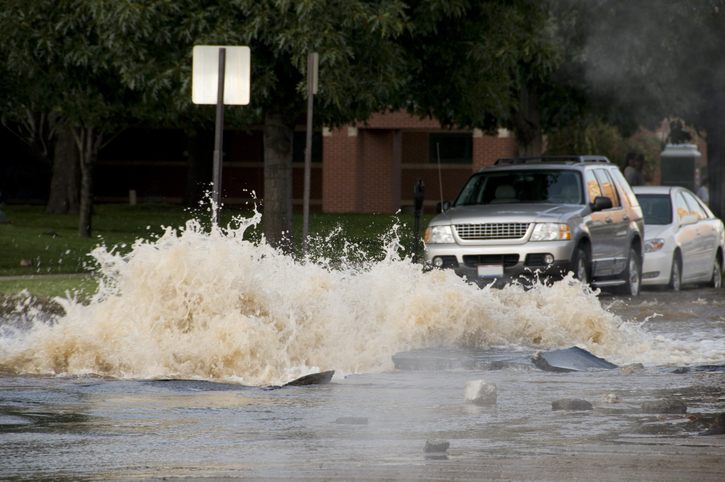
Virginia has more than 7,000 miles of coastline. Much of it has receded, due to the 14 inches of sea level rise since 1930. The Build Back Better Act, if passed, would help Virginia strengthen its natural coastline infrastructure to protect it from further losses. The Pew Charitable Trusts described some ways the Senate-passed bill could address flooding:
- Dedicate $1 billion to a program that helps communities plan and build projects to protect them from extreme weather.
- More than triple grant awards available through FEMA’s flood mitigation program. This would help people reduce the risk of repetitive flood damage.
- Dedicate nearly $9 billion to help state and local governments assess, plan, and build projects to reduce the vulnerability of roads and bridges in natural disasters (i.e., getting washed out by a flood).
- Make clear that federal highway funding should consider and include weather resiliency projects as well as safety and traffic congestion.
- Fund research on how to make infrastructure more resilient to weather events. For example, develop permeable pavements that can help reduce flooding.
- Add natural solutions, like preserving or restoring wetlands, to federal programs that try to reduce damage to transportation systems.
Learn more here about how the Build Back Better Bill could help coastal communities address flooding along Virginia’s Eastern Shore.
 Source: Getty Images
The Office of the City Administrator established the District of Columbia (DC) Flood Task Force in September 2021. This unit supports policies and projects that strengthen flood readiness throughout DC. It also works to protect its residents and economy from future flooding.
DC’s Flood Task Force plans to produce a report with an action plan for each of these issues:
- Flood and sewer line backup insurance.
- Repairing flood damage in low-income homes and neighborhoods.
- Flood-proofing individual homes and facilities.
- Sewer line backups and backwater valve installation.
- Flood mitigation infrastructure projects.
- Regulations, legislation, compliance, and permitting.
- Mapping and modeling.
- Flood mitigation planning and coordination.
- Flood emergency planning, response, and recovery.
The Flood Task Force meets every two months. To learn more, visit DC’s Flood Task Force website.
 Source: National Weather Service
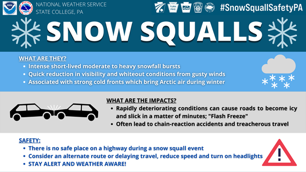
Pennsylvania and West Virginia partnered with the National Weather Service (NWS) in 2021 to host awareness weeks on winter hazards. The third week of November was Snow Squall Awareness Week in Pennsylvania and Winter Weather Awareness Week in West Virginia. This media strategy is used to widely share hazard-related public service announcements. Agencies often offer training exercises to prepare people and help them respond in the week and months leading up to awareness weeks.
Pennsylvania’s Snow Squall Awareness Week described the dangers of snow squalls, how alerts and warnings are issued, and how to stay safe. Snow squalls are brief but intense periods of heavy snow, strong winds, and whiteout conditions. They create incredibly dangerous driving conditions. NWS, the Pennsylvania Emergency Management Agency (PEMA), the Pennsylvania Department of Transportation (PennDOT), and other state partners created a series of tools to educate drivers about the dangers of snow squalls. These included videos that show the impact of squall hazards on roadways.
 Source: National Weather Service
West Virginia’s Winter Weather Awareness Week was established for the first time in November 2021 through a Governor’s Proclamation after extreme ice storms, snow, and flooding greatly impacted the state in early 2021. Media releases reminded residents to stock emergency kits, have their vehicles serviced, and check furnaces, fireplaces, and chimneys to be sure they were ready for winter.
Visit the National Weather Service for more information on Snow Squall Awareness Week and Winter Weather Awareness Week, including safety tips and resources for both hazards.
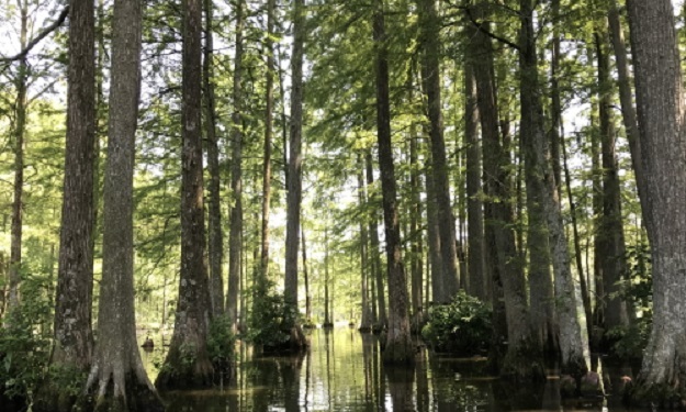 The Middle Chesapeake Sentinel Landscape encompasses portions of the Nanticoke River.
In 2013 a coalition of federal agencies, state and local governments, and non-governmental organizations formed the Sentinel Landscapes Partnership. The goal of the partnership is to work with private landowners to advance sustainable land management practices in the vicinity of military installations throughout the United States. The Partnership works to strengthen military readiness, conserve natural resources, bolster agricultural and forestry economies, and increase resilience to climate change.
Sentinel landscapes are defined as areas where natural and working lands are well suited to protect defense facilities from land use that is incompatible with the military's mission. Once a sentinel landscape is designated, the coalition helps to promote sustainable management practices. These include farming, ranching, and forestry, which offer economic and ecological benefits and protect military assets.
Sentinel landscape partners, along with private landowners, have permanently protected over 467,000 acres of land. They have applied sustainable management practices on 2.3 million more acres. Projects have successfully preserved wildlife habitat, bolstered agricultural and forestry production, and reduced land-use conflicts around military bases.
One example of a successful Sentinel Landscapes Partnership project in FEMA Region 3 is the Middle Chesapeake Sentinel Landscape. The Sentinel Landscapes Partnership accepts applications for Sentinel Landscape designation during specific application cycles that can be found on their website. Additionally, there is an interactive landowner resources tool that connects landowners to voluntary federal and state assistance programs offering numerous funding opportunities. Properties that fall within a sentinel landscape boundary may be eligible for priority consideration. To learn more about the Sentinel Landscapes Partnership and landowner resources, please visit the coalition’s website: https://sentinellandscapes.org/.
FEMA Region 3 hosts an ongoing webinar series for hazard mitigation planners and other partners interested in reducing risk in their communities. These “Coffee Breaks” are hour-long webinar sessions hosted every other month to provide mitigation best practices and highlight the work happening at federal, regional, state, and community levels to reduce risk across the region.
Coffee Break webinars are open to everyone involved in hazard mitigation, resiliency, or risk reduction planning in the public and private sectors, which includes community planners, emergency managers, floodplain managers, Geographic Information Systems (GIS) technicians, government officials, contractors, and anyone else involved in the development and implementation of hazard mitigation and risk reduction strategies.
Participants who are Certified Floodplain Managers (CFM) through Association of State Floodplain Management (ASFPM) or are American Institute of Certified Planners (AICP) certified through the American Planning Association (APA), may be eligible to receive one (1) Continuing Education Credit.
Please see below for descriptions of all upcoming Coffee Breaks. You can register for Coffee Break webinars here.
Funding Your Hazard Mitigation Actions
March 30, 2022 from 11:00 AM - 12:00 PM ET
Once a Hazard Mitigation Plan (HMP) is approved, communities must employ a variety of funding sources to implement their prioritized mitigation actions. Though FEMA Hazard Mitigation Assistance (HMA) offers a significant source of mitigation funding, the evolving exposure of vulnerable populations, the enduring impacts of climate change, and the increasing cost of natural disaster damages warrant the use of additional sources of mitigation funding that are often identified within an HMP, yet are less frequently pursued. This webinar will explore how to implement mitigation actions through a variety of funding sources available at the state and federal level.
Future Conditions and Hazard Mitigation Planning
May 18, 2022 from 11:00 AM - 12:00 PM ET
The time to plan for future conditions is now. In this training, participants will learn about the four factors that FEMA includes in ‘future conditions’: climate change, population change, demographic change, and land use/development change and how to integrate them into a Hazard Mitigation Plan. This webinar will highlight examples of how future conditions can impact risk assessment and the development of effective mitigation strategies in order to respond to a changing world.
Establishing Meaningful Outreach Strategies
July 20, 2022 from 11:00 AM - 12:00 PM ET
From big cities to small towns, effective community-wide public outreach is vital to developing a Hazard Mitigation Plan that reflects the priorities of each individual jurisdiction. Early and often engagement with community members helps local officials understand their community risk, identify interest in specific mitigation projects, establish where to allocate mitigation funding to reach those most in need, and develop community ownership of the plan. This webinar will explore different methods of public outreach and examples of successful mitigation communication strategies.
Addressing Equity through Hazard Mitigation Planning
September 21, 2022 from 11:00 AM - 12:00 PM ET
Considering equity in emergency management and hazard mitigation is an important goal. The most at-risk members of our community often experience the greatest losses from disasters. A “Whole Community” approach to hazard mitigation includes incorporating the considerations of these populations into the hazard mitigation planning and project development process. This webinar will make the connection between equitable planning and inclusive project development and the community outreach that goes into making this possible.
Utilizing University Partnerships in Hazard Mitigation Planning
November 16, 2022 from 11:00 AM - 12:00 PM ET
Bringing the right people to the table is an important component of hazard mitigation planning. Universities possess unique data and the opportunity to research important topics to hazard mitigation, including development changes, ongoing mitigation efforts, and the impacts of natural hazards. This webinar will explore how to maximize the opportunity for collaboration between jurisdictions and higher education institutes when drafting Hazard Mitigation Plans.
|
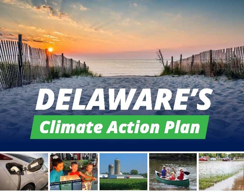 Source: Delaware Department of Natural Resources and Environmental Control
Delaware Department of Natural Resources and Environmental Control (DNREC) introduced a new climate action plan, outlining the state’s goals and efforts to address rising temperatures and sea levels. The plan encompasses input from residents, businesses, and technical experts to address key components such as the economy, natural resources, infrastructure, transportation, wastewater, air quality, and land use planning. A number of alarming statistics are identified to help encourage action. For example, the plan points to the one foot of sea level rise already recorded at a tidal gauge in Lewes since 1900. By 2050, the state expects a rise of 9 to 23 inches and up to 5 feet by 2100, which could permanently inundate Delaware’s coastal lands. These statistics show that Delaware is already feeling and will continue to feel the effects of climate change.
While the plan does not force environmental mandates on Delaware’s 57 local cities and towns, it does offer local government leaders help to accomplish the plan’s goals in their communities. Shawn Garvin, Secretary of DNREC stated, “The Climate Action Plan provides a roadmap of strategies and actions that state agencies can take to minimize emissions and maximize resilience to climate change.” In addition, DNREC hopes that by partnering with higher education institutions like Delaware State University, underserved communities who may be adversely impacted by the effects of climate change will be reached, ensuring that everyone is able to be a part of the solution. The full plan can be viewed on DNREC’s website here.
 Source: Digital Coast
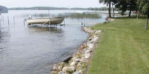
Maryland’s Department of Natural Resources (DNR) completed an online course to learn how to use CanVis. This free visualization tool helps users produce realistic simulations of coastal changes. It can modify digital photographs to show potential changes and depict “before” and “potential after” views of the same setting. The online CanVis course is available through NOAA’s Office for Coastal Management.
CanVis visualizations have become an important tool for Maryland DNR. The agency gives living shorelines training workshops for contractors, engineers, and private landowners. These visualizations have also been used to strengthen shoreline restoration grant applications.
Many landowners, builders, and contractors in Maryland had expressed concern over the state’s Living Shoreline Protection Act. They worried about its effects on shorelines and how projects will be applied. However, seeing the results of proposed projects in advance gives them more information and reassures them about future changes.
This story is featured as a Case Study on the U.S. Climate Resilience Toolkit website. For more case studies and resilience resources, visit the U.S. Climate Resilience Toolkit website.
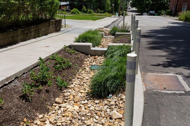 Source: City of Pittsburgh Water and Sewer Authority
Pittsburgh has experienced increased sewer overflows, surface flooding, basement sewage flooding, and poor water quality. These come from a combination of aging infrastructure, increased impervious areas, and more frequent and intense rainstorms.
The city’s Water and Sewer Authority has taken on a comprehensive unified planning approach to address these challenges. Evolving since the early 2010s, their approach is to collaborate with local and regional organizations, agencies, and the community. Through the application of stormwater strategies, this process aims to maximize both community and economic benefits, while also emphasizing equity and affordability.
Since its initiation, the stormwater management process has seen positive results, which include a series of watershed and neighborhood plans, a citywide green infrastructure plan, and a stormwater strategic plan. Community engagement has driven the process to prioritize stormwater management strategies in each neighborhood. The plans cover strategies such as managing combined sewer overflows, controlling sediment and erosion, mitigating roadway flooding, and restoring historic streams.
Visit the U.S. Climate Resilience Toolkit for more information on Pittsburgh’s planning model and other case studies in the region.

In this issue of the Resilience Report, we virtually connected with Kurt Donaldson, GISP, CFM, Senior Project Manager at West Virginia University’s (WVU) Geographic Information Systems (GIS) Technical Center to discuss updates to the West Virginia Flood Tool. The West Virginia (WV) Flood Tool is an interactive online mapping application designed to help both citizens and professionals make informed decisions based on the degree of flood risk for a specific area or property. The tool uses the best available flood mapping data from FEMA and includes up-to-date and accurate base maps and reference layers. Since its initial development in 2006, the West Virginia Flood Tool’s data layers have been continually improved, resulting in increased use of the application. To learn more, please refer to the WV Flood Tool Summary Notes or visit the WV Flood Tool resources page.
|
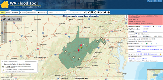 Source: West Virginia Flood Tool
Q: Can you tell me about your role at the WVU GIS Technical Center?
I joined the WVU GIS Technical Center in 1999 and continue to serve in my role there as GIS Manager. I have worked on a variety of GIS and mapping projects during my time at the Technical Center including trails, energy projects, archival maps, parcel data and 911 addressing. We began to work with the Federal Emergency Management Agency (FEMA) around 2003, and our focus was on digitizing flood maps into the Flood Insurance Rate Maps (FIRM) format that is used today. This work was the foundation of gathering the datasets and information for the creation of the WV Flood Tool. Today, a lot of our efforts go towards maintaining and improving the tool with new data and functionality to make it accessible and beneficial to our stakeholders.
Q: How has the WV Flood Tool evolved since it was created and how has it helped to reduce risk in communities throughout West Virginia?
The WV Flood Tool was created in 2006 and has made significant improvements since then, especially regarding the data, technology, and functionality we are able to offer. Our work with this tool really revolves around the data. Over the years, we have been able to build a comprehensive database that is cross-referenced for accuracy and provides robust information at both the state and local levels. The granularity of the local data allows for a more personal experience for users in checking a specific property’s flood risk.
Technological advancements for the WV Flood Tool have been instrumental in improving the user experience of the tool and attracting new users. For example, by adding higher resolution data, we were able to increase the zoom level of the tool substantially to meet the requests of many of our stakeholders. As the tool attracts new and different types of users, we are able to customize certain applications to better meet the specific needs of these users. We also now have a mobile version of the WV Flood Tool. Overall, the interactive nature of the platform allows users to dictate their own experience and use the tool at their own comfort level and for their own purpose.
The WV Flood Tool offers three different views based on who is using the tool and their purpose with the tool. The three views are public, expert, and RiskMAP. The public view allows people to make basic flood hazard determinations for identified locations. The expert view is for more advanced users focused on making floodplain management and mitigation decisions. Lastly, RiskMAP is an advanced view that depicts FEMA’s flood maps and mitigation programs.
The WV Flood Tool has helped reduce risk in West Virginia by empowering people and communities across the state to make informed decisions about their level of risk using the best data available. I think our technological and user experience improvements have made that possible for more and more people. As we continue to bring education and awareness to the tool, as well as provide technical support, there are ample opportunities to continue reducing risk in West Virginia, especially in our most vulnerable communities.
Q: What are the opportunities you see for the WV Flood Tool moving forward?
There are a few data and mapping projects currently in the works for the WV Flood Tool. New LiDAR elevation data will soon be available, which will provide more accurate flood maps across the state. We recently worked on a data accuracy improvement project for all of the Letter of Map Amendment (LOMA) data on the platform. Additionally, we would like to continue building out datasets for other potential hazards in West Virginia such as landslides and dam inundation and create functionality for analysis of those hazards on the flood tool.
Mitigation and visualizations are probably the two best opportunities to improve user experience of the WV Flood Tool. With mitigation, we would like to not only continue tracking mitigation projects, but also identify mitigation initiatives and future mitigation potential. Enhancing these aspects of the tool would be beneficial for floodplain managers to help with project tracking and generating attention for future projects. It would be great if we could attach or link these mitigation mapping functionalities to something that could estimate or calculate project cost.
When it comes to visualization, the 3D flood visualizations on the flood tool have made it easier for non-technical users to understand risks to their property in feet of water rather than relying on the base flood elevation. I think there will be continued opportunities to build this out and increase the use of visualizations to demonstrate technical concepts.
Lastly, I see stakeholder outreach as an opportunity with the WV Flood Tool. We hope to continue our education and training efforts that we have conducted in the past and continue collaborating with our partners across the State. This includes trainings with local floodplain managers and collaborating with West Virginia’s Planning and Development Councils on regional planning initiatives. Our outreach will prioritize our most vulnerable communities in the West Virginia, providing them with the tools to build capacity and local experience to increase their resilience to hazards.
|