The Natural Resources Conservation Service (NRCS) in Idaho has released the January Water Supply Outlook Report for the 2026 Water Year.
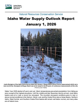
"The Western U.S. and most of Idaho is in a snow drought thanks to warmer than normal temperatures in November, December and the beginning of January, said Erin Whorton, Water Supply Specialist for NRCS Idaho. “Even though Idaho received above normal precipitation this winter thus far, with high-temperature records being set everywhere, only the highest mountain ranges have gotten more snow than rain."
To read the entire Water Supply Outlook Report, please visit the NRCS Idaho Snow Survey Webpage.
For questions about water supply or snowpack conditions, please contact Erin Whorton at erin.whorton@usda.gov or 208-514-0464.
|
Idaho Water Supply Outlook Presentation
Idaho Water User Association 89th Annual Convention
Wednesday, January 21 at 1:30 to 2:30pm at the Riverside Hotel
Conference Agenda
January Water Supply Meeting
Thursday, January 15 from 9 a.m. to 12 p.m. the Idaho Department of Water Resources will hold the January Water Supply Meeting at the Bureau of Reclamation building, 230 N Collins Rd, Boise. Attendees may also participate via Microsoft Teams, Join the meeting now.
Meeting ID: 228 507 351 272 49
Passcode: 7MQ6Xr6V
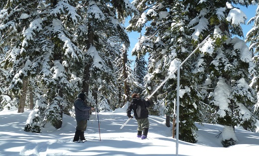
We’d also like to give a shout-out to the vast network of volunteers, agency partners, and NRCS field staff who manually measure the snowpack, every winter month, at approximately 1,100 snow courses across the West and Alaska. Although only measured once per month, snow courses play a critical role in forecasting seasonal streamflow because they are:
(a) the longest, continuous snowpack records in the United States (measurements began in 1910 near Lake Tahoe), but they also
(b) fill in the geographic gaps in between the automated SNOTEL stations, and
(c) help us better understand low and mid-elevation snowpack conditions.
Fun fact - the longest, continuously measured snow courses in Idaho have 89-year records! There are several Idaho families, who have been measuring the snowpack in their ‘backyards,’ for multiple-generations. What a family legacy and contribution! If you meet a snow course volunteer, please tell them thank you and listen their stories – you’ll be amazed at what a team of dedicated people can contribute to public good.
For a great read on the ‘golden’ days of snow surveying, check out this book by Patrick Armstrong who has been measuring the snowpack since 1972, or dive into the history of the snow program in this USDA report.
We invite you to take a moment to marvel that there are (literally!) hundreds of people out measuring the snowpack on the first of each month the next time you’re looking at current snowpack conditions on the NRCS interactive map. The NRCS Snow Program is only about 50 people. We can’t be in 1,110 places at once, so thank you again to our snow surveyors. We could not provide critical snowpack data to the public without their help.
To help the public stay informed, we have released a new Idaho SNOTEL Site Issues Map, which tracks known outages and sensor problems across the network. While we work hard to keep this resource as up‑to‑date as possible, we always appreciate the public’s assistance in identifying potential sensor issues or irregular data. Our team can be contacted at: IDBOISE-NRCS-SNOW@usda.gov
Several additional sites are currently experiencing operational difficulties. Dollarhide Summit SNOTEL stopped reporting on December 12 and a field crew is traveling to that site on January 13 to try and get it back online. Idaho snow staff will also make repairs at Swede Peak, Hyndman, Bunchgrass Meadow, and Moscow Mountain SNOTEL sites during the week of January 12. Crater Meadow SNOTEL went offline on December 1. That site can only be accessed via helicopter, so field staff will begin restoration work as soon as possible. Please see the story below for an update on the Grand Targhee station.
Good news - Cozy Cove SNOTEL site is fully operational again!
Our team installed a new snow pillow and repaired the precipitation on November 18, just three days after the government shutdown ended. This site is critical for managing Deadwood Reservoir and forecasting runoff in the Payette and Boise River basins. The Cozy Cove station burned to the ground (except for the precipitation gauge - which was remarkably resilient) during Water Year 2024. Unfortunately, inventory limitations prevented replacing the pillow that year, and then in July we were thwarted again by debris-flows that prevented access to the site.
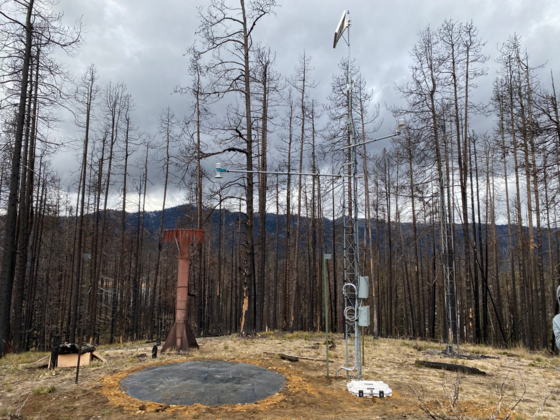 Cozy Cove SNOTEL site on November 18, 2025 after the new snow pillow was installed. Some bunchgrass vegetation remains around the site, but all of the trees were killed in the 2024 fire. Changes in canopy structure affects accumulation patterns and the ‘soot’ off the trees will likely have a strong influence on snowpack melt rate and timing for the next 10 to 15 years.
This winter, we are testing a new shelterless set-up at Cozy Cove. This allowed us to get the site up and running since we did not have the field days and staff hours required to pour a concrete foundation and build a shelter before the snow started flying in late-
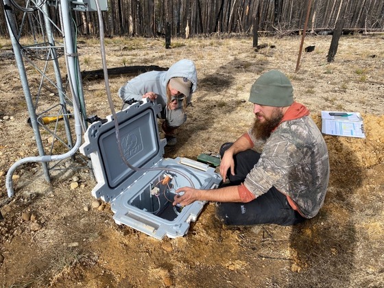 Our team has designed a new shelterless system that we are testing at the Cozy Cove SNOTEL site this winter. This ingenious design utilizes an insulated cooler with the snow pillow measurement instruments in it. It’s a simple way to protect the pressure-transducers from the daily temperature fluctuations that affect snow water equivalent (SWE) measurement accuracy. It has also allowed us to reduce the site footprint and replace a shelter with minimal field hours unexpected time constraints. We look forward to seeing how this design performs over the winter and will incorporate what we learn into the 2.0 design.
It will be interesting to see what effects the fire may have on the snowpack accumulation, snowmelt rates, and the timing of that melt going forward at all of the SNOTEL sites that have experienced fire in recent years. Fires typically have a measurable and significant influence on the snowpack for an average of 10 to 15 years post-fire.
Snow pillow replaced after Salt River Summit
This summer, firefighting crews saved the Salt River Summit SNOTEL site from wildfire. Without their efforts, the Salt River station would have burned to the ground this past summer. We are incredibly grateful to the many wildland firefighters, incident fire resource managers and other fire staff who have worked very hard to protect our sites. They’ve saved numerous other SNOTEL sites in Idaho in the past two years (e.g. Big Creek, Banner Summit).
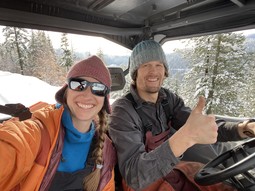
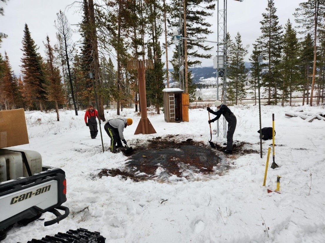
During the government shutdown, a burned tree fell and punctured the Salt River Summit snow pillow which is used to measure the water content in the snowpack (SWE). During an early December trip, the Idaho Snow team excavated the broken pillow (below), and they were able to repair the site so that it’s fully operational in time for winter.
 During the September 27 field inspection, the Salt River Summit SNOTEL site was fully operational and largely unaffected by the fire. However, a burned tree fell and punctured the snow pillow later in the fall. This site is critical for measuring the snowpack in the southeast portion of the Snake River headwaters.
More post-shutdown SNOTEL repairs
Additional repair work during the early December trip to the Upper Snake River region included fixing fixing the precipitation sensor leak at Gros Ventre and the ST-300 temperature sensor at Grassey Lake. All of these repairs would not have been possible with the support of Idaho NRCS state leadership and our team of dedicated hydrologists who ensure NRCS can continuously provide the high-quality data water users count on year-round.
This year was a fairly quiet year for snow pillow replacements (only three in 2025) compared to the previous two years, when seven pillows were replaced during both the 2023 and 2025 field seasons. One site that is either cursed or just happens to be the path of migrating elk (latest working theory) is Fish Creek in the Little Wood Basin. After numerous broken pillows and ripped out sensors since that site was built in 2020, our team was able to replace the pillow in late-November and install a protective fence around it. Hopefully that will keep elk (or cattle) from digging it up, rolling around on it or doing whatever they’re doing that keeps breaking them.
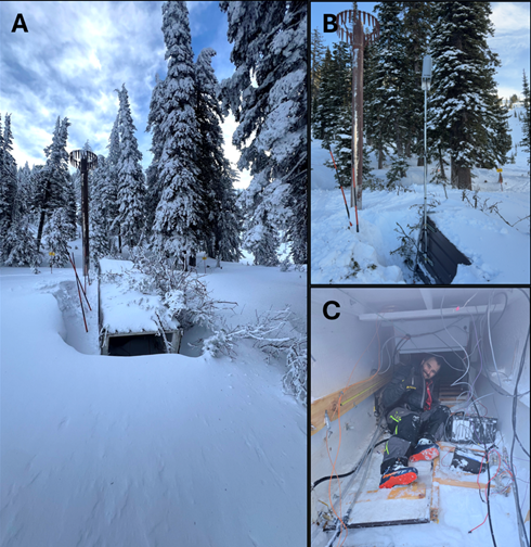
A tree falls at Grand Targhee - A tale of success, and then disappointment
During a severe windstorm in mid-December, a large tree fell and tipped over the instrument shelter at the Grand Targhee SNOTEL site. This caused a loss of station data on December 19, and the site was no longer was transmitting the critical snowpack information that upper Snake River water users rely on. This SNOTEL site is located within the Grand Targhee we’re very grateful for all the help from the resort’s ski patrol and mountain operations team! They did an amazing job providing photos and critical information which gave our team the best chance of getting this site back online as quickly as possible.
Photo A: Damaged Grand Targhee SNOTEL site after a tree knocked over the shelter.
Photo B: Improvised antenna mount so data can be transmitted this winter.
Photo C: Up is down! Hydrologist, Dave Eiriksson, working inside the downed shelter.
Snow Survey staff visited the site on December 31 to assess the situation and found that despite the extensive damage to the shelter, the core measurement equipment fared better than expected. The snow pillow remained fully functional and both the snow depth sensor and air temperature sensor were found to be undamaged. After a full day of on‑site work and some creative temporary repairs, staff were able to restore partial functionality to the station. The site was back online for the winter season and continued to provide snowpack and temperature data until last week the snow pillow suddenly went ‘flat’ on January 8. Despite our best efforts, the precipitation gauge and ST-300 temperature sensor at Grand Targhee are not currently operational.
We are evaluating options for restoring these sensors this winter but as the snow continues to pile up, it’s becoming increasingly unlikely we’ll be able to get this station fully functioning until the snow melts. Fortunately, the snow depth and YSI temperature sensors are still working and can provide some snowpack data to interested water users.
Please don’t hesitate to reach out to our team if you have any questions or concerns. We can be contacted at: IDBOISE-NRCS-SNOW@usda.gov
|