|
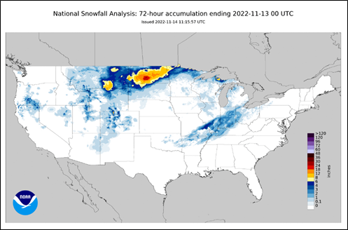
An early season blizzard in the Upper Midwest, which started on November 10, broke snowfall records for the date. The storm stretched from Wyoming to northern Minnesota, with North Dakota bearing the brunt of the snowfall. The National Weather Service in Bismarck, North Dakota, measured 17.1 inches of snow, nearly double of the previous record of 9.1 inches for the day, and nearly reaching all time one day record of 17.3 inches. Snow depth measurements in the nearby area of Mandan were as high as 24 inches. High winds accompanied the storms had gusts as high a 40–50 mph, creating drifts of 3 to 5 feet. Open report>>
|