|
Michigan 185th Anniversary of Statehood (1837):
January 26, 2022 |
|
|
|
|
|
|
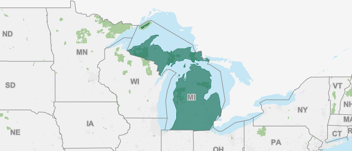
| Michigan joined the Union on January 26, 1837, as the 26th state. |
|
|
|
|
|
|
Nickname: "The Great Lakes State" (official); "The Wolverine State" (unofficial); "Water Winter Wonderland" (unofficial)
State Bird: American robin
State Fish: Brook trout
State Reptile: Painted turtle
State Fossil: Mastodon
State Flower: Apple blossom
State Tree: White pine
State Wildflower: Dwarf lake iris
State Gem: Chlorastrolite
State Stone: Petoskey stone |
|
|
|
|
|
|
| The area of Michigan was part of the original territory of the United States and was part of lands ceded by four states to the United States and designated in 1787 as the "Territory northwest of the River Ohio." Michigan Territory was organized on June 30, 1805, from the northeastern part of Indiana Territory, and included all of the Lower Peninsula, the eastern part of the Upper Peninsula, a small strip of northern Indiana, and a portion of northwestern Ohio that was later contested. |
|
|
|
|
|
|
| In 1818, when Illinois was admitted as a state, all of the remainder of Illinois Territory was added to Michigan Territory, including almost all of present-day Wisconsin, part of Minnesota, and the western part of the Upper Peninsula; at the same time, the central portion of the Upper Peninsula and eastern Wisconsin were added from the former Indiana Territory. In 1834, Michigan Territory was enlarged from part of Missouri Territory, including all of present-day Iowa, the remainder of Minnesota, and the eastern part of North Dakota and South Dakota. Michigan was reduced with the organization of Wisconsin Territory and the cession of the Toledo Strip to Ohio in 1836. As a compromise for the cession of territory to Ohio, Michigan Territory retained all of the Upper Peninsula when Wisconsin Territory was organized, resulting in a boundary generally the same as the present state. |
|
|
|
|
|
|
| Although not yet legally established as a separate territory, census data for Michigan are available beginning with the 1800 Census. The 1800 Census includes the population of a small area that is in present-day Ohio and excludes the population that was enumerated with Indiana in a small area of present-day Michigan. The 1800 population of the legally established Northwest Territory (of which Michigan was a part) was 45,916. The 1810, 1820, and 1830 Census populations are for the entire area of Michigan Territory, including population in extensive areas not in the present state, and, in 1810, excluding again the population of a small area of present-day Michigan enumerated with Indiana. |
|
|
|
|
|
|
| Data for the legally established state of Michigan are available beginning with the 1840 Census. |
|
|
|
|
The following facts are available thanks to the public’s invaluable participation in U.S. Census Bureau surveys. We appreciate the information shared by each respondent as we continuously count and measure America’s people, places, and economy. |
|
|
|
|
|
The percentage of people in Michigan who have obtained at least a bachelor's degree
|
|
|
|
|
|
The total number of housing units in Michigan
|
|
|
|
|
|
The percentage of the labor force in Michigan who are employed
|
|
|
|
|
| 2020 Census: The Population of Michigan |
|
|
|
| The number of people living in Michigan was 10,077,331 as of April 1, 2020, an increase of 2.0% since the 2010 Census. View Michigan’s population change by decade. |
|
|
|
|
| Michigan's Population Topped 10 Million in 2020 |
|
|
|
| America Counts has launched a state-by-state look at the demographic changes the 2020 Census results reveal. |
|
|
|
|
| Our state profiles bring you key population characteristics of your state and your county all on one page. |
|
|
|
|
| See how they compare to the nation overall and to neighboring counties and states. Through interactive state and county maps for the 50 states, the District of Columbia and Puerto Rico, each page provides a snapshot of change from 2010 to 2020 on five topics. |
|
|
|
|
Did you know?
- The numeric change in population for Michigan from 2010-2020 was 193,691.
- The percentage of the population aged 18 and older in Michigan was 78.5%, a total of 7,914,602 adults. This was an increase of 5.0% from the 2010 Census population aged 18 and older in Michigan.
|
|
|
|
|
 |
| About the Geographic Areas |
Michigan has 13 federally recognized American Indian reservations, 9 with off-reservation trust lands. Michigan has 15 metropolitan statistical areas, 18 micropolitan statistical areas, 2 metropolitan divisions, and 5 combined statistical areas.
There are 83 counties in Michigan. All counties in Michigan are functioning governmental entities, each governed by a board of commissioners. |
|
|
|
|
|
| Foreign Trade |
Take a look at the various imports to and exports from Michigan. See where materials such as motor vehicles and their parts and accessories, petroleum oils and oils from bituminous minerals, natural gas, lithium ion batteries, immunological products in measured doses or packings for retail sale, adrenal cortical hormones and their derivatives, medicaments in measured doses containing antibiotics, threaded screws and bolts, and more rank on both lists. Also, see lists of the countries that have sent the most imports by 2020 dollar value to Michigan and the countries that have received the most exported goods from Michigan as measured by 2020 dollar value.
|
|
|
|
|
|
|
|
|
|
|
|
| View Michigan Statistics in Our COVID-19 Data Hub |
|
|
|
| View the state COVID-19 impact planning report. Take a look at new survey data and estimates. |
|
|
|
|
| Community Resilience Estimates: Michigan |
|
|
|
| Community resilience is the capacity of individuals and households to absorb, endure, and recover from the health, social, and economic impacts of a disaster such as a hurricane or pandemic. When disasters occur, recovery depends on the community’s ability to withstand the effects of the event. In order to facilitate disaster preparedness, the Census Bureau has developed small area estimates, identifying communities where resources and information may effectively mitigate the impact of disasters. View Community Resilience Estimates for Michigan. |
|
|
|
|
Looking For More Data and Information About Michigan? |
|
|
|
|
| Customize the data that you receive from the Census Bureau. When you click on the link for your state below, we will be able to provide you with more timely and relevant information. We'll be able to send you state-specific updates, upcoming events in your area, job opportunities, interactive data visualizations, and more. Take the next step today! |
|
|
|
|
Help us spread the word about Census Bureau data. Share this newsletter on social media or forward it to a friend. |
|
|
|
|
|
|
|
| About the Census Bureau |
| We serve as the nation's leading provider of quality data about its people and economy. The Census Bureau is the federal government's largest statistical agency. As the world's premier statistical agency, we are dedicated to making our nation a better place. Policy-makers, businesses, and the public use our data to make informed decisions. |
|
|
|
|
|
|
|
|
|
|