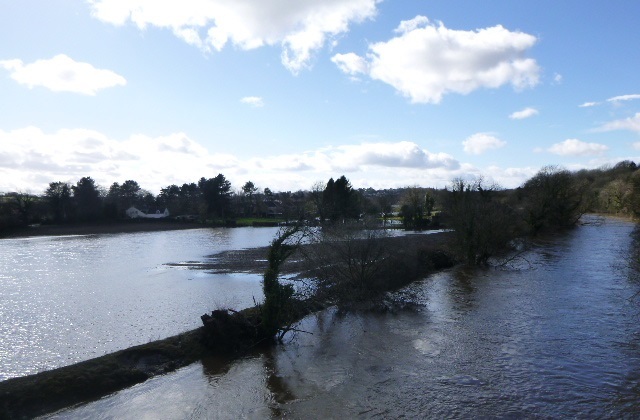
We continue to progress our study to better understand flood risk to communities in the middle Wharfe Catchment, and to model solutions to alleviate that risk. We have now completed our baseline model for flood risk in the area.
Our approach to mitigating flood risk across Leeds draws on large amounts of data to understand how areas react to high volumes of water. We assess rainfall statistics, condition of sewers and drainage, ground height, the number of developments, condition of green areas, condition of any existing flood defences and more to create a picture of how flooding may occur, and how many properties and pieces of infrastructure would be impacted at various levels of rainfall events.
This data is also gathered on a large scale, because the catchments for our rivers and streams go far beyond political boundaries. The river Wharfe catchment stretches right up into the Yorkshire Dales beyond Appletreewick and Conistone – with conditions there having an impact all the way down to Leeds.
At our engagement session in Wetherby Town Hall held in September 2021, we gathered a range of useful information from residents that has been used to verify our model. First-hand experience of how flooding occurs in the area from those who live there is incredibly useful to this process, we would like to thank everyone who joined us on the day.
Now that we have undertaken the modelling up and down the catchment, and factored in the insight from the community, our baseline model is complete. Once this has been approved by the Environment Agency, it will enable us to enter the next phase of works.
We have also categorised the comments and questions that we received in September 2021 into themes and have provided responses to them below:
Theme 1 : Our approach to alleviation of river floods
Several of the comments and questions that we received following our engagement event were around requesting for specific areas to be considered, such as specific streets and buildings, and Thorpe Arch Bridge. There were also requests for specific measures such as flood walls, embankments, or the introduction of beavers, as well as calls to use a combination of the suggested measures. These suggestions have all been factored into our modelling where appropriate.
Now that we have created our baseline model, we can begin to highlight different approaches that would alleviate flooding wherever risk is identified. This work will include testing permanent interventions like flood walls and embankments, natural flood management such as soil aeration or leaky dams, or the need for enhanced maintenance or clearance. These options are consulted on with the community, as well as assessed based on their financial and environmental impacts. At this point, it becomes clear which of the options would be optimal in certain locations, and often includes a combination of interventions to balance cost, impact on the environment, complexity, and flood alleviation benefits.
The goal is to provide the highest level of protection possible for as many homes, businesses, and pieces of key infrastructure within the constraints of the available funding, and without damaging the environment or increasing flood risk elsewhere.
Theme 2: Flood alleviation schemes and the environment
Several of the comments and questions that we received following our engagement event concerned the environmental impacts of the scheme.
As part of any flood alleviation scheme that we carry out across Leeds, we follow strict rules and regulations to ensure that we have as little effect on the environment as possible. There is also new legislation in place that requires developments to go beyond simply keeping things the same, and to improve on the biodiversity in the area. Surveys for birds, bats, newts, fish, and other wildlife are carried out at the appropriate time. Any removal of trees is kept to an absolute minimum, with a target to replant any trees that are removed on a 3:1 ratio in a nearby location.
We received many comments about dredging, particularly surrounding the island that has formed downstream of Thorp Arch bridge. Leeds City Council and the Environment Agency no longer utilise dredging as a flood alleviation method in most instances. This practice is expensive, can offer only a very short-term solution to flooding, and can be damaging to wildlife. You can read more about the Environment Agency’s approach to dredging here.
The islands in question will be assessed as part of the scheme. If they are found to increase flood risk, we will consider options to reduce the risk. An example of the types of action we take on islands such as this is the management of vegetation on the islands downstream of Otley Weir as part of our Otley Flood Alleviation Scheme. Here, we are managing out crack willow, and replacing it with a tree species that poses a lower flood risk. Find out more about the Otley Flood Alleviation Scheme here.
Next steps
The next phase of work is to understand the flood risk benefits of a range of options in the area, to model their benefits independently, and in various combinations. This will inform the potential for a flood scheme.
This phase of work is currently planned for completion in summer 2024, where we will be arranging another engagement event, like that of September 2021.
We will be providing another update on our progress with the modelling in Spring 2024.
Contact us
If you have any questions, please get in touch with us using the contact details below (Monday - Friday excluding bank holidays, 9am - 5pm).
Tel: 0113 378 7304
Email:FRM@leeds.gov.uk
Or visit our webpage for more information.
|