You are receiving this message because you opted to be contacted about the study via email when filling in our online survey, or directly requested to be kept up to date. If you do not wish to receive these updates going forward, you can manage your subscription preferences at the bottom of this email.
Why Meanwood needs flood protection
There have been major flooding events in the Meanwood Beck Catchment in 2002, 2007 and 2015. This has affected commercial properties at Sugar Well Road and Meanwood Close and residential properties at Monk Bridge and Boothroyd Drive. In addition to these the Mill Garth Hospital close to the beck was flooded in 2004 and 2007. There has also been frequent flooding from Meanwood Beck to highways.
We have completed our assessment of the long list of options based on further survey, hydraulic modelling and the feedback from the public engagement event in 2021 - thank you to all who have contributed to the study so far.
What we’re doing to reduce the risk of flooding
Leeds City Council have been working with the Environment Agency to model the Meanwood Beck catchment and identify areas of flood risk.
In the summer of 2021, an initial long list of potential solutions was created, and an online survey was published to consult with local residents, landowners and the wider public. The results of that survey were conveyed in this newsletter (September 2021).
In late 2022 we completed our assessment of the long list of options based on further survey, hydraulic modelling, and the feedback from the public engagement event in 2021.
From our long list, three options to hold water during flood events and reduce flood risk downstream have been shortlisted for further consideration. Additional Natural Flood Management options are also under consideration to supplement the flood reduction benefits. The options will also be looked at in combination. You can find a map outlining which three areas are being considered, and which three are no longer under consideration on our website.
Shortlisted Option 1: Scotland Wood
This area has the largest potential for flood storage. The culvert crossing the A6120 ring road is very large and restricting flow upstream of this can store large amounts of water upstream of the road without impacting on other property or the highway.
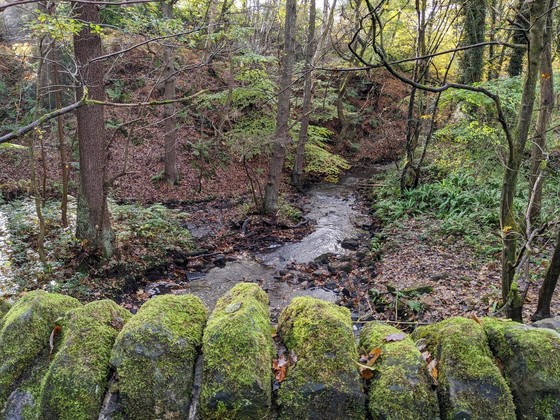
Shortlisted Option 2: Woodhouse Ridge
This area is suitable for flood storage without significant excavation work. This area already holds water during flood events. This area also has good potential for environmental improvements.
Shortlisted Option 3: Meanwood Valley Urban Farm
This area is suitable for flood storage and provides a reduction in flood extents at key locations downstream. This area provides the smallest flood storage of the shortlisted options without very large embankments. The area still provides significant benefits and could also be combined with the other options.
Natural Flood Management Options
The areas at Scotland Wood, The Hollies and Woodhouse Ridge are also being considered for Natural Flood Management options. This work will consist of leaky dams, ponds, meanders and modifications to historical structures. These options will not address flood risk on their own but will be considered alongside other options to improve the standard of protection provided and deliver environmental enhancements.
Next Steps
- Our hydraulic model is currently under review by the Environment Agency. Once finalised, we will continue assessing the three shortlisted areas to determine the most suitable option or combination of options
- Alongside this, we will be carrying out an environmental review of the options to better understand the impacts of the scheme and the potential improvements that can be delivered
- Once the options have been assessed and the designs developed further, we will host consultation / engagement events to share information on the project with the public both online and in person
- We expect to have a finalised outline design and submit a business case for the scheme in Autumn 2023
- You can find the latest information on the study on our dedicated webpage
Options no longer under consideration
The Hollies - This area is relatively small. This would also require excavation and is difficult to access. Works here would have a large ecological impact and a high cost for a relatively low reduction in flood risk compared to other options.
Highbury Cricket Club - This area provides relatively small flood benefits. As the field is at a high level above the beck providing the required volume of storage would require excavation throughout the field. This would have a high cost for the reduction in flood risk provided.
Woodhouse Cricket Club - This area provides relatively small flood benefits. Providing significant flood storage here would require excavation with a high cost and likely unacceptable impact on the cricket club. This area has no advantages when compared to the Meanwood Valley Urban Farm area.
Preparing for a flood event
Leeds City Council and the Environment Agency have completed several flood alleviation schemes across the city, which have significantly improved the resilience to flooding across Leeds. Despite this, there is still some risk to our residents, particularly as we enter what are typically the wetter months. That is why it is important for everyone to take steps to increase their own flood resilience and create a plan for flooding.
There are some steps that all residents can take to improve their flood resilience for free:
- Create a flood plan for your home or business using the template from the Environment Agency
- Sign up for flood alerts in your area for free on gov.uk
- Read guidance on the different types of flood warnings, and what they mean for your home or your travel plans
There is support available to help residents prepare for flooding. You can find advice on what to do before, during and after a flood on the Leeds City Council website.
Please also note that Leeds City Council do not provide sandbags to residents and businesses during a flood. We must prioritise our limited stock of sandbags for:
· working with emergency services
· keeping priority roads open
· protecting services such as hospitals, care homes and schools
· supporting recognised flood groups
You can find more information on how to source your own sandbags or alternatives on the Leeds City Council Website.
You're up to date
Thank you for taking the time to stay up to date with the Meanwood Beck Flood Risk Study.
If you have any questions, please get in touch with us using the contact details below (Monday - Friday excluding bank holidays, 9am - 5pm).
Tel: 0113 378 7304
Email: FRM@leeds.gov.uk
Twitter: @LeedsFAS

|