Improving flood resilience across Devon
April 2025
Please note: This is the April DRIP newsletter, but was sent out on 06.05.25 due to restrictions in the pre-election period.
Smart biosphere platform
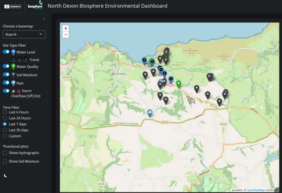
The North Devon Biosphere are excited to launch their prototype application providing real-time environmental data for North Devon. Initially focused on the River Umber (Combe Martin) and Little Dart (Chulmleigh) catchments, the network of sensors measure rainfall, soil conditions, river levels, and water quality. They will be expanding the reach to include more rivers, estuaries, and beach locations. The data will be used to help detect pollution, predict flood events, and monitor environmental change.
Explore the data here: North Devon Biosphere Environmental Dashboard and visit their website to find out more about the Smart Biosphere. If you have any feedback, or want to find out more please email: biosphere-mailbox@devon.gov.uk
Part of 'Connecting the Culm', Blackdown Hills National Landscape
 |
|
Tree planting has been completed across further locations in the Culm catchment. This work forms part of the wider 'Connecting the Culm' project, aiming to help make the River Culm and its catchment better for wildlife and people, and more resilient to flood and drought. |
Building Resilience In Communities (BRIC), Plymouth
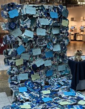
The BRIC team held a display at Drakes Circus, Plymouth, to showcase the 500 'puddles' that have been made by people attending their engagement events over the past year. They chatted to over 450 people across the 4 days of exhibition, with the sewer rat providing entertainment throughout!. This was an excellent opportunity to discuss 'slowing the flow' and flood resilience with Plymouth residents. The team also showcased the display at the Plymouth National marine park, speaking to over 200 people. |
|
 |
Pilot projects update
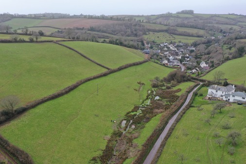
We are pleased to say that the final stage of Natural Flood Management (NFM) works in Stokeinteignhead have been completed. This has included tree planting in a steep field behind the village hall, where contour trenches were delivered in late 2024.
The University of Exeter and University of Plymouth are continuing to monitor the NFM, with some positive initial results indicating the scheme is successfully slowing the flow of water travelling into the village. The image below was taken during drone surveys of the NFM, showing the series of ponds and scrapes alongside the stream, increasing water storage.
Image credit: Kirsty Frith and Alan Puttock, University of Exeter
 |
|
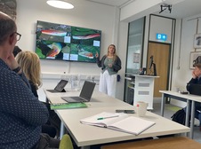
Early in March we held a productive meeting at the University of Plymouth, with all of our DRIP PhD students. They presented initial results from their research, to a panel of academics and representatives from the Environment Agency and Devon County Council. This was an excellent opportunity to get feedback and will be used to inform their research for the final two years of DRIP. Look out for future newsletters with more details of these results! |
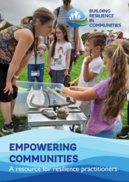
Empowering communities practitioner guide
Produced by the Building Resilience in Communities (BRIC) project
|
The BRIC team have produced an excellent guide for resilience practitioners, collating all their knowledge of community engagement over the past two years.
The booklet contains information on engagement models, activities and resources such as mini-water butts, newsletters and primary schools. There are also details on specific campaigns such as 'Puddle to Flood' and 'Climate Pioneer Street'.
This will be a useful tool for anyone undertaking community engagement in future resilience projects.
|
|
 |
For more regular project updates, follow us on Instagram @devonfloodresilience and Facebook /devonfloodresilience.
DRIP is part of the £200m Flood and Coastal Innovation Programmes, managed by the Environment Agency
Next newsletter: July 2025
|