Seabed mapping survey underway around the UK’s south-west coastline

Having trouble viewing this email? View it as a Web page.

BGS Latest News
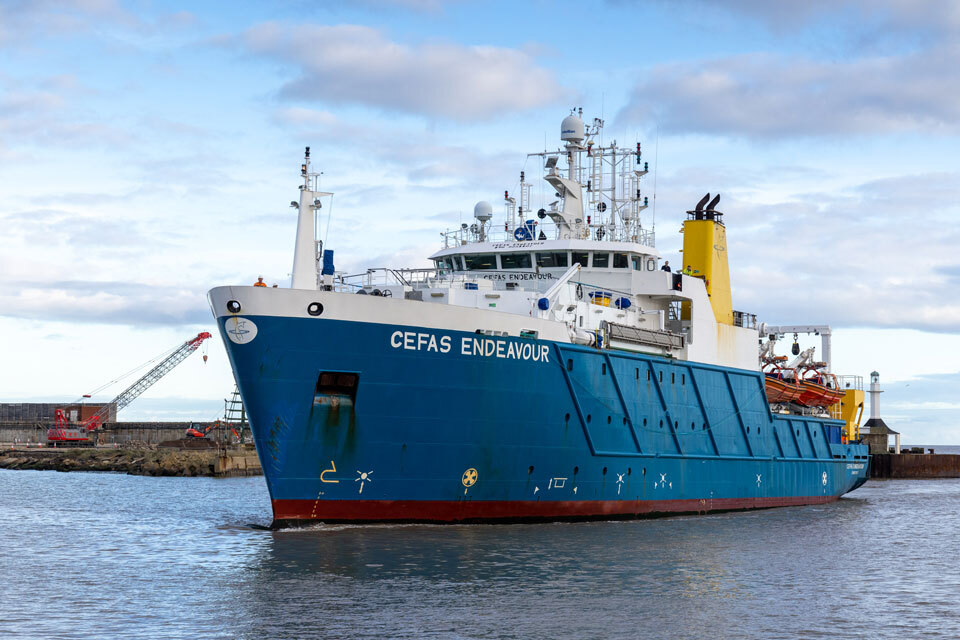
Research Vessel Cefas Endeavour © Cefas

Scientists unite for seabed mapping survey of the UK’s south-west coastline

The UK Centre for Seabed Mapping, a group of over 30 public sector organisations with a shared commitment to collect and share high-quality marine data, are undertaking a seabed mapping survey to explore and map the seabed along the UK’s south-west coastline.

Throughout the four-week survey, using cutting‑edge survey technology deployed from the Research Vessel Cefas Endeavour, the project will collect vital hydrographic, geological and environmental data.

BGS marine geoscientists Dayton Dove and Duncan Stevens will be on board, with a primary focus on acquiring sub-bottom profiler (SBP) data. This data is required for many offshore infrastructure applications, and importantly also provide further information on the nature, composition, and stability of the seabed itself.

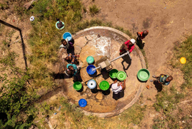
A group of individuals congregated around a well in the village of Quionga, Mozambique. (c)iStock

New research could help provide a more reliable water supply for millions in rural Africa

Millions of people in sub-Saharan Africa rely on hand-pumped boreholes for their water supply, but they are often unreliable, with frequent breakdowns and long repair times.

A recent paper by BGS scientists in collaboration with WaterAid and local researchers in both Africa and the UK, provides crucial information for decision makers across governments, non-governmental organisations and communities aiming to make rural water access more reliable.

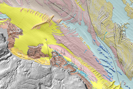
Seabed geology 1:10 000 map, offshore Yorkshire. BGS © UKRI 2025

Updated assessment of the Southern North Sea set to underpin future offshore infrastructure development

The first regional geological assessment for 30 years will support offshore marine and subsurface planning for the UK’s low-carbon energy infrastructure, including the 2030 target of 45 to 50 GW generated through offshore wind.

The assessment examined evidence across pre-glacial, glacial, interglacial and post‑glacial periods from 200 million years ago to the present day. Understanding how different sedimentary units were deposited provides vital insight into geological formations that may present specific geo-engineering complications.

In other news

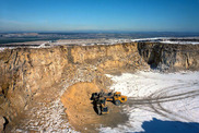
leven seat sandstone quarry

UK Minerals Yearbook 2025 now available

Published annually, the Yearbook provides comprehensive statistical data on the production, consumption and trade of UK minerals. It also includes definitive updates to inform decision makers, the minerals industry and those interested in the contribution of minerals to the national economy.

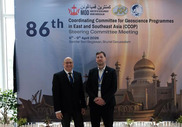
Marcus Dobbs at CCOP

BGS engineering geologist elected to CCOP

Marcus Dobbs, head of BGS Engineering Geology, has been appointed as vice-chair of the advisory group for the Coordinating Committee for Geoscience Programmes in East and Southeast Asia (CCOP). The advisory group’s role is to provide strategic advice to the CCOP steering  committee and technical secretariat to support the development and delivery of CCOP’s overall strategy, ensuring it meets the needs of member countries and aligns with sustainable development goals.

https://geoindex.bgs.ac.uk/

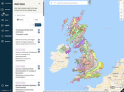
BGS GeoIndex viewer BETA receives new updates

Following user testing on our new BGS GeoIndex BETA viewer, we have just released a new enhanced version based on initial stakeholder feedback.

Functionality improvements in the latest version (v1.23.00) include: additional geological data layers available to view (users can now access 45 geological data layers); new tools have been added to enable measurement of distance, area and perimeter; users can now search and zoom to a location using Ordnance Survey map sheets; and layer filtering and card interface has been upgraded to make finding layers and adding layers easier.

We would welcome further user feedback during this beta phase, as we continue to develop this application as the long-term successor to our primary map viewer.


On the blog

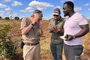
Zambia minerals

Strengthening capacity through partnership: a critical minerals perspective

BGS has been working in partnership with the Geological Survey Department of Zambia (GSD) to build national capacity, improve data accessibility and support long-term, sustainable development.

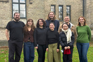
roup picture with the Prohaska group. From the left: Dominik, Maja, Sara, Katarina, Yike, Chris, Alessandro, and Dr. Ana Prohaska. BGS © UKRI.

PhD adventures in Copenhagen, Denmark: revealing past recovery processes of tropical forest systems through ancient environmental DNA 

PhD student Chris Bengt visited the University of Copenhagen to carry out very delicate extraction of aeDNA from lake-sediment cores, in the hopes of unlocking the secrets of past volcanic eruptions.

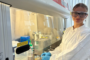
Dorontina undertaking solvent treatment in the Geomicrobiology lab.

Isotopes and science: my student placement at BGS

Chemistry student Dorontina Domi’s first couple of months placement at BGS, rotated between different laboratories including organics, collagen extraction and modern environmental gas analysis.

Industrial placements at BGS for undergraduate students give real-life experience of working in laboratories and learning different analytical techniques.

Latest video: UK CMIC Showcase 2026

UK CMIC Showcase 2026

Join scientists from the UK Critical Mineral Intelligence Centre (CMIC) for an online showcase of major research outputs from the last year, comprising of the copper waste and scrap flows for the UK, future of digital and the methodological progress on criticality assessments.