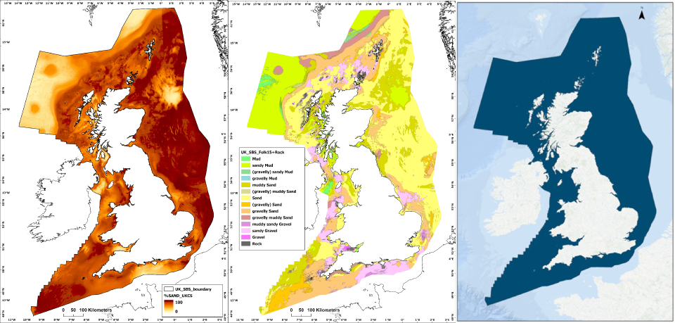
Characterising the distribution of seabed sediments (SBS) is critical for a wide range of applications, including marine ecosystem science, defence, mineral and aggregates assessments, offshore infrastructure siting and coastal management.
BGS has developed the new national-scale BGS Predictive Seabed Sediments (UK) dataset aimed at supporting these applications. The dataset comprises four digital maps that portray SBS composition, including a classified map of sediment types, as well as the predicted proportions of gravel, sand and mud across the UK continental shelf.
|