Updates to the BGS OGCAPI
Three new data collections have been added to the BGS OGCAPI – Features service, which allows programmatic access to our data and is fully supported as a data source by QGIS and ArcPro:
-
Non-coal mining plans: the dataset comprises plans of various types relating to mining activity, gathered since the 1800s
-
BGS Historical Magnetogram Scans: magnetograms are records of variations in the strength and direction of the Earth’s magnetic field. The magnetogram collection, one of the longest running geomagnetic series in the world, provides a continuous record of more than 160 years of UK measurements
-
BGS World Mineral Statistics: BGS has one of the largest databases in the world on the production and trade of minerals containing annual production statistics by mass for more than 70 mineral commodities per country and continent. Import and export statistics are also available for years up to 2002
The BGS OGCAPI – Features service uses the OGCAPI-Features standard. This is the same as used by Ordnance Survey for their OS NGD API – Features service.
Have your say
BGS is continually reviewing its data offerings to ensure they remain fit for purpose and identify potential updates and improvements. Implementing effective change requires input from all our stakeholder groups and we’d like to hear from you. Ongoing engagement campaigns include the BGS Infiltration SuDS Map and BGS Seabed Geology data. If you would like to contribute to either please take a few minutes to complete the questionnaires linked below. Thank you!

Seabed geology data: stakeholder consultation
BGS has been approached by The Crown Estate to undertake a project aimed at better understanding the current and future requirements for national-scale seabed geology and shallow subsurface information. To ensure we capture user needs, we would very much like to hear from spatial planners, asset managers, developers, consultants, researchers, and anyone who works with seabed geology information.
> Take part in the survey
|

Infiltration sustainable drainage systems questionnaire
The BGS Infiltration SuDS Map provides a preliminary indication of the suitability of the ground for infiltration SuDS. Infiltration SuDS are drainage systems that allow surface water to infiltrate the ground, such as soakaways, infiltration basins, infiltration trenches and permeable pavements.
We would like to hear from those involved in the planning and design of sustainable drainage systems and for those who approve SuDS planning applications.
> Complete the questionnaire
|
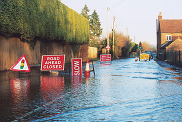
Recent feedback from our data users has highlighted the wide-ranging applicability of the BGS Groundwater Flooding Susceptibility dataset. Our recent blog post outlines the costly impacts of groundwater flooding in the UK and puts a spotlight on how BGS data can identify susceptible areas.
|
Events round up
Colleagues from the BGS Digital Products and Business Development teams have been busy attending industry events and engaging with our valued stakeholders.
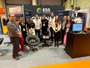
Events such as the Environmental Services & Solutions (ESS) Expo in Birmingham and the Extractive Industry Geology (EIG) conference at the University of Hull have been fantastic opportunities to catch up with existing and prospective partners and users of BGS data.
|
At the ESS Expo, BGS co-hosted a Government Hub with The Coal Authority and the UK Health Security Agency which was a great opportunity to discuss land stability in the coalfields and radon hazard respectively. Discussions with attendees included interesting conversations about BGS’s data offering, enquiries around contaminated land, geophysics and general awareness raising around our activities in the UK and abroad.
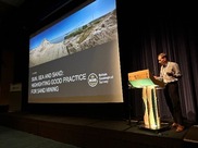
BGS staff delivered two presentations at the EIG conference on UK mineral waste and sustainable sand mining practices as well as hosting a stand.
|
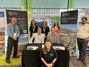
If you missed us, BGS will be attending the Government Geography Profession conference hosted at the Ordnance Survey in Southampton 19 and 20 November 2024. BGS Digital Products colleagues will be there with poster presentations on open and licenced BGS Data Products.
If you would like to find out more about our geology maps, coastal and river erosion data packages, subsidence susceptibility tools or any other BGS data products feel free to reach out in advance and at either event please do stop by and say hello on the day.
|
We would love to hear from you!
If you would like to talk to BGS about commercial applications of our data products, please contact BGS Digital Data (digitaldata@bgs.ac.uk).
Please visit the datasets web pages for more information.
|