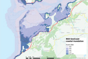
Following a surge of interest in BGS GeoCoast datasets and the recent launch of the Flood and Coastal Erosion Risk Management programme’s areas of interest, we are highlighting BGS datasets. BGS GeoCoast can support coastal researchers and practitioners facing adaptation challenges at the coast.
> Find out more about BGS GeoCoast in our spotlight article
|
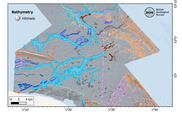
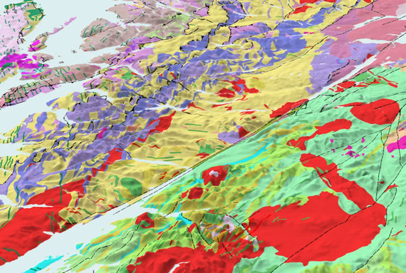
New geological data has been used to create an offshore East Anglia fine-scale (1:10 000) map. The map captures essential insights that will prove invaluable in the pursuit of further renewable energy development in the area, whilst allowing for better protection of nationally important habitats and species.
The East Anglia map forms part of a series of new fine-scale maps produced by BGS that focus on the seabed geology of the UK’s continental shelf.
|
Upcoming events
Colleagues from the BGS Digital Products and Business Development teams have been busy attending industry events and engaging with our valued stakeholders. Events such as GeoBusiness, Flood and Coast and the Esri UK Annual Conference have been fantastic opportunities to catch up with existing and prospective partners and users of BGS data.
If you would like to find out more about our geology maps, coastal and river erosion data packages, subsidence susceptibility tools or any of our other data products, feel free to reach out in advance or stop by and say hello at any of the upcoming events.
We would love to hear from you!
If you would like to talk to BGS about commercial applications of our data products, please contact BGS Digital Data (digitaldata@bgs.ac.uk).
For more information on our data products, please visit our website.
|