BGS secure funding to develop a new Groundwater Flooding Risk dataset
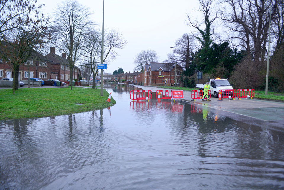 BGS been successful in securing funding from the Government Office for Technology Transfer to develop a 'Groundwater flooding risk under climate change' dataset. The project aims to deliver the first gridded, digital map dataset of projected risk of groundwater flooding across mainland Great Britain under different greenhouse gas emissions scenarios and time horizons spanning the years 2020 to 2100. Initial work packages will carry out market research to maximise the utility of the dataset in commercial and public sectors, including conveyancing, lender and insurance markets as well as the UK's flood management and response sector within our public environmental regulators.
If you would be interested in contributing to this market research please contact Rob Shaw or Jon Mackay.
BGS data product licence fees to rise
From 1 April 2024, BGS will apply a 5 per cent increase to its direct licence fees for all data products. This means that any direct licence issued or renewed on or after 1 April 2024 will reflect this increased price. Existing data licensees will not be affected until such time as their licence is next due for renewal, after 1 April 2024.
BGS has not increased its data product licence fees for many years: this 2024 increase takes into account inflationary and cost pressures faced by BGS, including increased staff costs, and follows a review of Office for National Statistics guidance with regard to inflation and price indices. Going forwards, BGS will undertake annual price reviews and will communicate any future licence fee changes (from 2025) as appropriate.
If you have any queries regarding this matter, please contact the IPR digital team (iprdigital@bgs.ac.uk).
|
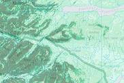
BGS data highlight: soils
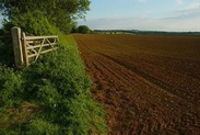
New legislation concerning soil management and technology in modern farming has led to an increase in enquiries about BGS’s Soil Parent Material Model. In response, our digital products team have published a blog discussing the importance of soils for farming, ecology and water supplies, how the BGS Soil Parent Material Model can be used to provides information to better understand soil and subsoil characteristics across Great Britain and how this data can be accessed. Find out how BGS is helping the farming sector of Great Britain.
|
Geospatial Commission collaboration
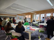
A massive thank you to our colleagues from the Ordnance Survey, Geospatial Commission and Valuation Office Agency for joining the BGS Digital Products geospatial shadowing workshop. This was a fantastic opportunity for members of our Geospatial Commission partner organisations, and staff from across BGS to come together to explore BGS data products.
The task for the day was a fictional town planning exercise where mixed groups were asked to design and justify a development plan for a new town utilising the full suite of BGS data products. Planners weighed up factors such as availability of building materials, geohazards, water resources and geotechnical ground properties amongst many other considerations.
Key BGS datasets for the planners included:
The day was a huge success, providing an opportunity for networking and knowledge exchange as well as a chance to proudly showcase BGS research and datasets.
If you’re interested in finding out more about our datasets, you can access details of the full BGS product portfolio. You can also contact us (digitaldata@bgs.ac.uk) if you would like information about which BGS datasets are available and can support your planning and development needs.
Members of BGS Informatics staff were also hosted by the Ordnance Survey and the Coal Authority. The Ordnance Survey shadowing experience demonstrated the collaboration between the data architecture, data science and the quality management teams and involved an interactive session designing a data management workflow for a product. The Coal Authority shadowing opportunity focused on emergency response to hazards related to historic mining activities. This covered the types of emergency situations dealt with and the available datasets that can support the Coal Authority's response. These principles were then demonstrated in action with a fieldtrip to a local mine-water treatment site, highlighting the importance of continuing maintenance of legacy mining activity.
|
And finally
Introducing Lauren Hart, who has recently joined the BGS Business Development team. Lauren will be BGS’s commercialisation manager, representing our organisation at public events, acting as our primary contact point for commercial clients (such as resellers). Lauren has previous experience as a business development manager, developing natural hazard susceptibility data products and working with commercial clients to utilise geospatial offerings. Lauren is looking forward to working with you!
If you would like to talk to BGS about commercial applications of our data products, please contact BGS Digital Data (digitaldata@bgs.ac.uk).
|