|
This is the first session of the Spring/Summer webinar series, presented by the Wildlife Viewing and Nature Tourism Working Group, part of The Association of Fish and Wildlife Agencies.
This is a free webinar series, open to anyone interested in learning more about the selected topics. Please forward this email or share the below webinar link with any interested colleagues or partners that may want to attend.
Oct. 27, 2022, 2 – 3 p.m. EDT
Using Smartphone GPS Locations to Track Increased Visitation and Minimize Impacts on Wildlife
After registering, you will receive a confirmation email containing information about joining the meeting.
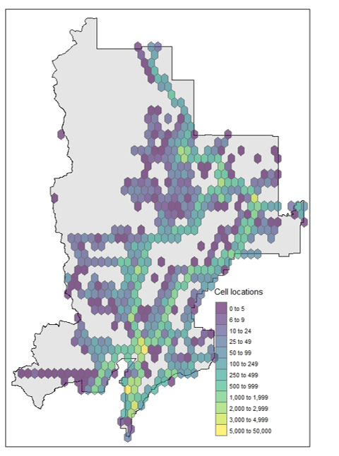
Visitation within the public lands was rapidly increasing prior to the Covid-19 global pandemic. Now, with unprecedented visitation numbers, the need to accurately identify and map recreation use is imperative for managing recreation and minimizing impacts on wildlife. Land management agencies are tasked with both ensuring recreation opportunities for an ever-growing population, while also maintaining ecosystem health and protecting wildlife resources from undue human disturbance and harassment. Yet, without accurate recreation data across broad spatial scales, and a corresponding understanding of how recreation use impacts wildlife, management plans are unlikely to successfully address both objectives.
In this webinar, we demonstrate the ability to quantify visitation and assess the spatial and temporal patterns of recreation at both broad and fine scales using GPS data from smartphone devices. These data can be used to develop standardized cross-boundary estimates of recreation, with the ability to discern many recreation types, while providing useful data for pressing recreation science and recreation-wildlife impact questions. The information gathered enables the calculation of movement rates and space use that can be used to identify likely recreation behaviors (e.g., OHV vs. hiking).
Our preliminary work demonstrates the numerous possibilities of using cellular data to: 1) understand the dynamics of human recreation behavior, 2) improve our ability to quantify the response of wildlife to recreation, and 3) produce tools and maps to inform management efficacy and monitoring. Future projects include use of the cell data to better delineate the human footprint with wildlife connectivity models.
Webinar Registration: Using Smartphone GPS
|
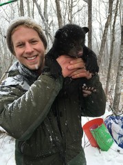
Presented by Mark A. Ditmer, Ph.D., Research Ecologist, USDA Forest Service.
Mark is a research ecologist with the Rocky Mountain Research Station (USFS) in Fort Collins, CO. He received his PhD studying the spatial ecology of black bears at the University of Minnesota. Since his PhD research, Mark has worked on a variety of species from cougars to songbirds, and on a variety of topics including sensory ecology, conservation physiology, and movement ecology. Currently at the Rocky Mountain Research Station, his work includes the understanding the influence of recreation on wildlife, restoration of gray wolves to CO, and the use of physiological biologgers to gain new insights into wildlife stressors and changing forage patterns.
|
Webinar Connection: PLEASE REGISTER NOW USING THE LINKS ABOVE! This will be the only way to access each individual webinar. Note: Each webinar has its own unique link.
If you were forwarded this email and would like to receive future information about our webinar series and upcoming conferences, enter your email here to be added to the wildlife viewing and nature tourism distribution list.

|