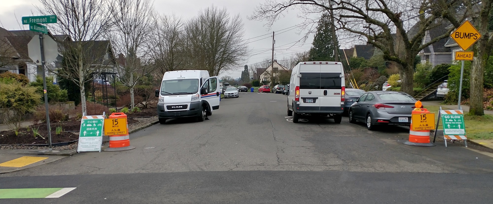
Looking south on the NE Alameda Neighborhood Greenway across NE Fremont St. The safety project will simplify this intersection and reduce the potential for crashes..
Traffic pattern change pilot project construction scheduled for week of Dec. 26
(December 20, 2022) – The Portland Bureau of Transportation (PBOT) plans to construct the NE Alameda Street and NE Fremont Street Intersection Safety Project the week of Dec. 26 - Dec. 31.
This pilot project will be installed by PBOT Maintenance Operations staff using non-permanent materials. Construction impacts should be minimal and take about one day. The schedule is subject to change.
More about the NE Alameda Street and NE Fremont Street Intersection Safety Project
NE Alameda Street is a neighborhood greenway and priority safe route to school corridor. The number of crashes, volume of vehicles, and volume of vehicle turning movements at the intersection of NE Fremont St. and NE Alameda St. creates an uncomfortable and potentially unsafe intersection for all users.
Portland's neighborhood greenways are designed to be calm streets that provide a safe and comfortable biking and walking experience. Neighborhood greenways typically feature a shared street environment rather than separated bike lanes, and use elements such as speed bumps, traffic diverters, enhanced crossings, and wayfinding to ensure that the street is clearly prioritized for people walking and biking while preserving local motor vehicle access.
Initially, the Slow Streets program planned to install more robust turn traffic calming at the intersection with concrete planters. After hearing from nearby residents and the neighborhood, PBOT changed the design and will now construct a pilot project that creates a simplified intersection with fewer turning movements and significantly less crash potential.
Image shows a map of upcoming safety changes at NE Fremont St. and NE Alameda St. Green arrows represent permitted vehicle turning movements. Red dashes represent a row of plastic bollards. The design reduces potential crashes between vehicles and people walking and biking across NE Fremont St.
Find project background information and the latest updates at
http://www.portland.gov/Alameda-Fremont
Questions or comments?
Scott Cohen | Program Coordinator
scott.cohen@portlandoregon.gov
(503) 823-5345
|