Oregon Wildfire Risk Map Withdrawn
Friends,
During the '21 Legislative Session, the Legislature passed Rogue Valley Senator Jeff Golden's Wildfire Bill.
Colleagues and I drafted similar legislation which we moved our of committee, but ultimately the Majority Party was not interested in moving our version of the legislation.
With only days left in the Legislative Session, we were able to move a version of Rep. Owens amendment to the WUI (Wildland-Urban Interface) portion of SB 762 to alleviate some potentially devastating impacts to property owners across the state.
SB 762 had some good investments for wildfire funding and preparedness, bolstered the great work of the State Fire Marshals Office and created the State Wildfire Program, with an appointed excellent and knowledgeable Director, we however have seen the unintended consequences of the legislation roll out over the past month that was our of their hands.
For many, SB 762 does not help address the root cause of catastrophic wildfire, the poor management of our federal forest lands in Oregon. (Click here to view Era of Megafire)
Our Private Forest Land Owners do an excellent job mitigating fire because their lands are managed and the data is clear on this. On average in Oregon, 80% of forests burned are on Federal Lands. Of the 20% burned off of Federal Lands, 15% of those areas burned are from fires off of Federal Lands. The remaining 5% started and burned on private lands are kept to under 100 acres.
While on this topic, hypocrisy is alive and well with the majority party in this area. As they push their climate change agenda, they fail to address and even push back on positive ways to manage our carbon sequestering forest resources, as they are beholden to the environmental groups that oppose any best management practices for the forest resources within our state. Our forests sequester nearly half of the anthropogenic emissions our state produces as a whole. In sequestering carbon, our forest resources grow the most resilient building material in the world (wood) with a biproduct that is oxygen.
We will continue to push forward for responsible management of our forest lands that are controlled by our federal agencies and cover over half our state.
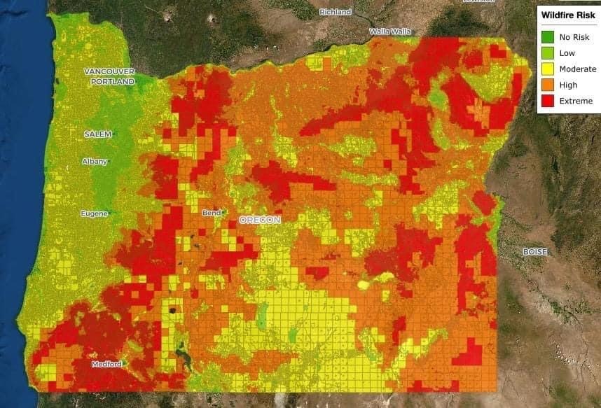
That said, thank you to all who reached out regarding ODF's Wildfire Risk Map. Your voices were critical in halting this from moving forward.
Please see the information i received late yesterday afternoon from the State Forester/Oregon Department of Forestry Director Cal Mukumoto below:
"Good afternoon:
Oregon’s wildfire environment has changed significantly in the past decade. Climate change is bringing us hotter, drier summers and historic levels of drought, resulting in severe wildfire conditions and longer, more complex and more expensive fire seasons. We find ourselves at a critical juncture when it comes to wildfire and need to take bold action to mitigate further catastrophic impacts to Oregonians, communities and our state’s natural resources.
Senate Bill 762 laid the foundation for that bold action. The bill passed in 2021 with bipartisan support and made investments in fire-adapted communities, wildfire response and resilient landscapes. Eleven state agencies are tasked with implementing the various components of SB 762. The Oregon Department of Forestry was directed to develop and maintain a statewide wildfire risk map. The map identifies the risk of a wildfire occurring in a given area to help determine where resources are needed most to protect lives and homes when a wildfire does occur.
In addition to writing the rules for map development and maintenance with a rules advisory committee, we were also tasked with defining the wildland-urban interface and assigning a risk classification at the property ownership level (1.8 million tax lots across Oregon). This work had to be completed by June 30, 2022, less than a year after the bill was adopted. We knew the first iteration of an undertaking of this scale and complexity wouldn’t be perfect, but we have been and continue to be committed to improving the map and our processes related to it. At the same time, our partner agencies are working to collect input as they develop the new codes for defensible space (Office of the State Fire Marshal) and home hardening (Building Codes Division) and address concerns related to homeowner’s insurance (Division of Financial Regulation).
We’ve been soliciting and collecting questions, concerns, and other input since the statewide wildfire risk map was released just over a month ago. We’ve received specific feedback from nearly 2,000 Oregonians that has helped us understand the key areas of concern related to risk classification. We have a window of opportunity before the new codes go into effect to take some immediate steps toward addressing those concerns, and we will be taking full advantage of the opportunity.
As required by SB 762, we posted a wildfire risk map on the Oregon Explorer on June 30, 2022 and sent notifications to property owners in the extreme and high risk classifications shortly after. In response to input received since posting, we have decided to remove the current iteration of the wildfire risk map from the Oregon Explorer and withdraw the notices sent. We will immediately begin working with Oregon State University on some refinements to improve the accuracy of risk classification assignments based on what we’ve heard from property owners thus far.
Since we are withdrawing the initial map and notifications, the current appeals process will end and any appeals filed will become moot. For those who did submit an appeal, we will be reviewing the information submitted and using it to identify any additional areas where we may need to take a closer look at the data. Please note, this decision does not impact the code development and adoption processes currently underway through Office of the State Fire Marshal for defensible space or Building Codes Division for home hardening.
While we met the bill’s initial deadline for delivering on the map, there wasn’t enough time to allow for the type of local outreach and engagement that people wanted, needed and deserved. Once this round of refinements is complete, we are planning to bring a draft of the updated map to communities for discussion and input. After another round of revisions based on local input, the map will be finalized. We will then post an updated map on the Oregon Explorer and issue new notices to property owners in the extreme and high risk classifications, which will start a new appeal period. We are in the process of developing a plan and timeline to complete these activities, including public engagement and outreach opportunities. We will share that publicly as soon as it is complete.
We know how important it is to get this right, and we’re fully committed to continuing to work with the Governor’s Office, legislators, our partner agencies, local governments, and Oregonians to do just that.
Thank you, Cal
Cal Mukumoto, Oregon State Forester"
We must continue to stay engaged as this process gets a reboot and moves forward. I will continue to advocate and sincerely appreciate all of your efforts.
Thank you again and I hope you have a safe and blessed day.
Best,
Representative David Brock Smith
Together, We will build a better Oregon
 House District 1
Curry, Coos, Douglas and Josephine Counties
Capitol Phone: 503-986-1401
Capitol Address: 900 Court St. NE, H-379, Salem, Oregon 97301
Email: Rep.DavidBrockSmith@oregonlegislature.gov
Website: http://www.oregonlegislature.gov/smithd
|