|
Hello Friends,
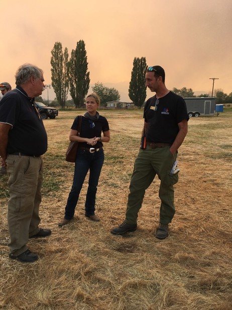
I had the opportunity to head down to the Paisley today to talk with U.S Forest Service Agency Administrator William Dunk and see the Brattain Fire first hand. The blaze has grown rapidly in the last week and our firefighters are working hard to contain it. They are some of the best I’ve seen and have put everything they have into protecting the citizens of Lake County and the rest of Oregon.
While the fires on the west side are dying down, there is still danger here central and eastern Oregon. The job is not finished. After it is, though, I look forward to having meaningful discussions about proper forest policy and management.
Please find resources and updates below for fires all around Oregon.
Wildfire Resources
For the most up-to-date wildfire information I have access to at this time please check out: Wildfire Resources. Due to the constantly changing information, some of the social media, Facebook and Twitter, links are the most quickly updated. Additionally here is an interactive fire map. If you plan on traveling, please check here to view the status of roads before you leave.
Additional Resources:
Text your zip code to 888777 to automatically sign up for text alerts.
The Red Cross has made accommodations available. Folks needing a hotel/motel can access the map below. The Red Cross has offered wrap around services so the price of the hotel will be paid for as well as food services. Those who are able to use an RV will also find safe places to park as well as wrap around services.
http://maps.redcross.org/website/maps/ARC_Shelters.html
Resources from HUD for those whose homes have been damaged or destroyed: https://www.hud.gov/states/oregon/library/disasterrelief/wildfires
How you can help victims: https://www.oregonlive.com/news/2020/09/oregon-wildfires-how-you-can-help-victims.html
Travel Oregon website to help Oregonians: https://traveloregon.com/things-to-do/ways-to-help-during-oregon-wildfires/
Volunteer for American Red Cross: https://www.redcross.org/about-us/news-and-events/news/2020/red-cross-response-to-western-wildfires.html
Listed below are active fires Klamath, Lake, and Jackson Counties. (Updated)
Two Four Two Fire (Klamath County)
- 19,200 acres located along Highway 97 in Chiloquin.
- Now at 15 percent containment.
- Mop up along Hwy 97 with National Guard crews. Focus has changed from catching the fire to securing the fire.
- Most roads should be opened in the late afternoon or early evening.
Almeda Drive Fire (Phoenix and Talent)
- Now 100 percent contained!
South Obenchain Fire (Eagle Point and Shady Cove)
Brattain Fire (Lake County)
- 34,100 acres located along Avery Creek south of Paisley.
- Warm and dry conditions coupled with strong, gusty winds will continue to be a challenge. A Red Flag Warning is in effect from 12 – 8 PM. Additional firefighting ground resources and aircraft are expected to arrive to bolster efforts. Forest Road 3510 and Clover Flat Road are being prepped as holding lines and mop up work will continue on the south and southwest perimeters. Establishing containment lines and structure protection are a priority in the northwest region of the fire.
- The Lake County Sheriff’s Office has issued the following evacuation notices:
- Level 3
- Highway 31 from Government Harvey Road (Forest Road 29) south to include all of Paisley – from Red House Lane (north of Paisley), continuing south on Highway 31 to Valley Falls/the junction with U.S. Hwy 395.
- All of Clover Flat Road from the intersection with Hwy 31 (Beachler’s Corner) south to Valley Falls.
- Level 2
- From Government Harvey Road/Forest Road 29 north to Summer Lake Store.
- Level 1
- From Summer Lake Store north along Highway 31 to the top of Picture Rock Pass.
- Abert Lake area southeast on 395, south on Highway 31 to Chandler State approximately 5 miles south of Valley Falls.
- The Red Cross has an evacuation area at the Lake County Fairgrounds in Lakeview (1900 North 4th St.). There is fire information there as well.
Active Fires Around the State (Updated)
Beachie Creek (Also known as Santiam Fire)
- Currently 16,776 structures are at Level 3 evacuations and another 18,528 homes in level 2 evacuations as the fire has grown to 190,100 acres.
- 15 percent containment around Scotts Mills, Drake’s Crossing and Silver Falls State Park area.
- The Marion County Sheriff's office announced Tuesday afternoon that Lyons and the area of Mehama west of Highway 226 would be downgraded to a level 2 - "Get Set" - evacuation notice.
- The fire’s east flank is about a mile away from the Lionshead Fire, and forestry officials say there’s a chance the two fires could burn together. Based on weather forecasts, they say they do not expect too much of a change in fire behavior if that happens.
Riverside Fire in Clackamas
- 136,300 acres
- No containment.
- Fire officials say they are focusing on strengthening fire lines, particularly in the area located about half a mile from Estacada where a pocket of fire remains disconnected from the main fire perimeter. Crews are also using infrared-capable drones to identify hot spots through the smoke.
- The current evacuation sites that still have room are the Clackamas Town Center (for RVs) and the Oregon Convention Center. The latter is also accepting pets. Livestock animals can be taken to the Clatsop County Fairgrounds, Columbia County Fairgrounds, Hood River Fairgrounds, Oregon State Fair and Expo Center, St Paul Rodeo Grounds and Yamhill County fairgrounds.
Lionshead Fire in Warm Springs
- 183,000 acres
- Started 20 miles west of Warm Springs, has met up at its western edge with the Beachie Creek Fire.
- Aviation assets were still unable to fly yesterday and flights will likely not be possible today because of poor visibility. The northeast portion of the fire on the Warm Springs Reservation continues to experience the most active fire growth.
- A Level 2 evacuation notice has been issued for the Sidwalter Flats area on the Warm Springs Reservation, up from a previous Level 1 notice for that area.
Holiday Farm Fire in Lane County
- The fire was estimated at 105,000 acres Wednesday and has grown overnight to nearly 167,600 acres Monday.
- 6 percent containment
- Incident commanders said Tuesday that 431 structures have been inspected in the fire zone so far. Investigators said 308 homes were destroyed, another seven were marked as “failed,” and 14 more were damaged.
- The Oregon State Fire Marshal’s Office and an 80-person Urban Search and Rescue team have been working within the fire zone to search for potential unaccounted for people while assessing the structures.
Archie Creek Fire in Douglas County
- 121,400 acres
- 15 percent containment with 708 people assigned.
- Spot fires have crossed containment lines in the Little River area, where firefighters are working to contain them and tie back into the primary line.
- Fire managers and the Sheriff’s Office urge residents returning to their homes to drive cautiously and watch for falling hazards such as trees and debris. If you feel unsafe, evacuate on your own and do not wait for notification from the sheriff.
Echo Mtn. Complex in Lincoln County
- 2,500 acres
- 100 percent of the control line has been completed, while the fire rests at 33 percent containment.
- 594 people remain on the fire.
All fires being responded to at this time are uncontained.
Basic priorities are evacuation and life safety.
If you wish to help by donating or volunteering, please visit the link to the Office of Emergency Management’s Portal:
https://oregonrecovers.communityos.org/?fbclid=IwAR0ELvJx-rD5StXtgcr0ZMU2bMwRJd5WoeKs3go20QYbwzuw3njka0qafxg
 
Capitol Phone: 503-986-1455
Capitol Address: 900 Court St NE, H-395, Salem, OR 97301
Email: Rep.VikkiBreeseIverson@oregonlegislature.gov
Website: http://www.oregonlegislature.gov/breese-iverson
|