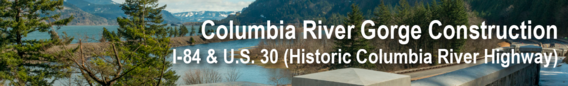
|
Thank you for your continued patience while we restore and improve areas along the Historic Columbia River Highway and I-84. Travelers should plan ahead, especially on weekends when traffic volumes increase. This email includes the following updates:
- Historic Columbia River Highway (U.S. 30) closes east of Multnomah Falls Oct. 1, 2025.
- Lane closures continue on I-84 eastbound at McCord Creek.
- Historic Columbia River Highway (U.S. 30) remains closed at Larch Mountain Road, landslide repairs nearly complete.
- U.S. 30 sidewalk curb ramp upgrades nearly complete in Hood River.
- Multnomah Falls Timed Use Permits end for 2025.
Read below for more information and visit TripCheck.com for real-time traffic impacts. Schedules are subject to change and weather dependent.
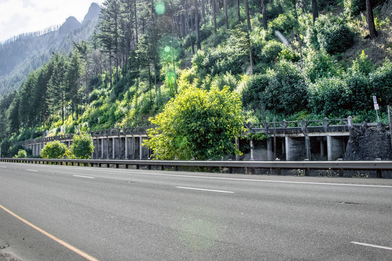 Photo above: view of the viaduct east of Multnomah Falls, built in 1914, on the Historic Columbia River Highway as seen from Interstate 84.
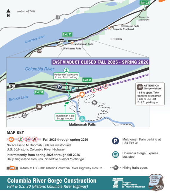
The east viaduct closes to all traffic, including bicycles and vehicles, starting Oct. 1, 2025 for repairs to the historic highway structure.
The work from fall 2025 through spring 2026 will repair cracks and exposed rebar at the railings and foundation, provide long-term stability and return the structure to its original condition similar to when it opened more than 100 years ago.
While the east viaduct is closed:
- All traffic, including bicycles and vehicles, is prohibited between Multnomah Falls and the Oneonta Trailhead parking lot.
- Westbound vehicles on the Historic Highway east of Multnomah Falls will be turned around at the Oneonta Trailhead, about 2 miles east of Multnomah Falls. Parking is limited at the Oneonta Trailhead.
- Eastbound vehicles on the Historic Highway west of Multnomah Falls will be turned around east of the Multnomah Falls Lodge once the closure begins.
- Public transit and private buses are available to Multnomah Falls. Visit RideCatBus.org or ReadySetGOrge.com to find more information about routes, schedules and tickets.
- The lot at Exit 31 from I-84 remains open, but parking spaces are limited. Real-time traffic impacts and cameras showing parking availability at the Exit 31 lot are available at TripCheck.com.
- As with all construction, the schedule is subject to change. The latest information including detour maps will be posted on TripCheck.com and on the project website.
- Other sections of the Historic Highway remain open during construction. I-84 is not impacted by this project.
In May 2025, crews finished restoring the west viaduct on the Historic Columbia River Highway (U.S. 30) between Wahkeena Falls and Multnomah Falls and reopened it ahead of schedule. Crews patched the original decorative concrete, reinforced the structure and poured a new road surface. We’re completing similar repairs to the east viaduct during this closure.
Learn more about the viaduct repairs by watching this video.
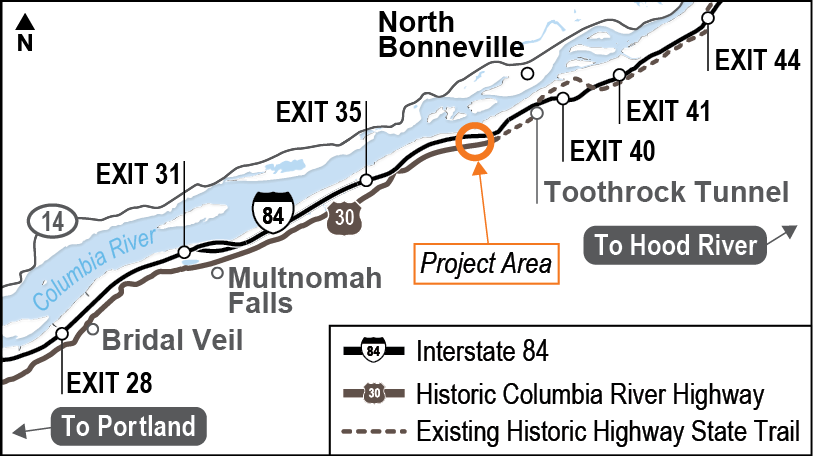 Map above shows the approximate location of the project area on I-84 at McCord Creek.
Gorge travel on eastbound Interstate 84 is reduced to one lane as crews continue work to replace the aging eastbound bridge over McCord Creek.
Replacing the eastbound bridge will eliminate a dip in the road and increase safety, earthquake resilience and the lifespan of the highway.
Over the summer, crews prepared the work site under the bridge and have started the first visible work for interstate travelers. Crews have been drilling under the eastbound bridge to install new support shafts while also constructing the work areas on the highway in preparation to shift all traffic to the westbound bridge in spring 2026.
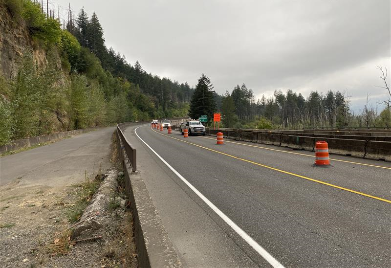 I-84 eastbound reduced to one lane while crews prepare sections of the highway for all traffic to be routed onto the westbound bridge in 2026.
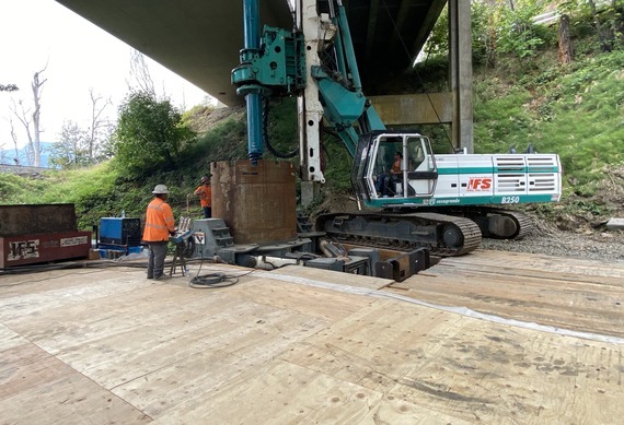 Crews drill new support shafts on McCord Creek Bridge while standing on the temporary work structure under I-84.
Travelers on I-84 can expect:
- Around-the-clock single lane and shoulder closures on I-84 eastbound at McCord Creek through late 2025.
- The NE Frontage Rd on-ramp to eastbound I-84 at the Elowah Falls Trailhead parking lot is also closed. Travelers accessing eastbound I-84 from NE Frontage Road must detour to the on-ramps at Ainsworth State Park.
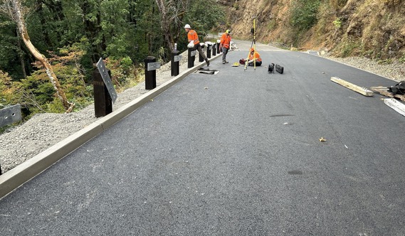 Photo above: ODOT crews use equipment to collect groundwater elevation and slope movement data in the landslide repair area on the Historic Columbia River Highway.
Work continues on the Historic Highway between Portland Women's Forum and Vista House while we repair an area of ancient landslide just east of the historic highway intersection at Larch Mountain Road. We closed this area in July and estimate the work will be completed and this section of the historic highway will reopen by the end of September.
Detours
- Interstate 84 is the detour route for people traveling through the gorge.
- Exit 22 at Corbett Hill Road and Exit 28 at Bridal Veil will remain open to access destinations along the Historic Highway.
- To reach Vista House, travelers should use eastbound I-84 Exit 28 to Bridal Veil and travel west on the historic highway.
- Visitors to Portland Women's Forum should take I-84 Exit 22 to Corbett Hill Road to access the forum
Please visit Tripcheck.com for the latest information on road conditions.
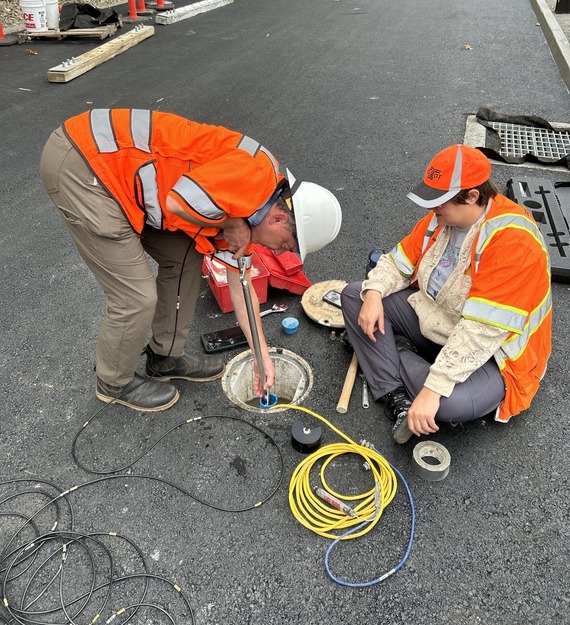 Photo above: ODOT crews install equipment to measure the slope as part of ongoing monitoring of the landslide repair on the Historic Columbia River Highway.
Work is nearly finished on upgrading the ADA curb ramps in Hood River along U.S. 30 (Oak Street and Cascade Street). Minor construction will continue through October. Learn more.
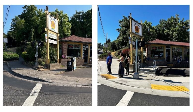 Photo above: Sidewalk curb ramps at the intersection of U.S. 30 (Oak Street) and 13th Street before (left) and after (right) ADA compliant upgrades.
The U.S. Forest Service's annual summer Timed Use Permits are no longer needed for private vehicles accessing Multnomah Falls from I-84 Exit 31.
Learn more.
Here are some tips for Traveling Safely in Work Zones
- Orange is your cue! Pay attention when you see orange signs, barrels, cones and barricades.
- Obey all speed signs for your safety and the safety of others.
- Expect delays—plan for them—and leave early so you can drive safely through the work zone.
- Allow extra time when traveling and follow all signs and flaggers for safety.
Travelers should expect delays in the area during construction activities. For the most up-to-date traffic impacts please visit www.TripCheck.com.
More information on work scheduled in the coming months and beyond is available on our project website. Stay tuned for more email updates!
|