|
For more information: Tom Strandberg (541) 663-6261, email Thomas.m.Strandberg@odot.oregon.gov
April 11, 2023
John Day –Travelers can expect high water in some sections of eastern Oregon as snow melt and rain collects in ditches, creeks and rivers.
High water is reported in Grant County along sections of U.S. 395-B near Mt. Vernon, U.S. 26 west of Dayville near Picture Gorge, U.S. 26 at Mt. Vernon and east of Mt. Vernon, U.S. 26 near Unity, U.S. 395-C south of John Day.
In Harney and Malheur counties expect high water along U.S. 20 west of Burns and east of Vale, and U.S. 95 north of the Nevada Border. Other highways and roads may also be impacted by flooding. Drivers should slow down, drive with caution and avoid high water areas if you can’t tell how deep the water is. Turn around. Don’t drown.
Before travelling check TripCheck.com for reports of high water or road closures.
While no state routes in eastern Oregon have been fully closed by high water, ODOT crews are monitoring known sites. With unpredictable weather patterns, conditions can change at any time. Be prepared for delays and possible detours.
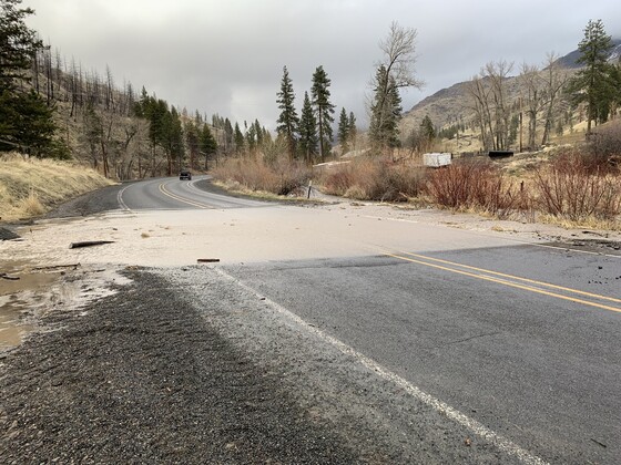
Photo taken earlier today along U.S. 395-C, eight miles south of John Day
Looking for a great job with a competitive salary and good benefits?
Want to help your community every day? Apply now at ODOTJobs.com.
Nothing quite fit? Check back often!
|

