 Feb. 22, 2022
For more information, contact Sally Ridenour, 503-576-9577
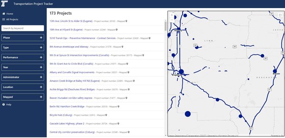
SALEM: It’s easy to see how and where Oregon's state and federal transportation funds are spent by local, state and federal agencies using the recently updated ODOT Transportation Project Tracker. The newly improved interactive map lets you click, pan and zoom to find projects in your area. Filters allow you to sort by project type, phase and more.
The map is designed to show information about the scope, schedule and budget of projects and studies, including projects in the Statewide Transportation Improvement Program known as the STIP, ODOT's four-year capital improvement program. In just a few clicks, the user-friendly tool shows you where state transportation dollars are being spent. It also shows whether completed projects are on time and on budget.
Other features include:
- Project snapshots with a brief description and summary of the project or study.
- Search options, where you can zoom in to the map or using the search box.
- Project clusters - project point locations are clustered on the map in high density areas to reduce the number of individual point locations displayed on the map and provide a cleaner user experience. The varying sizes of the clusters correlate to the number of locations in area.
View the ODOT Transportation Project Tracker at https://gis.odot.state.or.us/tpt/. Detailed information about the data displayed is available on the ODOT website.
|
